Death Valley is Full of Fantastic History
Sis Adventure 3.0, Part 1, Death Valley National Park
As always, traveling with my sister is an interesting adventure. This time, headed to Death Valley and Joshua Tree for a week, the entertainment began before we even left town. We had lodging in Death Valley at Stovepipe Wells – more on that later, but we were camping in Joshua Tree.
So how to pack for camping when you are flying out? We decided less was more, so we threw a tent, a tarp, 2 sleeping bags, and 2 sleeping mats along with 2 fire pokers into my giant Biaggi Zip Sack bag. Miraculously, everything fit! I will cover Joshua Tree and our others stops in later posts.
I flew out Southwest on a nonstop flight so it was less likely my checked bag would get lost. I am typically a carry-on only girl! So, I got to Vegas about 2 hours ahead of my sister, who wanted to use her points on a different airline. I picked up my bags, and then rode the shuttle to pick up our rental car. We had rented a 4×4 truck, because we planned to do the Racetrack at Death Valley and the Geology Trail at Joshua Tree.
I got the truck and after circling aimlessly around the Las Vegas airport forever, finally picked my sister up at the Departures drop-off. Don’t ask, because I have no idea how that happened. Regardless, we were off. We stopped in Pahrump to do our grocery shopping and eat lunch, then there was no stopping until Death Valley.
Death Valley is our nation’s largest National Park in the 48 contiguous states at over 3.4 million acres with 3.2 million being federally designated wilderness. Fun fact, Death Valley is the hottest place on Earth with its maximum recorded temperature logged at 134 degrees in 1913!
It also holds the record for the driest place in the United States with less than 2 inches of annual rainfall. In fact, we packed a picnic lunch one day with the plan to make peanut butter and jelly sandwiches. We no sooner opened the bag of bread, and it was as dry as toast! No kidding!
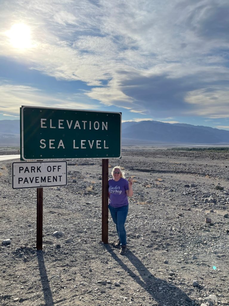
Death Valley is the lowest point in the Western Hemisphere with an elevation of 282 feet below sea level at Badwater Basin. More on that later. Death Valley was formed by the movement, specifically dropping, of Earth’s crust. It was designated a National Monument in 1933, and gained National Park status in 1994.
Be sure to stay safe when visiting Death Valley. Top tips, especially in the summertime, are to have plenty of water with you, and drink it! Also avoid outside activities during the hottest parts of the day. Hike in the early morning hours, and choose shorter walks. Higher elevations will have slightly lower temperatures. Stay out of basins and washes during the rain as flash flooding can occur.
Cell phone service is extremely limited, and GPS can occasionally be inaccurate. Always keep your vehicle filled to at least half a tank of gas. Keep to the main roads, in the summer especially, and if your car breaks down, DO NOT leave your vehicle. Stay with your vehicle until help arrives.
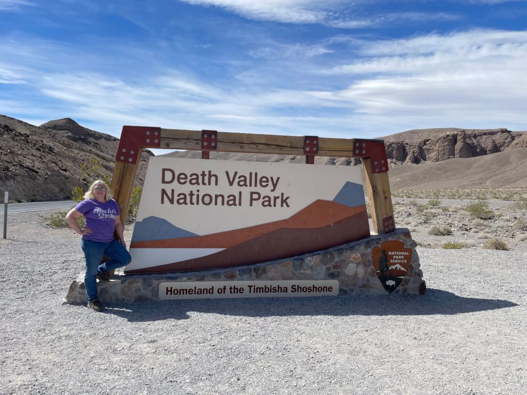
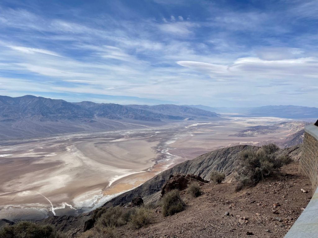
We made it into the park entrance after about a 2 hour drive, took the obligatory photos at the park sign, and stopped at the kiosk to pay our fee ($30.00 for 7 days for the vehicle). Our first stop in the park was Dante’s View. My sister got a lot of laughs here. Anyone who knows me knows that I am TERRIFIED of heights and do NOT do any mountain driving because it FREAKS. ME. OUT.
Well, the rental was in my name, so I would be doing all of the driving. The drive was great and no big deal until the last half mile or so that was a 15% grade with lots of hairpin turns on a little skinny road barely wide enough for two cars, let alone the RV coming down that we passed on our way up – on a corner no less. I was not a fan. The view, however, was worth it! You can look out over the entire valley!
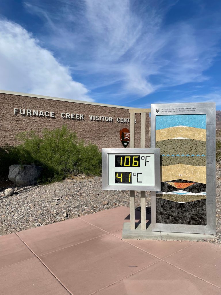
After Dante’s View, we stopped by Furnace Creek Visitor Center where it was 106 degrees…at 4:00pm…in March! Also, gas was $8.91 per gallon compared to $6.71 at Stovepipe Wells, and $5.45-6.55 outside the park. Not so fun fact, but good to know, the bathrooms here were disgusting, I would rather use the vault toilets elsewhere. After we watched the short video and picked up a park map, we headed out to Zabriskie Point.
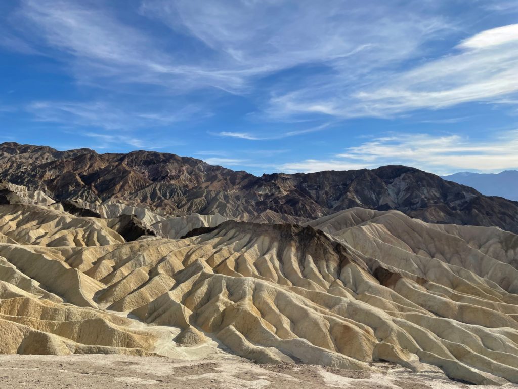
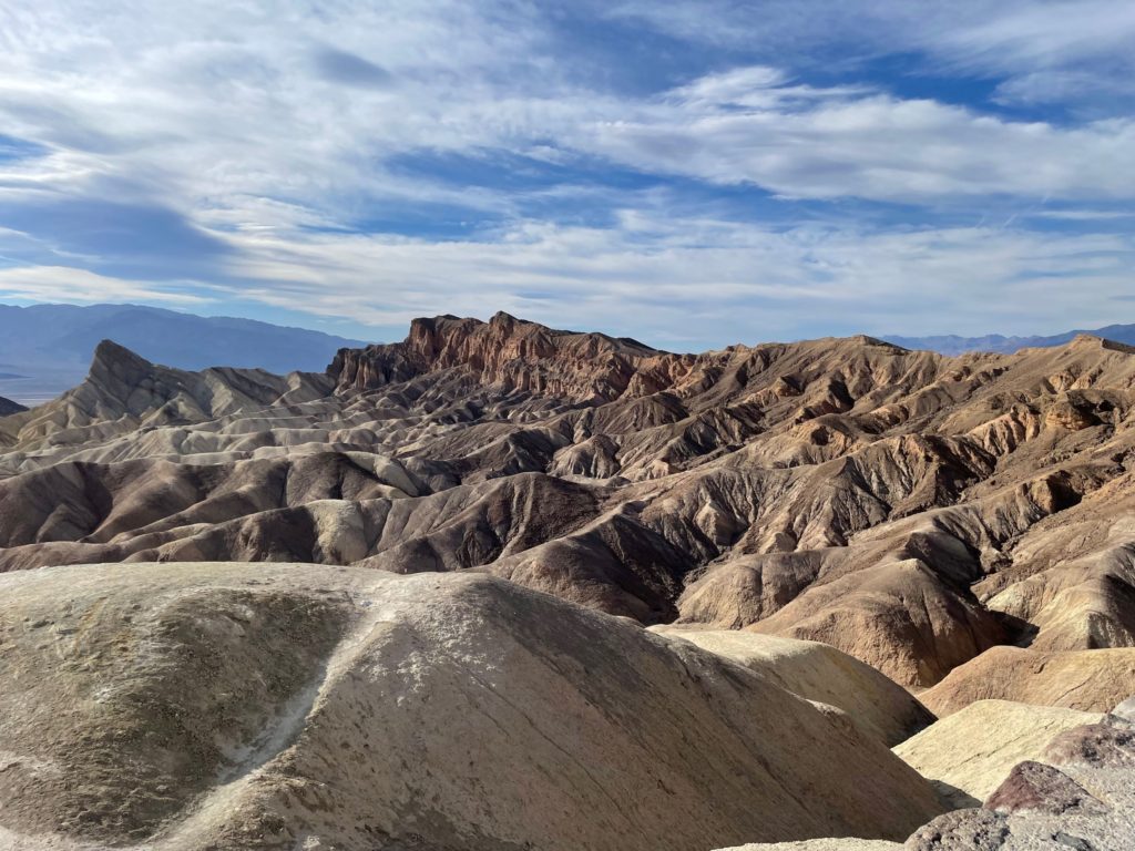
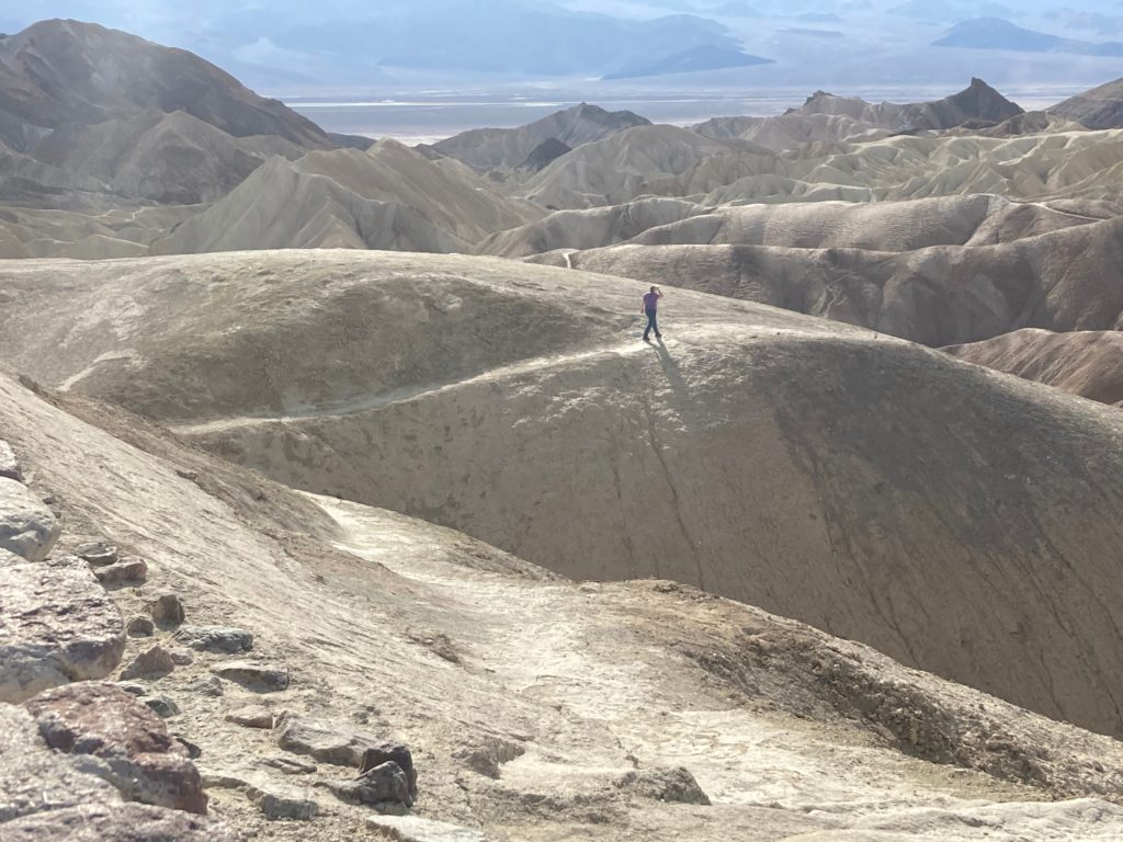
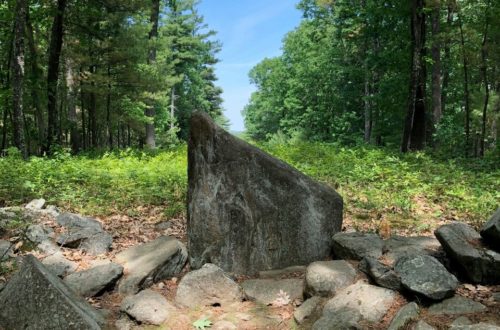
Zabriskie Point is reported to be a great place to view the sunrise and the sunset, although we did neither. We are not morning people! It does have some pretty great views of what are known as golden badlands. Between three and five million years ago, this area was covered by prehistoric Lake Manly. Silt and ash washed into the lake and settled. Over time seismic activity tilted the land and rainstorms eroded it into the landscape that you see today.
There are a few trails around, although I am not sure how many of them are legit. Possibly just a lot of people walking that way. I did venture out a little ways on one that had stone steps leading to it, so at least it seemed like I wasn’t destroying the park. I didn’t go too far, though, because well, you know, I am terrified of heights.
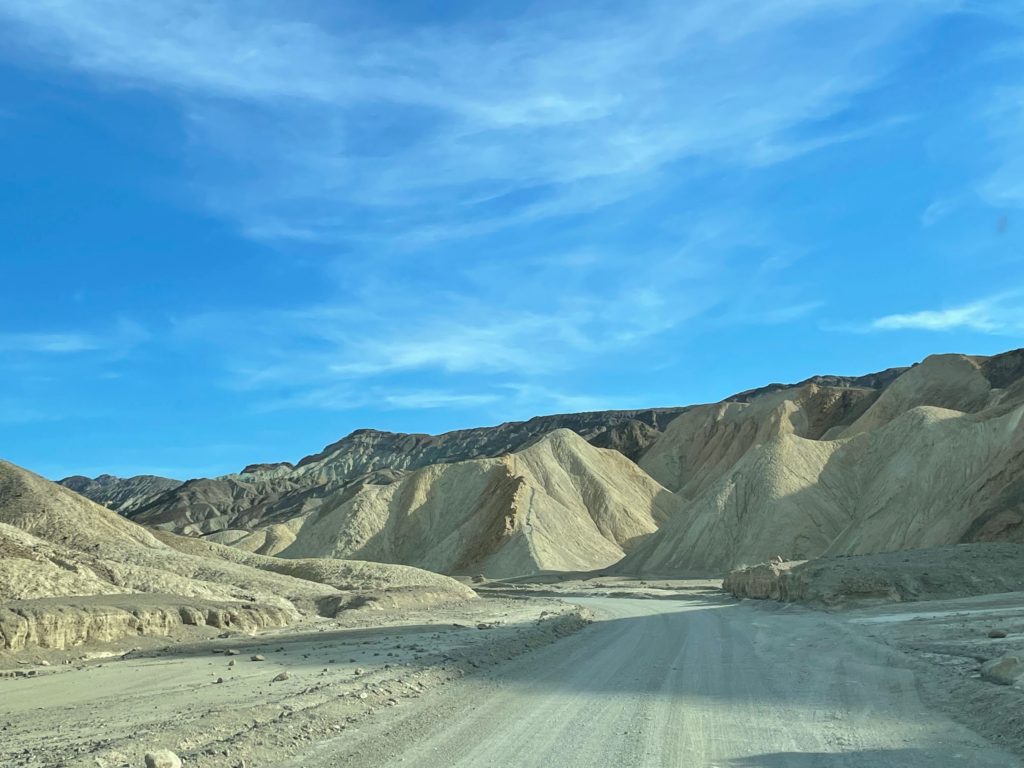
Our next adventure was the drive through 20 Mule Canyon. This drive is only about 2.5 miles long. It is all graded gravel, but not terrible to navigate. There are a few narrow places and a few steep places, but it was very cool to drive through…mostly. Again, that fear of heights got me! It is a great drive! There was just this ONE spot that stopped me for a moment! Haha!
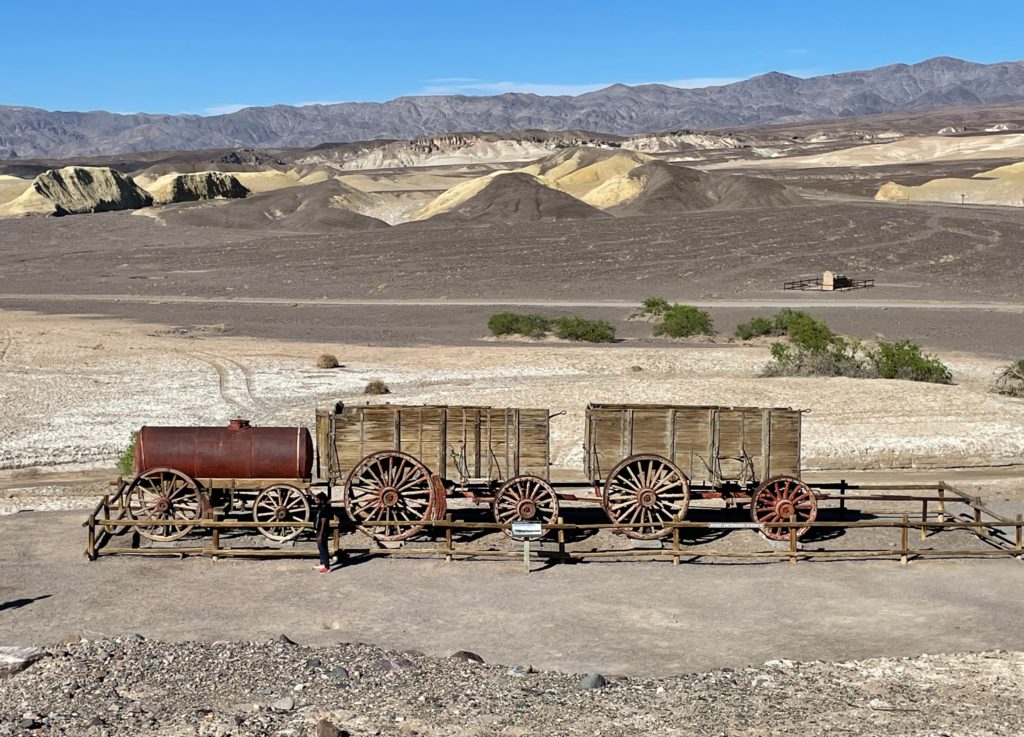
So this drive actually has some history to it. You knew I had to share more history on this trip! Twenty Mule Canyon is the historic route that the 20 mule teams would take to haul borax from the processing plant at Harmony Borax (more on this later) to the closest rail station at Death Valley Junction. These loads of borax weighed up to 36 tons, and the entire procession was more than 100 ft long.
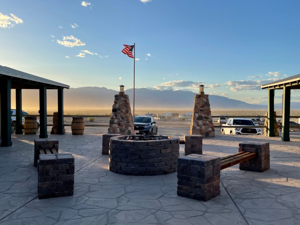
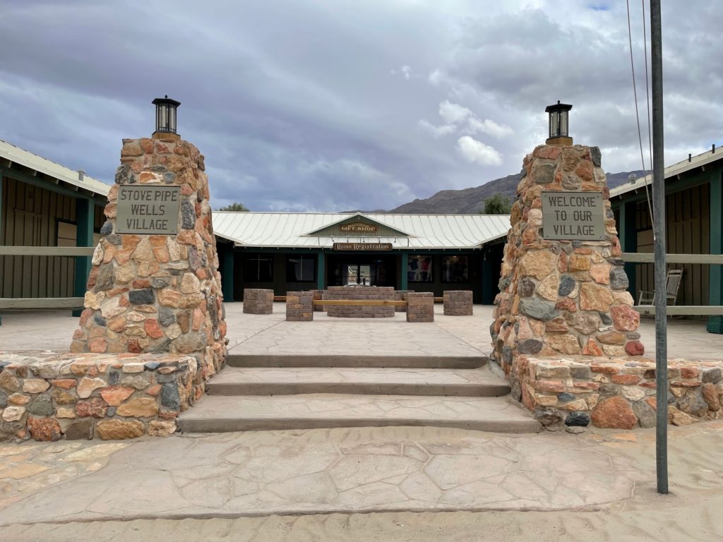
Lodging in Stovepipe Wells
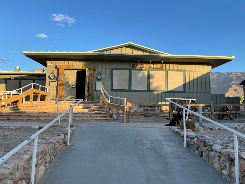
Once we finished the 20 Mule Canyon drive, it was nearing dusk, so we headed on out to our lodging for the next four nights at Stovepipe Wells Village. As of the writing of this post, our room rate was $144.00 per night for a room with a double and a twin bed on the patio. We had our own bathroom en suite, and we were near the pool, the saloon, and the restaurant. The rooms are not fancy by any means, but they serve the purpose. Our room had a TV (which we did not use), fridge, and air conditioning.
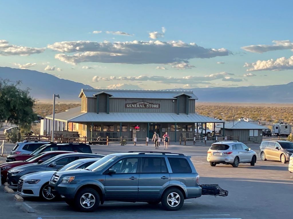
Stovepipe Wells also has a campground, a gas station, (my sister would want me to mention EV charging stations), a general store, and a ranger station. If you need gas in the park, get it at Stovepipe Wells where it was over $2.00 cheaper than at Furnace Creek when we visited. We ate dinner several times in the restaurant. They had amazing burgers, fries, and sandwiches! They also served breakfast, but we never made it over for that. The pool was nice, and the staff were all very helpful and friendly. Fun fact, the elevation at the Stovepipe Wells Ranger Station is exactly sea level!
Stovepipe Wells also, of course, has a unique history. The area got its name from the historic well nearby. In 1926, Herman William Eichbaum, originally from Virginia, opened the first hotel in the Stovepipe Wells complex which consisted of 20 bungalows and tents. It was nicknamed Bungalette City. Running water, electricity, food, and sightseeing tours were part of the amenities.
Eichbaum also constructed a restaurant, gas station, general store, and a 38 mile long toll road over the Towne Pass to help tourists get to Death Valley. Prior to the toll road, all roads were ungraded and left over from wagon trains. Eichbaum built the toll road, also called “the road to nowhere,” with six shovel men and one Caterpillar tractor. Today Highway 190 follows this route.
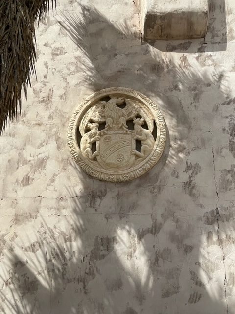
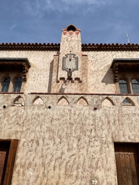
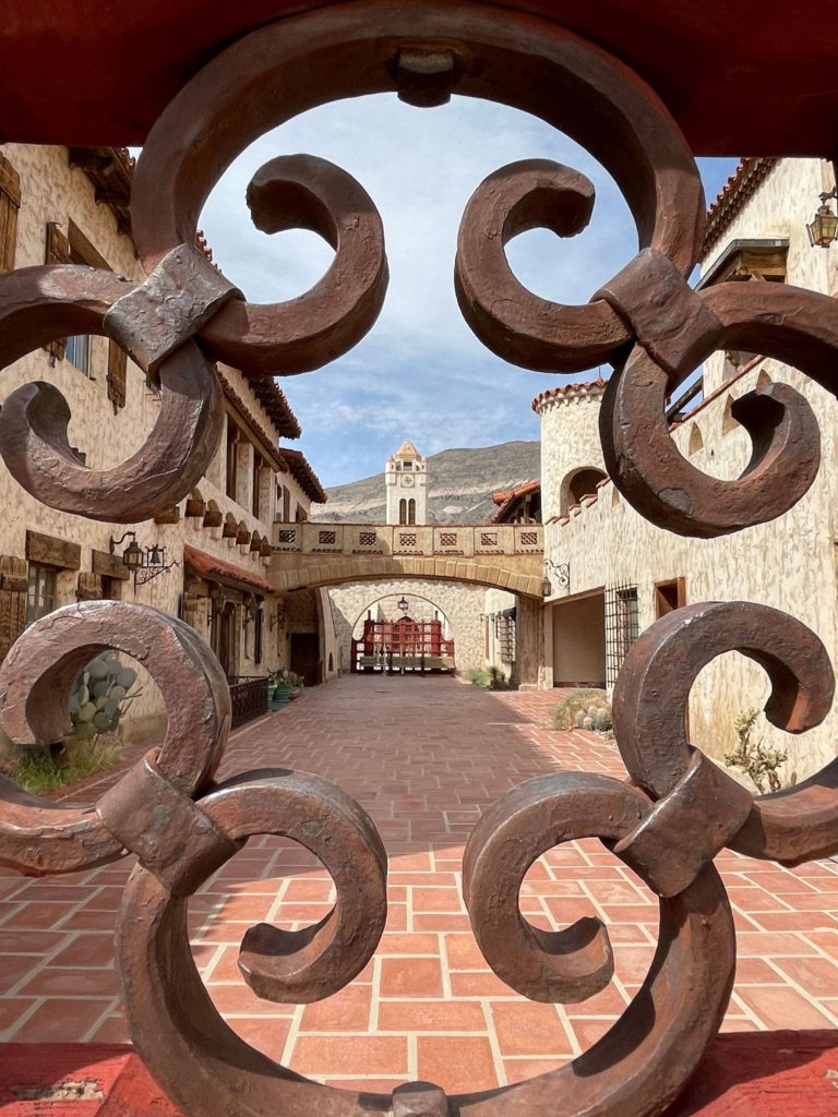
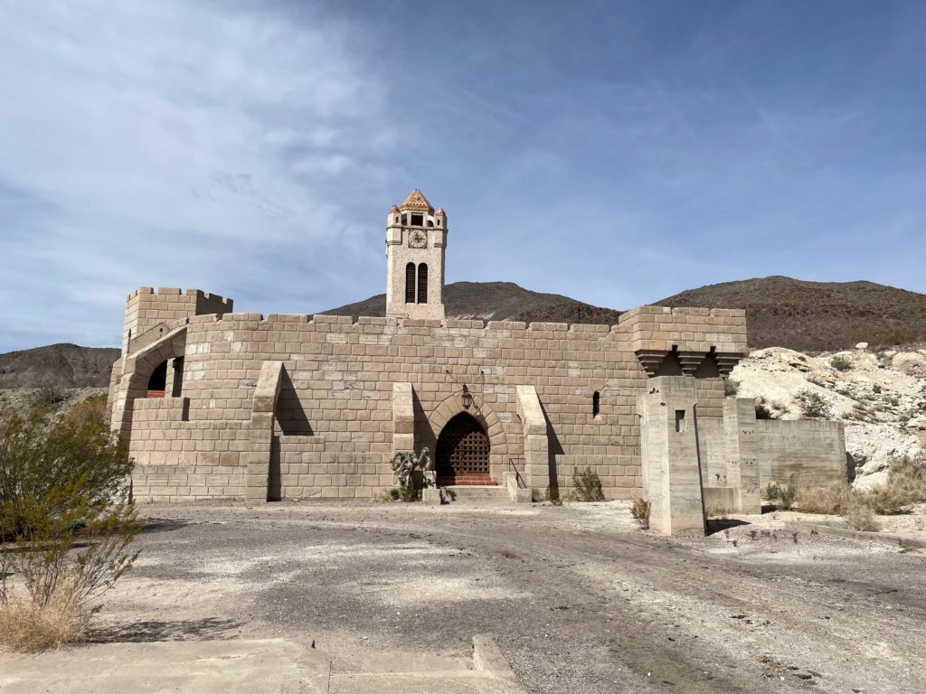
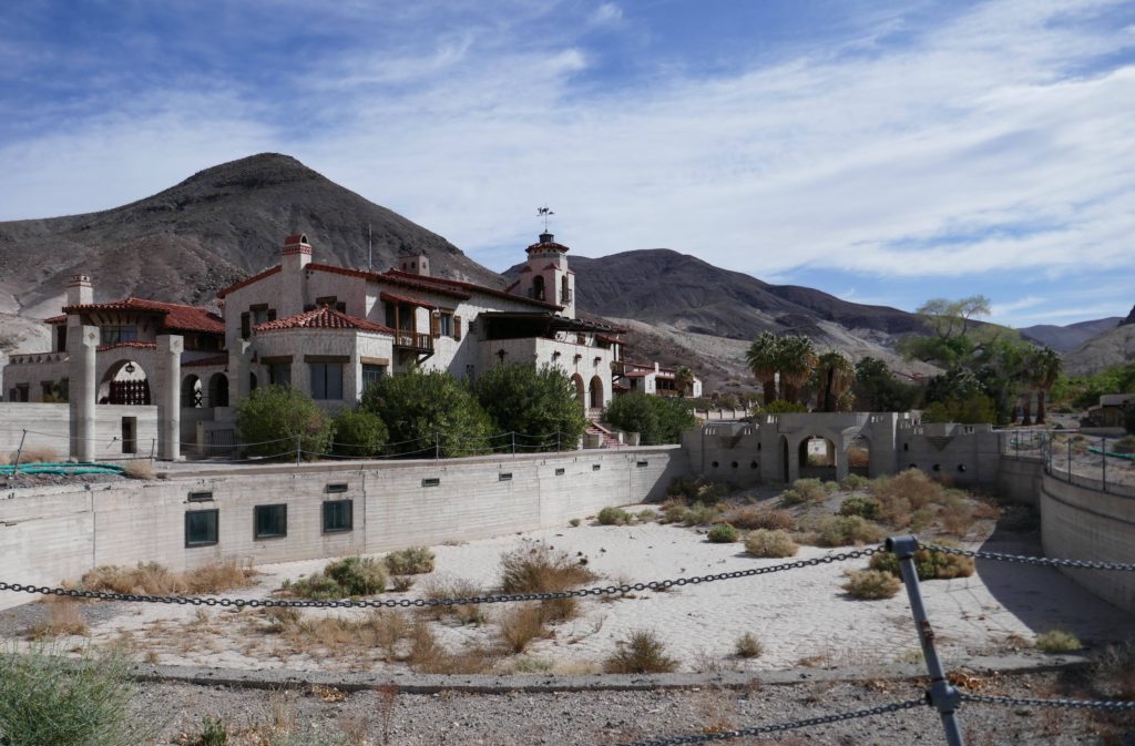
Scotty’s Castle
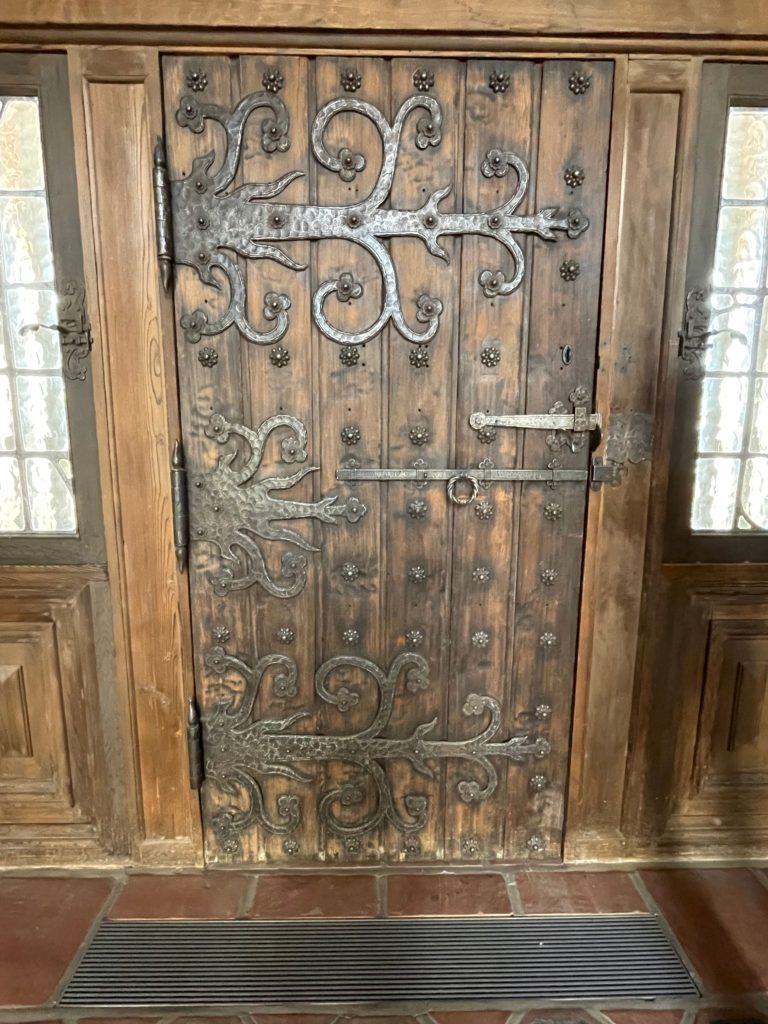
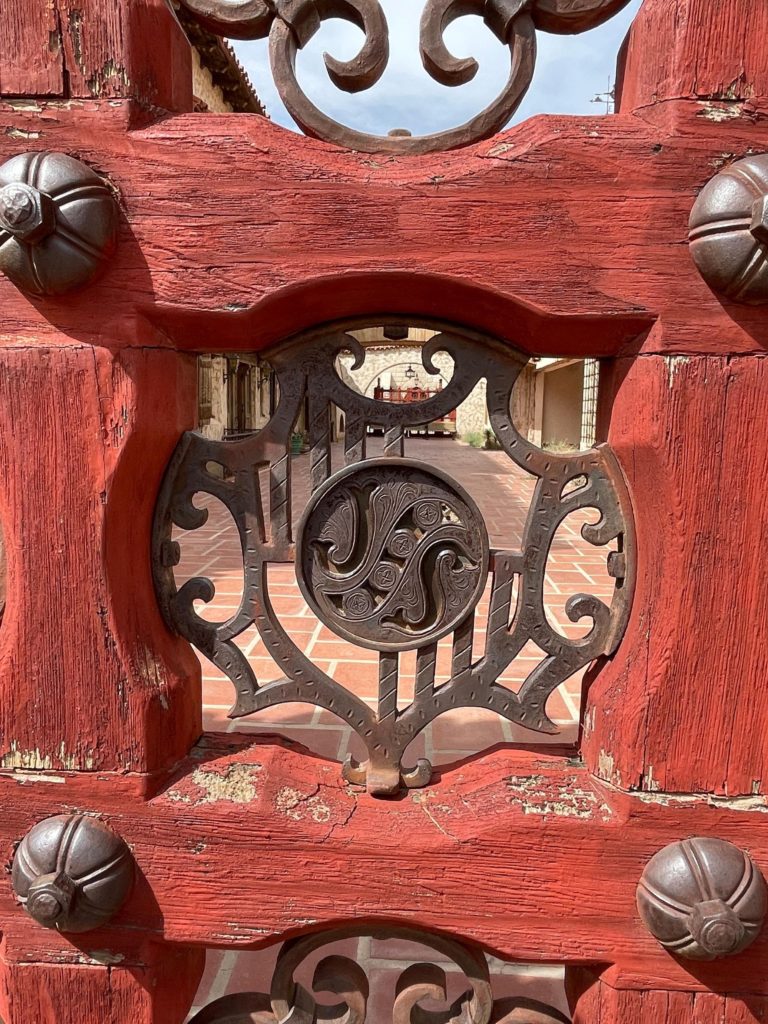
Our first full day in the park, we got up early and drove out to the Grapevine Ranger Station for a guided tour of Scotty’s Castle sponsored by the Death Valley Historical Association. The “castle” is a large estate that was built in the 1920’s by Albert Johnson and Walter Scott. Actually just by Albert Johnson, but Walter Scott is always given credit as well. The property is named after him – Scotty’s Castle.
The castle itself is currently closed to the public for repairs due to a flash flood in 2015. The road isn’t even open. The only way to visit the castle is by booking a guided tour with the Historical Association. The flash flood took place on October 18, 2015. On this day, over 3 inches of rain fell in 5 hours – normally the entire park sees 4 inches of rain over an entire year.
During the flood, 6-8 feet of water, 200 feet wide, moving 10-12 miles per hour washed through leaving up to 4 feet of mud deposited in its wake. It took until 4pm the following day to evacuate everyone, but miraculously there were no deaths. The flood took out 8 miles of the road near the castle.
Albert Johnson graduated from Cornell in the 1890’s met his wife Bessie there. She actually went to school with Herbert Hoover. Albert and his father were in a train accident in 1899 and he and one other lady were the only survivors. He broke his back and had trouble with his lower extremities, and ended up in the desert because the climate helped him feel better physically. In 1917, Johnson purchased what he thought was the land that Scotty’s Castle is currently sitting on.
Johnson was from Chicago, and was very wealthy. He initially built two “shoebox” designed structures, but they did not meet his wife’s approval. So, he actually hired Frank Lloyd Wright to design his vacation home, but did not end up using his designs. Designs were changed in progress several times, so some things are not the same and don’t appear to fit.
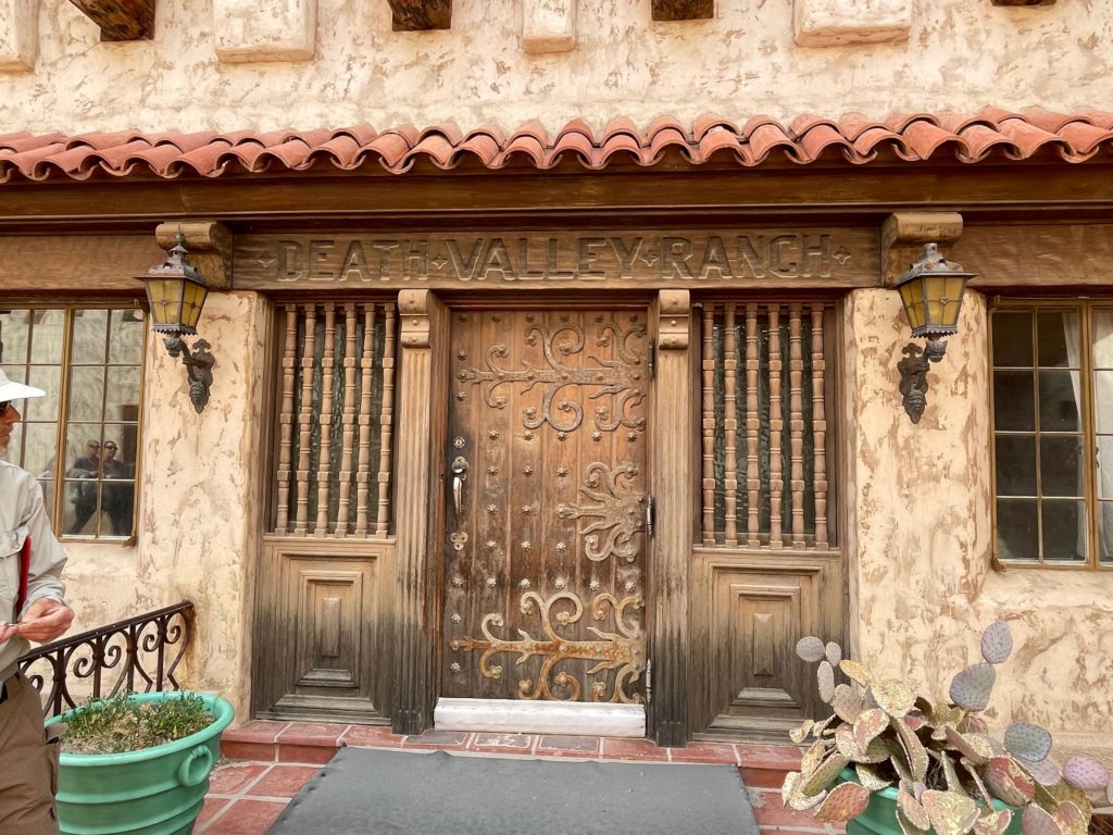
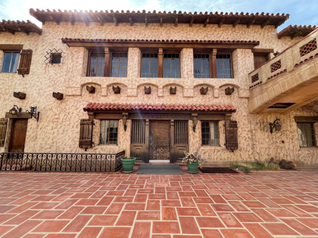
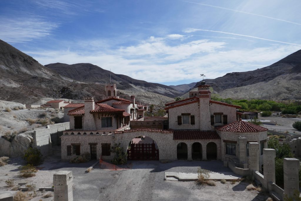
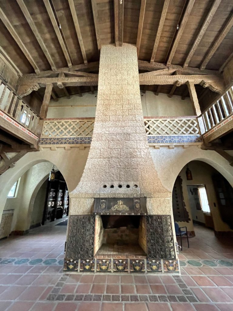
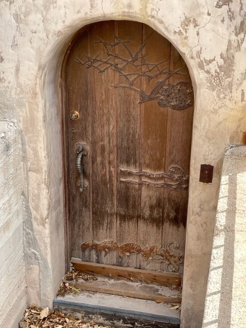
The “castle” was built with the annex on the left and the main house on the right. Guests stayed in the annex and Johnson lived in the main house which was built in 1922. Between 60-100 people at a time were working on building the property. A lot of work was done by Native Americans who had their own camp nearby. Inside of the buildings, all of the fancy furniture has been removed for preservation since the flood. In the main house, there is a fireplace which was solely for ambience. Johnson had purchased an old mining track and took up all of the railroad ties to use as firewood.
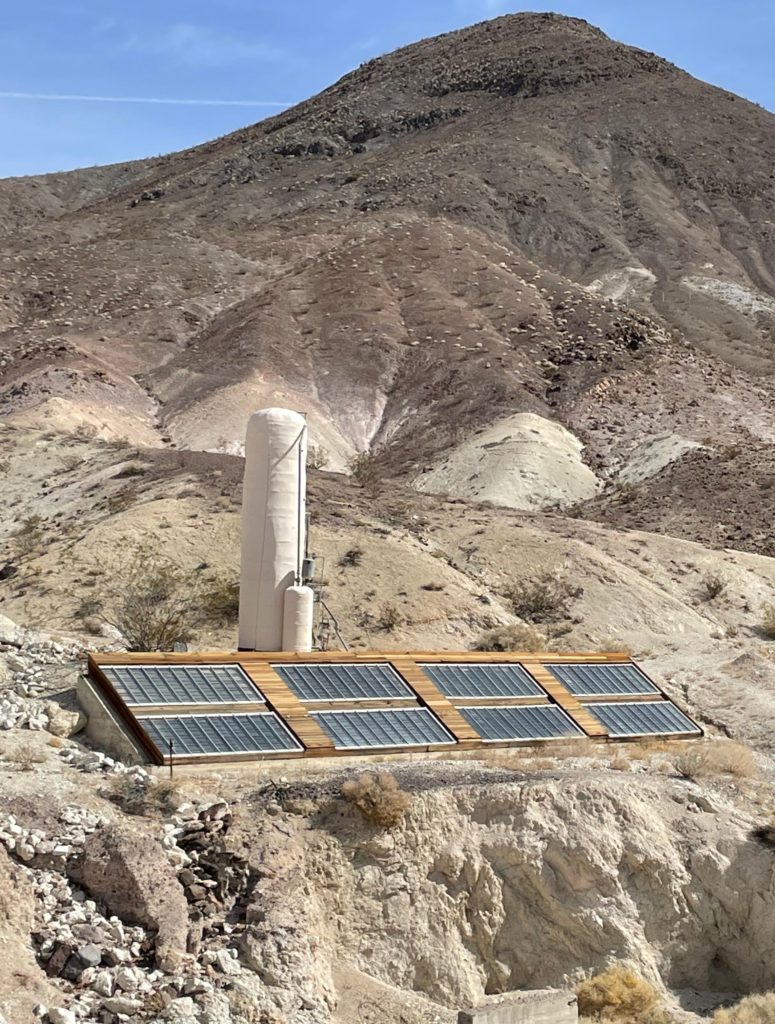
An indoor water feature (fountain) was designed to add humidity to the air. They also had hot water thanks to their solar water heating system! Albert’s office converted into a dining room when guests were present. However, the kitchen was only used a few times. Most food was prepared elsewhere by workers. The property had themed rooms, one of which had a seahorse theme and the door knob has a seahorse on it. The whole place had a rustic beauty about it!
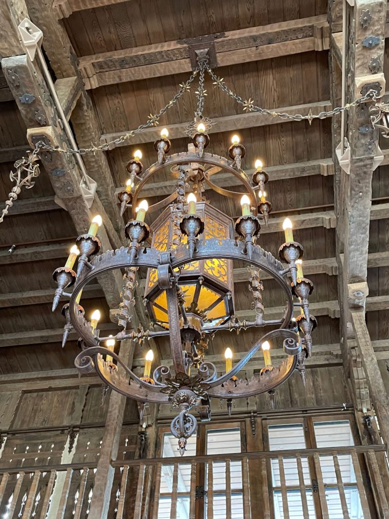
The chimes tower played using the same type of paper rolls that were used in a player piano. It has been changed over to digital today. The property had nicad (nickel cadmium) batteries in the basement and a diesel engine in the power building, so they always had consistent power.
The gate, pool, and grotto did not get finished. It was intended that cars would pull up in front of the pool, people would walk across the bridge over the pool and enter the main house through the front doors “Death Valley Ranch” but since the pool was never finished, cars would bring guests to the gates and drop them off and then go park in the stable. The grotto was designed to be a park-like setting with a waterfall.
In 1933, the government decided to build a monument in Death Valley. They sent a surveyor out and determined that according to the description on his deeds, that Johnson’s land was actually a mile away from the present site! Johnson used his wife’s connection to Herbert Hoover to get in touch with a Congressman and work out a deal.
In 1935, a deal was reached that allowed Albert Johnson and Walter Scott to purchase the 1,528 acres for the going rate of $1.25 per acre. Johnson’s wife passed away in the 1940’s, and Johnson lost interest in the property and moved to Hollywood. This left the property in the care of Death Valley Scotty.
So who was Death Valley Scotty? I am glad you asked. He was quite the character. In short, he conned wealthy businessmen into investing in his fake gold mine.
Scotty was the youngest of 10 children. His mother died when he was 4. He went to live with his father until around 11 or 12 when his step-mom decided he needed more education and he wanted no part of it. So, he hopped on a train to Wells, Nevada intending to meet an older brother, but his brother never met him. He began working with animals, and ended up on a Borax 20 mules team for one trip (which took a month). He then began moving ore, although no one knew for sure where or how he was getting the ore.
A talent scout for Wild Bill Cody came through and recruited him. But that job only lasted 8-9 months per year. In 1904-1905 the Wild Bill Cody show went to Chicago, and they had a parade through town. Scotty got drunk and missed the parade. He was spotted by Wild Bill Cody whooping it up in the crowd and he got fired. He and his wife then moved back west to do some “prospecting” but nothing ever made it back to his investors
One investor came out to see Scotty’s mining operation before investing. The group was attacked at Windgate Pass (one of the only ways through Death Valley with ore and borax) by “bandits” and one of Scotty’s brothers, Warner, got shot. Scotty started yelling “Stop! Stop! You shot my brother!” The set up was exposed.
The investor ended up suing Scotty, but was unsuccessful as the case was filed in Los Angeles court. During the trial a surveyor was brought in to testify, and the robbery had actually taken place in Inyo County. As a result, the case was thrown out and never re-filed.
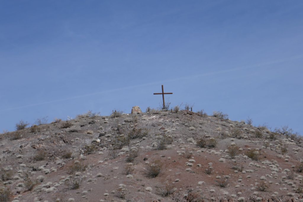
People wondered where Scotty was getting his money. The rumor was that his gold mine was beneath the castle. These rumors were reinforced when he installed a shot splitter by the door for protection. Scotty and his last dog are buried at the top of the hill behind the property. It is marked by a cross. He wanted to be buried with a couple of his mules, but that did not happen.
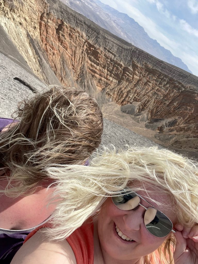
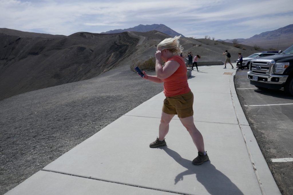
After our tour of Scotty’s Castle, we stopped by to see Ubehebe Crater because we were super close. It was cool, but INCREDIBLY windy. One woman’s glasses blew off of her face, and another guy was hanging onto his bumper. We have some great photos leaning into the wind to take pictures! Haha!
From Ubehebe, we drove out of the park and into Beatty, Nevada, hoping to fill up a little cheaper. We got away with $5.45 per gallon, but I am not sure it was worth the drive. Thankfully, we had planned to stop at the Rhyolite Ghost Town anyway, which wasn’t too far from Beatty, so the drive was well worth it for that.
Rhyolite Ghost Town
We made Rhyolite our lunch stop and enjoyed looking at the old abandoned buildings. Gold was discovered in the area in 1904, and the town of Rhyolite, also known as “the Queen City of Death Valley,” was founded in 1905, and named for the most common rock found in the area.
By 1906, it was becoming a modern town with indoor plumbing and electricity. In its heyday in 1907, Rhyolite had 18 grocery stores, 50 saloons, 19 lodging houses, 6 barbers, 4 bakeries, 35 gaming tables, 8 doctors, 3 railroads, and 5,000-8,000 inhabitants! However, by 1910, the mines were closing and people were leaving. In 1911 the Montgomery Shoshone Mine, which had been the most profitable, closed, and by 1916 the power was turned off in the town. Today the remains of about 8 structures can be seen.
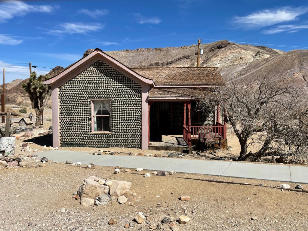
The Bottle House, which is still intact, was built in 1906 by a man named Tom Kelly, a miner born in Australia. Wood was hard to come by in the desert, so he built the house out of 50,000 glass bottles. Kelly paid local kids 10 cents for a wheelbarrow of bottles. Oddly enough, once the house was finished, Kelly raffled it off rather than live in it. He sold 400 tickets at a price of $5 each, which actually caused him to lose money.
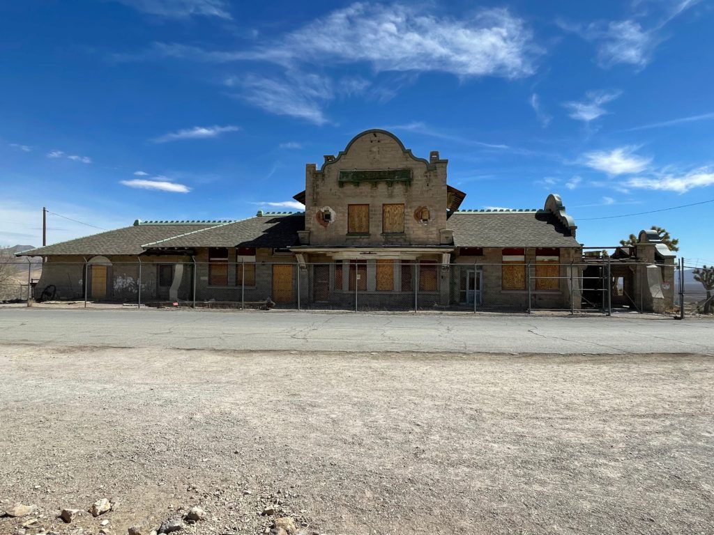
The other building which is fully intact, is the Las Vegas & Tonopah Train Depot. The depot was finished in 1908, but more people were leaving Rhyolite than arriving by this point, and by 1919 it was out of business. In 1937, however, the depot was opened as the Rhyolite Ghost Casino where gambling was conducted downstairs and red light business took place upstairs with the working women. The casino closed with the onset of World War II. The building opened briefly again in the 1960s as a museum and gift shop, but that did not last either.
The front façade still Remains of the Porter Brothers Store. Hiram and Lyman Porter moved from one mining camp to the next following the strikes. They opened their store in Rhyolite in 1905 out of the tent, but by 1906, had moved into their $10,000 building. It was one of the largest employers in the town, second only to the mines. The store closed in 1910, however, Hiram stayed in Rhyolite and served as the town’s postmaster until the office closed in 1919.

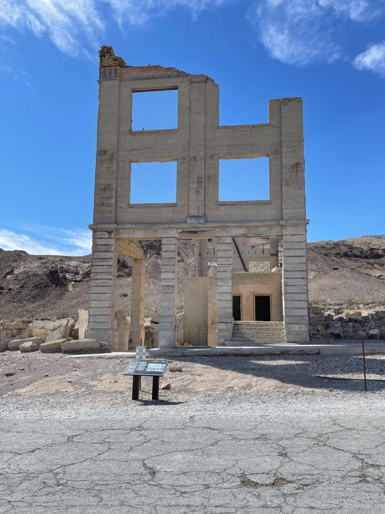
One of the most famous ruins in Rhyolite is the Cook Brothers Bank Building. The Cook brothers started their bank in 1905, and opened a branch in Rhyolite. It was one of four banks in the town. Built in 1907, the building was three stories tall and also held the post office. It had marble staircases, indoor plumbing and electricity. The bank hit hard times during the 1907 Knickerbocker Crisis, and permanently closed in 1910.
The last ruin that I will mention is the schoolhouse. This was especially cool to see, being a teacher! The ruins are actually the second schoolhouse in the town. The first was a small wooden building that opened in 1906 with 26 students. Within a year it had grown to an enrollment of 225 students, and it is said that the teacher had a nervous breakdown. I believe it!
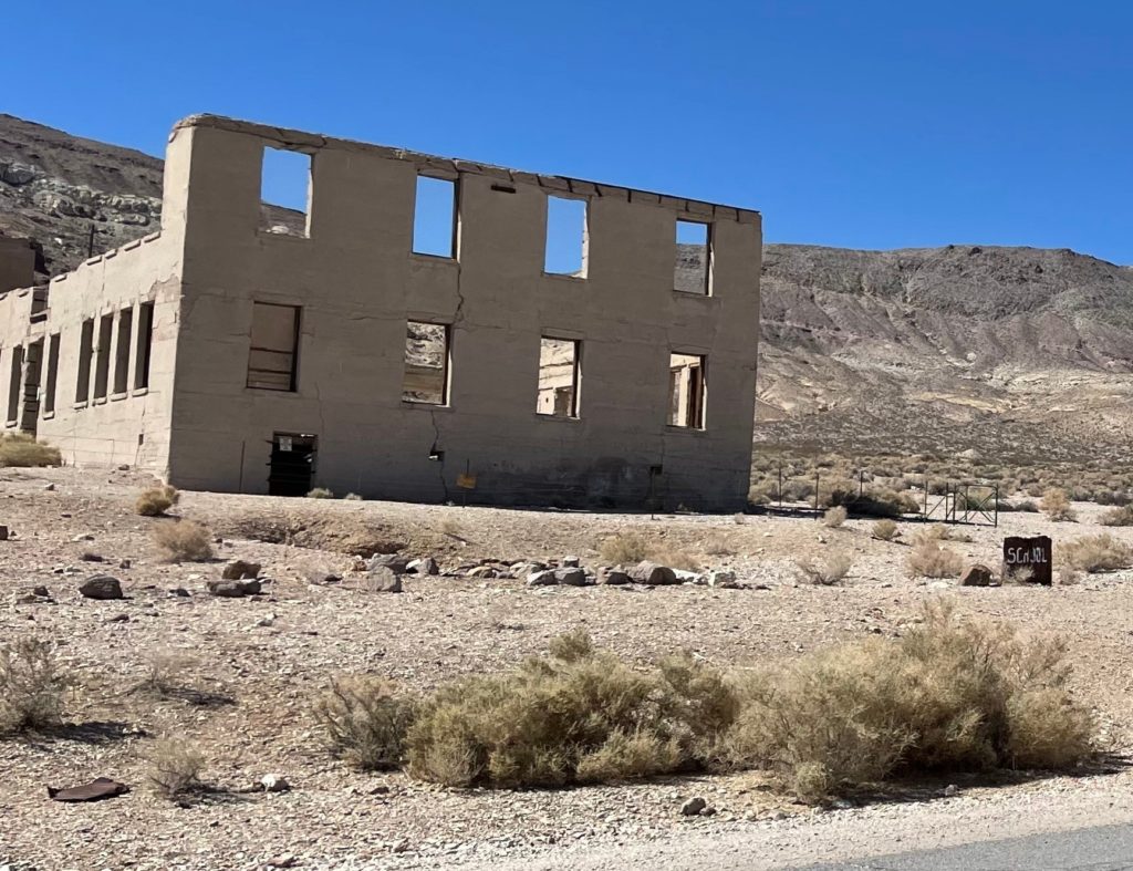
In 1907 a $20,000 Bond was passed to build a new schoolhouse out of concrete. It contained four classrooms and an auditorium. This school building opened in 1909, but closed in 1911 as people continued to move out of Rhyolite. The original Bond was passed on to the town of Beatty, and fun fact, it was not paid off until 1978!
Back in Death Valley National Park
Back in the park, our next stop was the Keane Wonder Mine. I wanted to walk the short distance to see the mine, but my sister did not. Having learned my lesson last time we traveled when she almost left me for dead in the desert (but we don’t talk about that and I have forgiven her) we set alarms on our phones so she would get help if I wasn’t back. Haha!
As it turned out, this really was a short walk to the main structure. I wouldn’t even call it a hike, although there is a longer hike that takes you to what is left of the tramway. When hiking near the mines, be sure to stay on the designated trails as mine hazards and contaminants may be present. Also be sure to stay off of the structures as they may not be stable. Do not enter the mines.
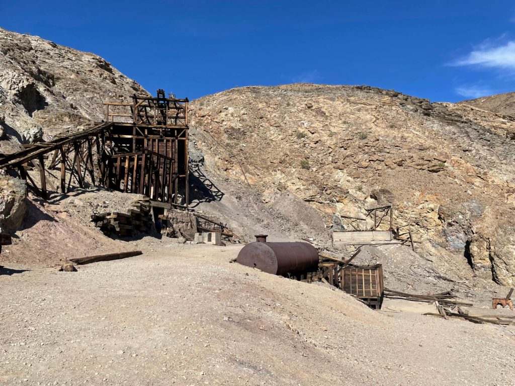
The Keane Wonder mine was nicknamed “the king of the desert.” It produced over a million dollars in gold from 1904 to 1917. Some of the gold from the mine was minted into coins and used to pay the employees. New owners purchased the mine in 1907, and added a housing, an ice plant, and a mile long aerial tramway to move the ore. Keane Wonder Mine is said to be the most intact example of an early 20th century mining operation in all of our National Parks.
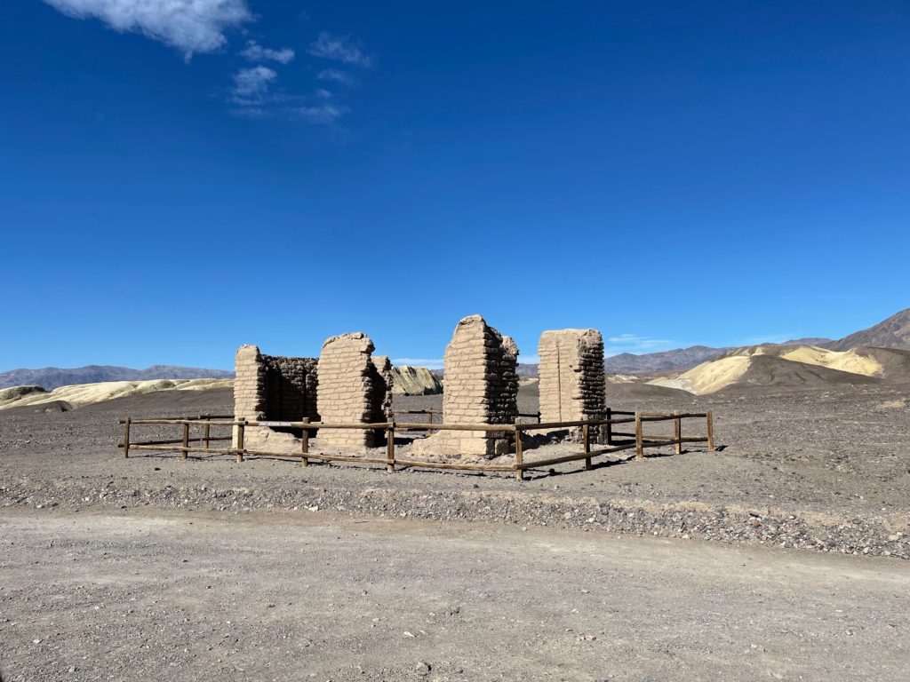
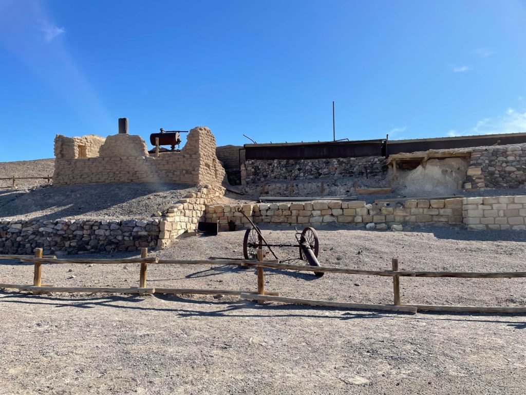
The next stop on our agenda was Harmony Borax Works near Furnace Creek. Harmony Borax Works was built by William Coleman, a San Francisco businessman, in 1882 to refine “cotton ball” borax from the nearby salt flats. The borax had to be refined on site, due to the expense of transporting both the borax and the waste to the railroad which was 165 miles across the desert.
Borax was first discovered in a recrystallized form out on the salt flats. Immigrant Chinese workers who were paid 1/3 of the salary of a white man were hired to harvest the salt flats. It was more economical to mine the borax, and this eventually became the common practice. Harmony Borax Works closed in 1888 as borax was discovered in other more easily accessible locations in California.
If you aren’t old enough to know what borax is, haha, it has been used for centuries by blacksmiths, potters, and farmers. It is also a common ingredient in household cleaners, makeup, etc. Borax is the recrystallized borates, a type of salt, that came to be in this area in particular from an ancient lakebed. Borax is known as “white gold of the desert” and was Death Valley’s most profitable mineral. Gold and talc were the only other profitable minerals to be mined there.
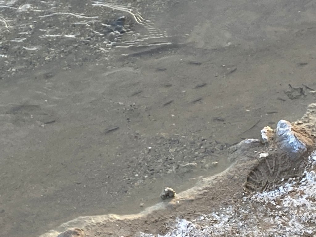
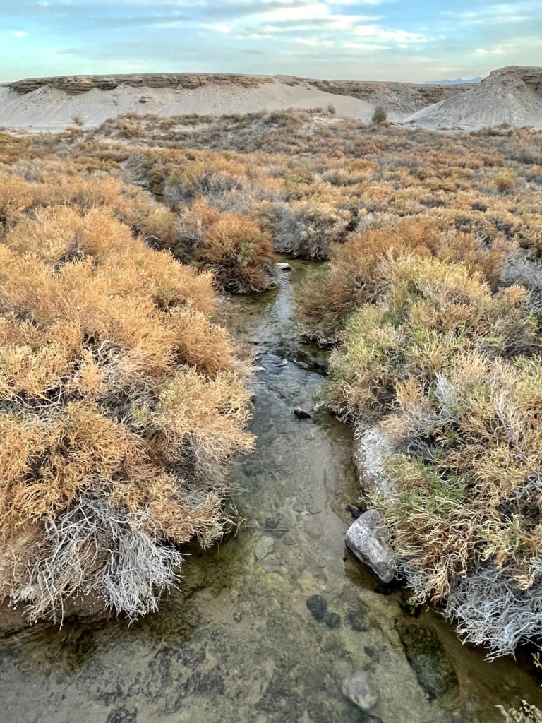
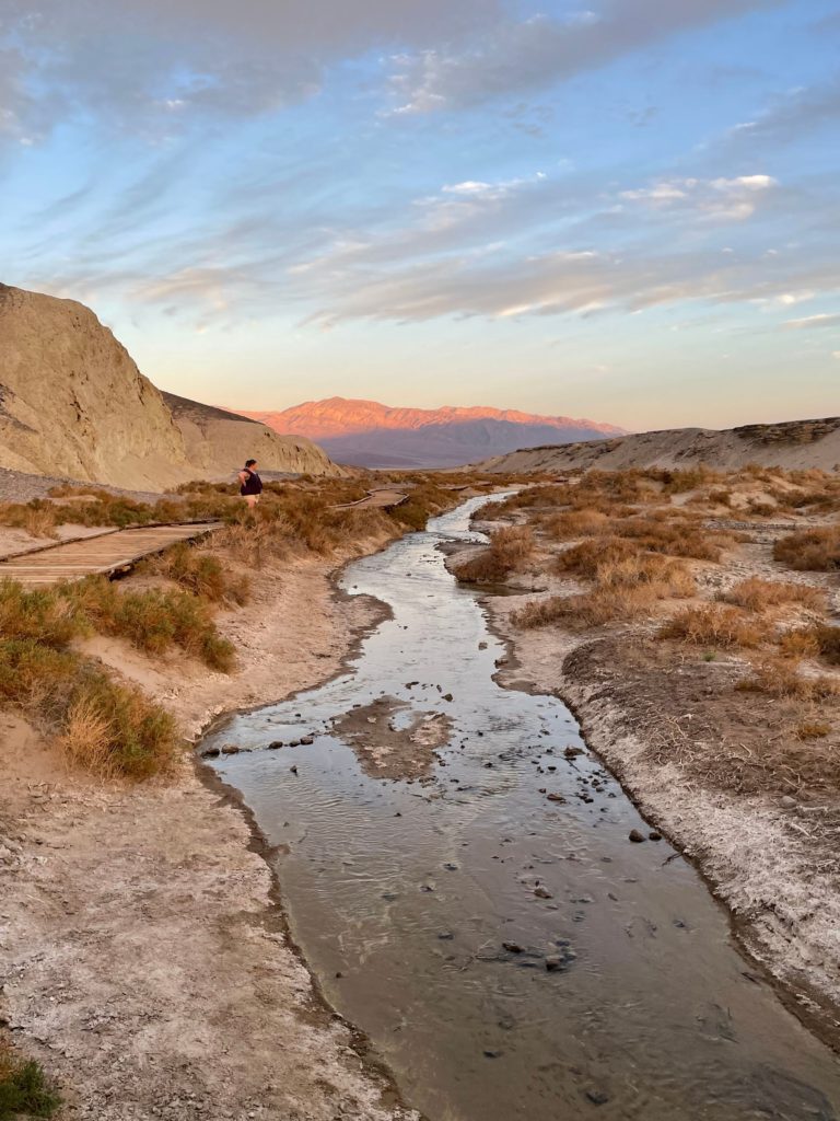
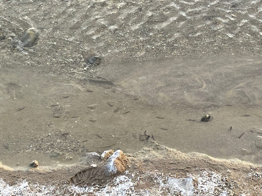
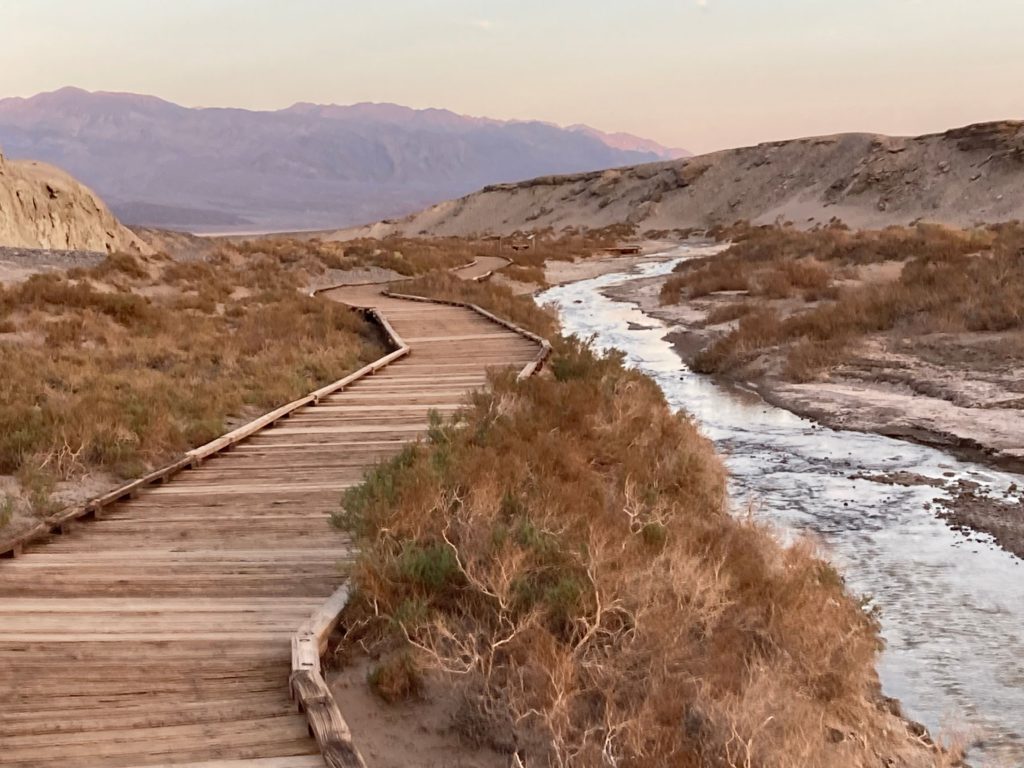
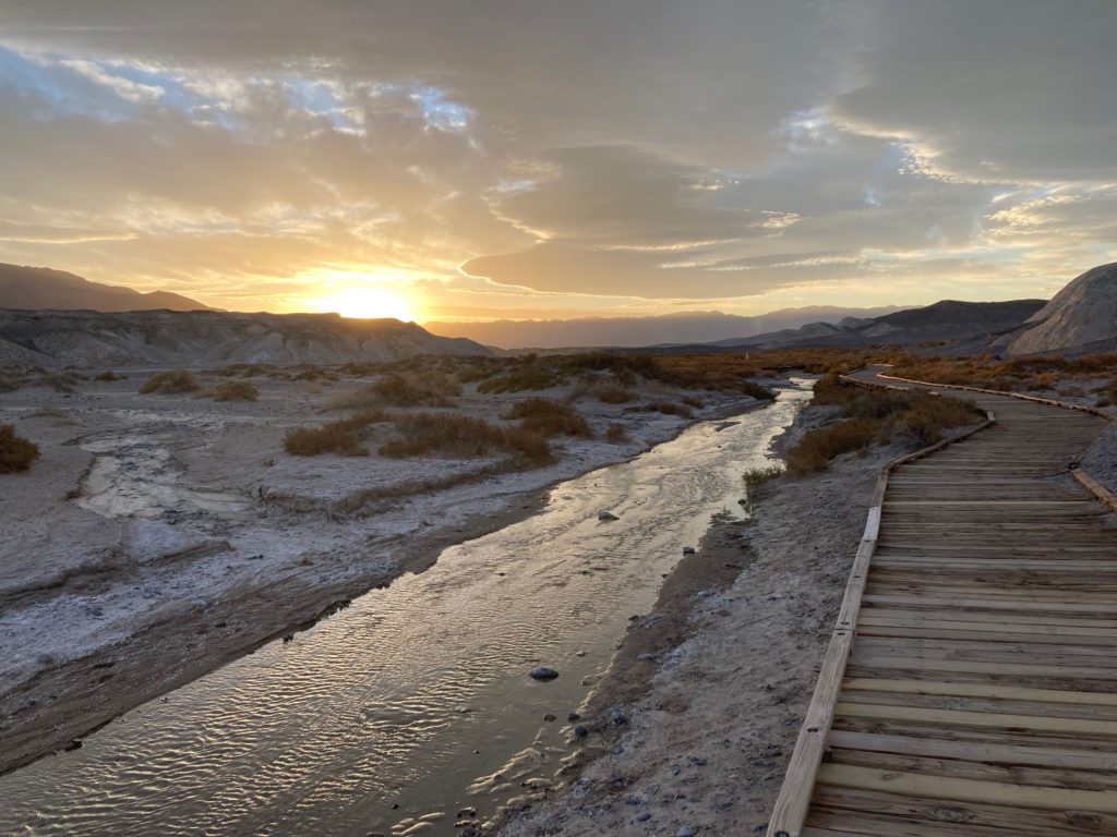
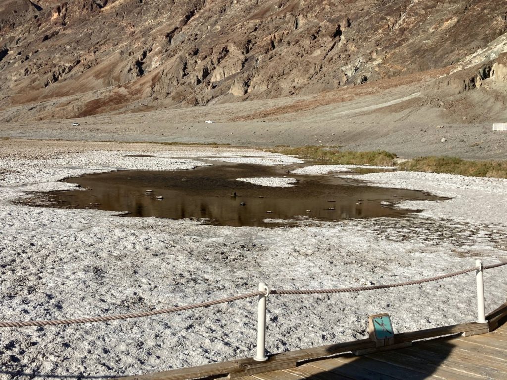
On our way back to Stovepipe Wells, we had time to stop by Salt Creek at sunset. It was beautiful, and I highly recommend getting there at this time of day! There is a boardwalk with interpretive signs that stretches for about a quarter of a mile along the edge of the creek. Please stay on the boardwalk! Be sure to look for the Salt Creek Pupfish that are unique to Death Valley.
The Salt Creek Pupfish originated from Lake Manly over 10,000 years ago! As the lake dried up they became stranded in the pools left behind, and had to adapt to their changing environment. Unlike most fish who absorb water, they drink it. These pupfish are also able to survive in water with several times the salinity of seawater, and in temperatures ranging from just above freezing to over 100 degrees. Spring is the best time to see the pupfish.
On our second and last full day in the park, we had planned to head out 26 miles to the Racetrack Playa. This is a dry lakebed with rocks that move mysteriously across the ground leaving tracks behind them. No one is quite sure what causes this phenomenon.
We stopped at the Ranger Station just to double check our tires, and learned that roadside assistance out that way can be upwards of $3000! The Ranger recommended we NOT go that route as we were in a rental, and even though it was four wheel drive, the tires were basic all terrain and really needed a thicker tread. We decided it was not worth the risk, and headed to the other playa she recommended out toward Badwater Basin instead.
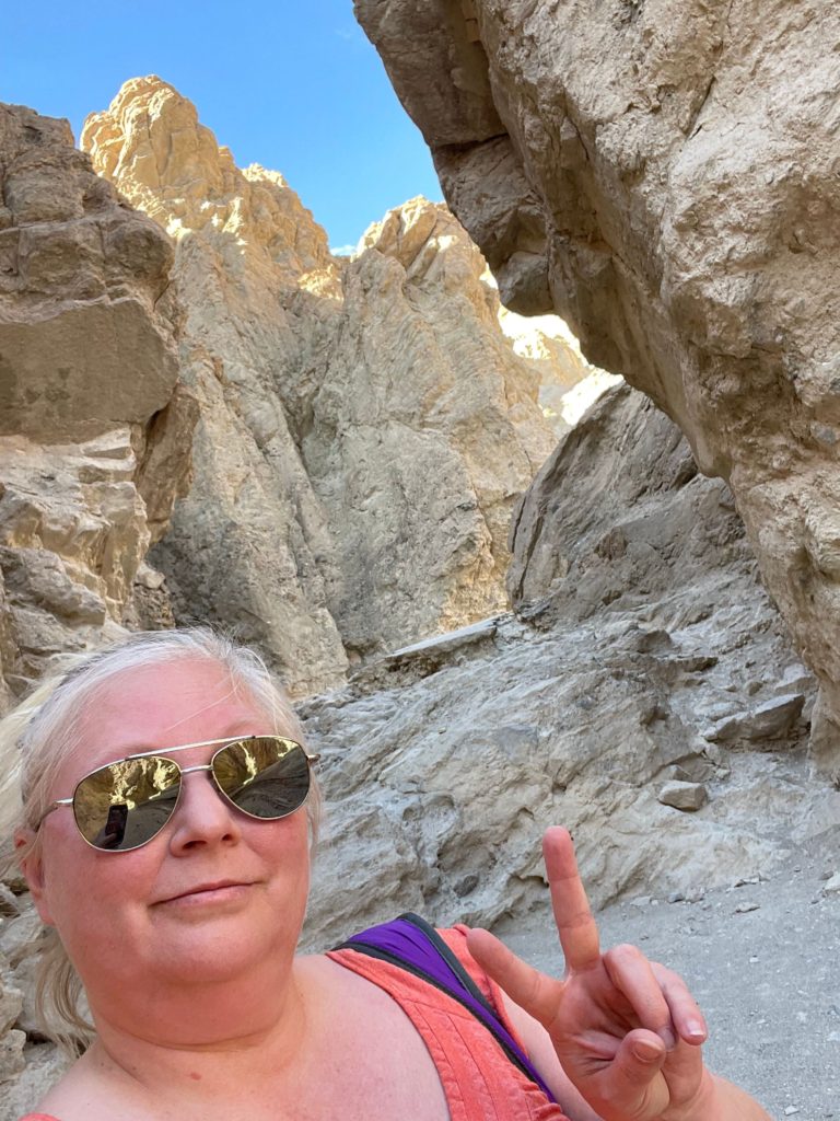
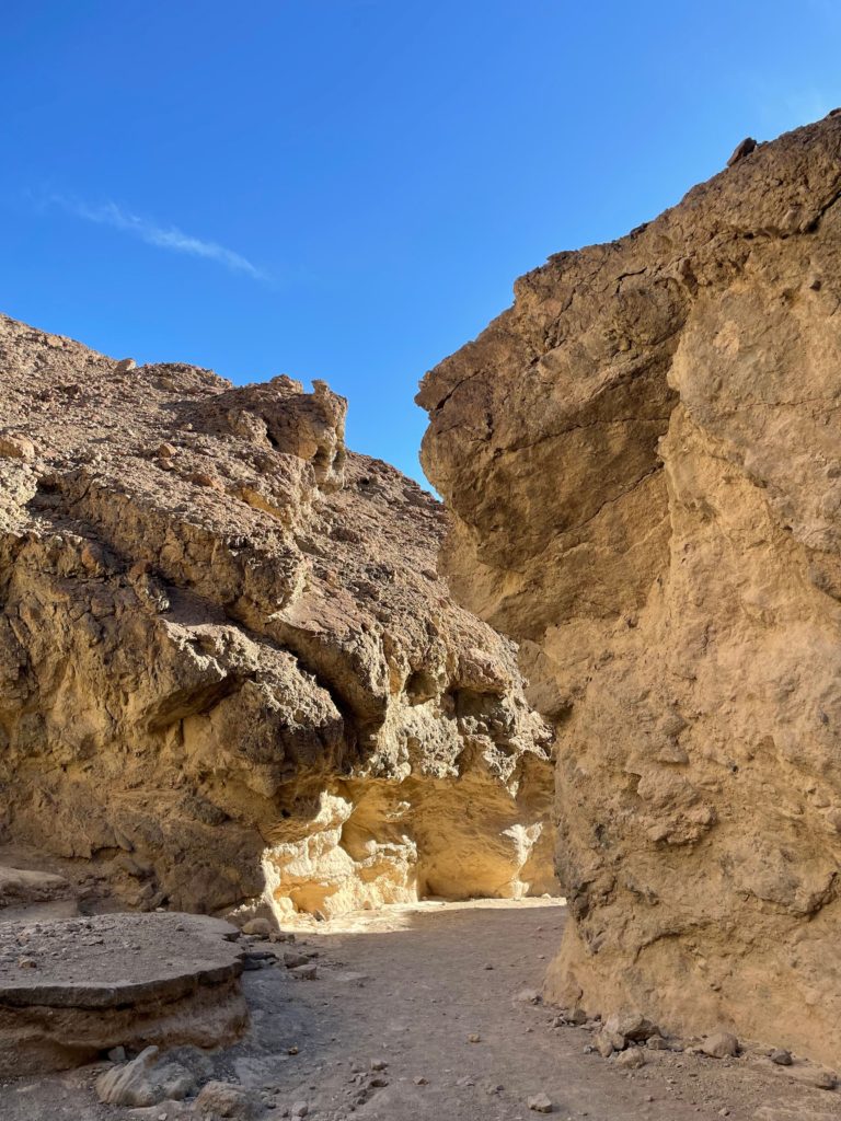
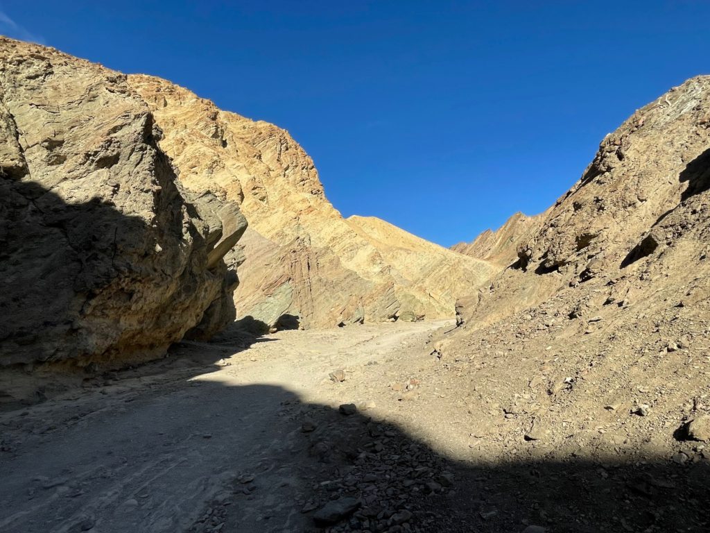
Our first stop was Golden Canyon. The Golden Canyon Trail, is a four mile loop, and the park’s most popular trail. We did an out and back walk. Fun fact, scenes from the Star Wars movies were filmed here, so you can take a walk on Tatooine!
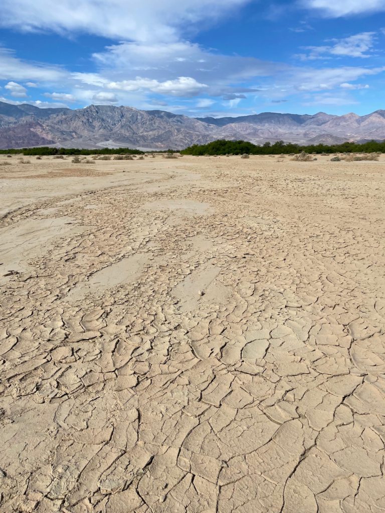
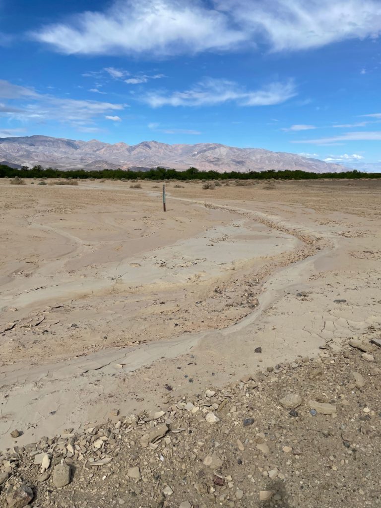
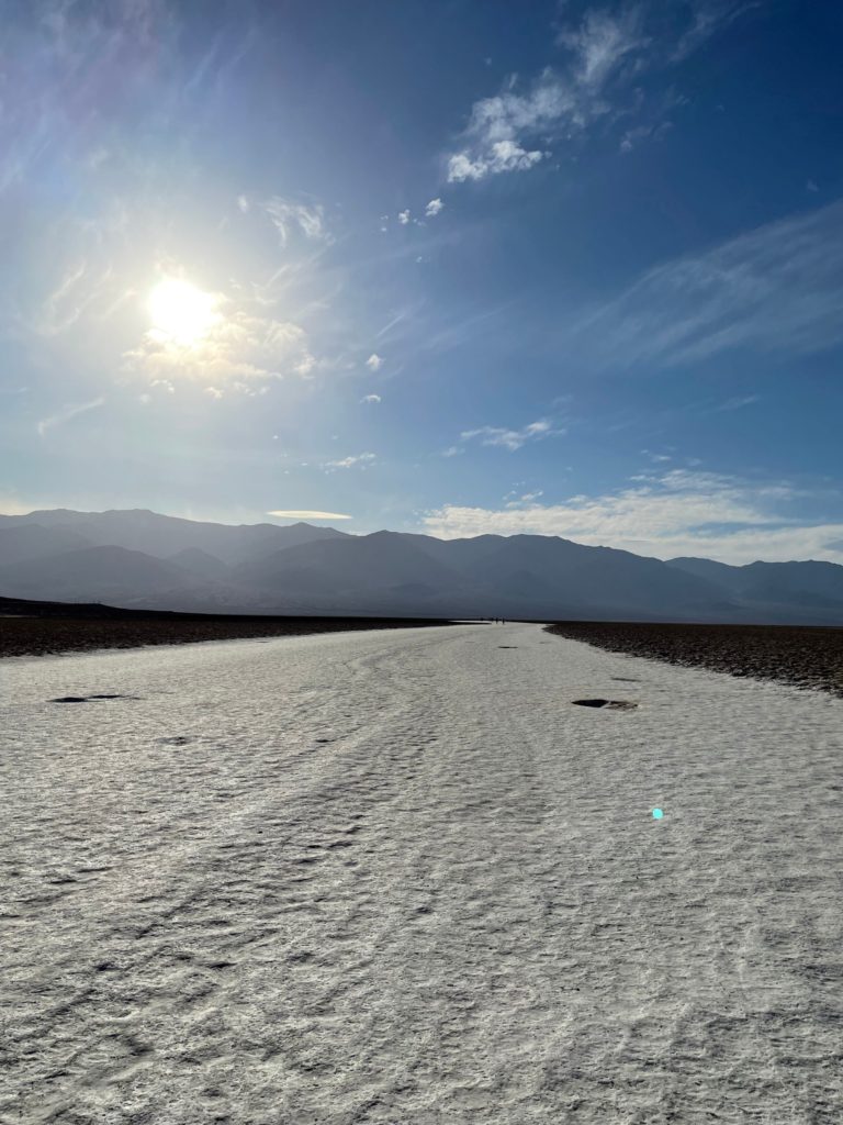
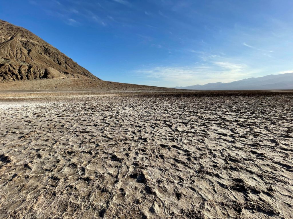
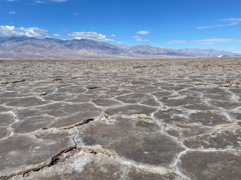
Our next stop was Badwater Basin. This is the lowest point in the United States, and also the Western Hemisphere. It sits at 282 feet below sea level. Badwater Basin is a salt flat. You can walk out onto the flat to see the salt crusts, although, you will need to walk out quite a distance. The unusual shapes of these crusts are the result of the salt crystals oozing up between cracks in the mud. During the winter after rains, the Basin sometimes forms a shallow lake.
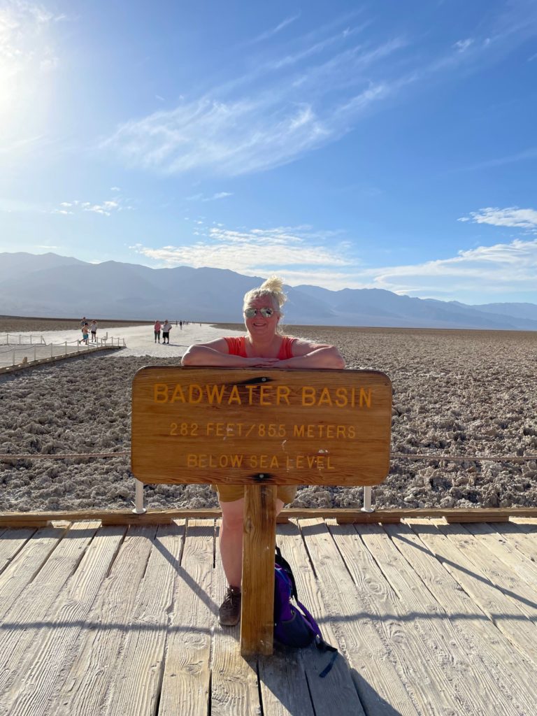
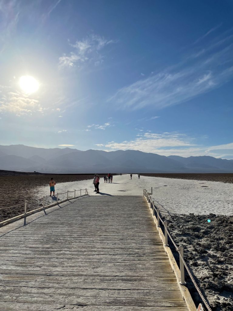
The Badwater Pool is also located here near the parking lot. Again, be sure to stay on the boardwalk to avoid damaging the ecosystem. The pool got its name when a surveyor tried to get his mule to drink from the pool and it would not. He wrote on his map that the pool had “bad water,” and the rest is history. The water is not toxic, just salty. The pool is filled year round with ancient ice age water from an aquifer. The faultline here allows the water to seep out. This pool is home to the Badwater Snail, another creature unique to Death Valley.
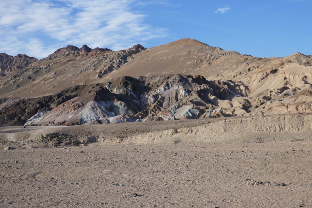
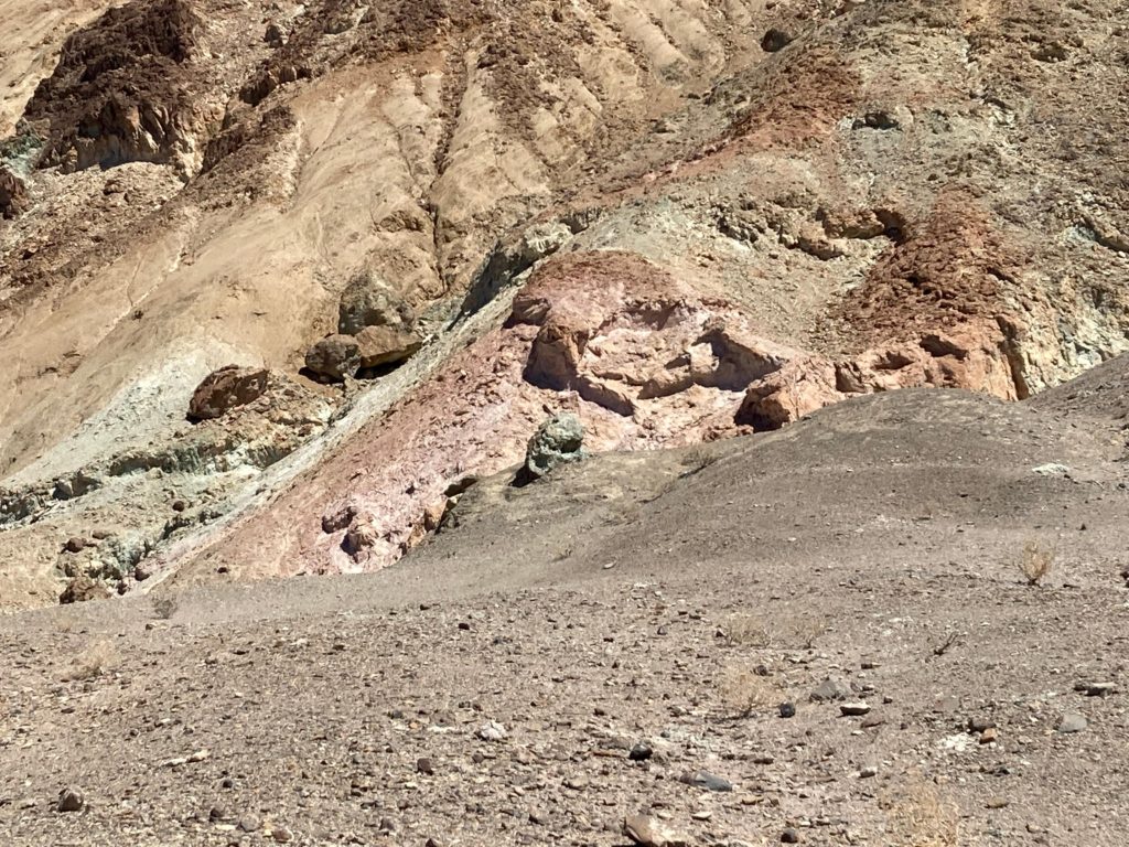
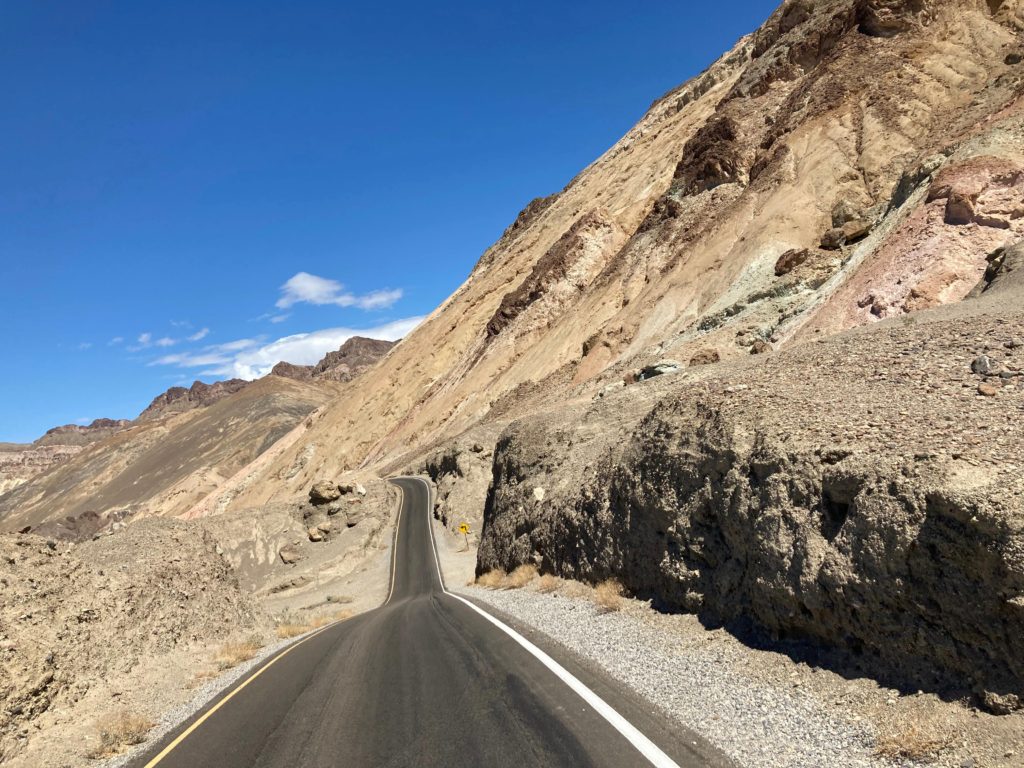
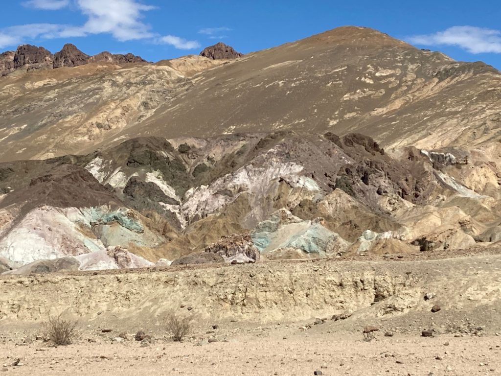
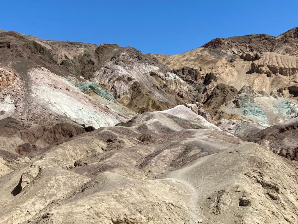
Artists Drive through Artists Pallet was next on our agenda. Artists Pallet is an area known for its colorful rock formations. It was formed over 5 million years ago. Volcanic eruptions flung lava, ash, and minerals that were chemically altered by heat, water, and oxidation. Iron, aluminum, magnesium, titanium, red hematite, and green chlorite have all been identified in the rock here. This drive is nine miles and paved, although vehicles over 25 feet are prohibited. There is also a .3 mile out and back trail through some of the rock formations.
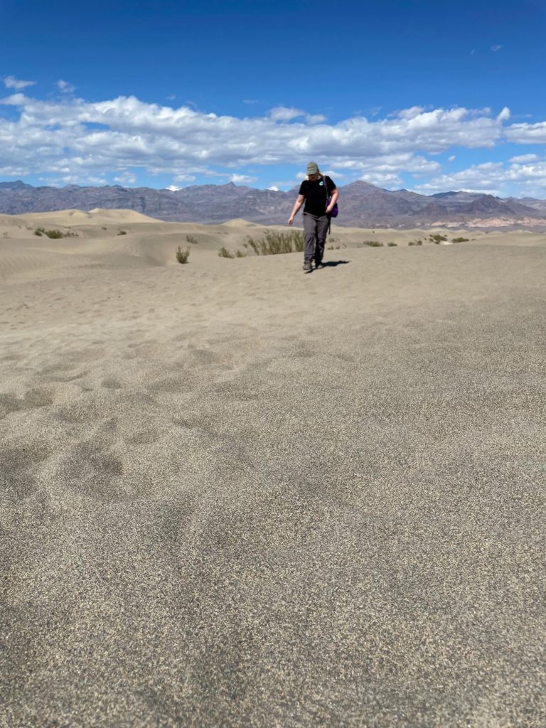
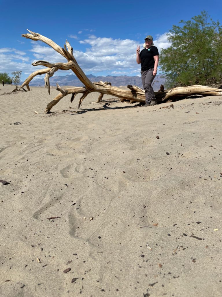
Mesquite Sand Dunes was our last stop of the day. These dunes cover 14 square miles, and are best seen in the early morning or evening light. You are free to wander here. There are no designated trails, just watch out for sidewinder rattlesnakes. Did you know that for sand dunes to form in addition to sand, of course, you need strong winds and something to stop the wind (like a mountain). We had fun exploring here for a while, and then called it a day.
In this vast park, there is a lot to see and do. I feel like we just scratched the surface, but the stops I have mentioned here would be my top recommendations. Next time, I would like to do some more hiking. I would like to see the Devil’s Golf Course. I will also spend the money to rent a jeep in the park (there is a vendor near Furnace Creek) and go see the Racetrack. Look for new articles covering the rest of our trip to U2’s Joshua Tree, Manzanar Internment Camp, and Joshua Tree National Park coming soon, hopefully!
As always, if you enjoyed what you read, please click subscribe to be updated when new posts are published. You are also invited to join our community on Facebook: Tours, Trips & Travel Tips for History Lovers | by Travel the World History. If you enjoy reading about my Sisadventures, you can read more here and here. Thanks for reading! Happy travels!

You May Also Like
Surprising Stonehenge
Eleven States in Seven Days A Sisadventure