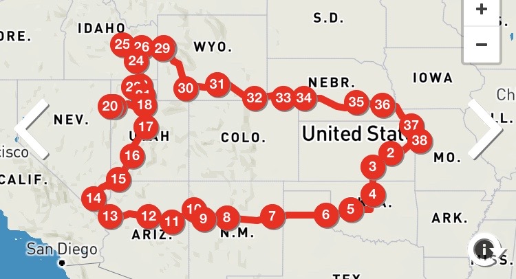
Eleven States in Seven Days A Sisadventure
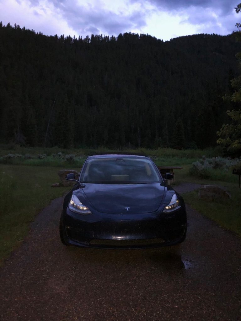
Well here we go! My little sis and I are off on our seven day vacation, an Avoid the Rona Road Trip. Yes, mom, we have our masks and we are wearing them. We will be driving (and camping) in my sister’s Tesla Model 3, which she calls Nik (#NiksNotReal). My sister is a science teacher, and way more techy than me. If EV’s are your thing, you can check out her blog too for all of the details about how great they are here! I will stick to history and hilarity! For those who know my sister and I, you know this trip is sure to be a riot, although we actually plan to avoid those as well. Usually our trips include some sort of misadventures that are pretty comedic, so I call them sisadventures instead!
Our plans? Well for lodging, we will be car camping for four of our nights (with climate control while we charge) and two of our other nights will be in hotels – (one night in Vegas at a 5-Star hotel). The fancy hotel is my sister’s thing not mine! If you’ve read previous blogs, you know that she is a hotel snob! Haha! She will readily admit it. I am more budget friendly haha. I know we go from one extreme to the other here. As far as stops on the way, we only have plans for the Bandera Volcano & Ice Cave, the Golden Spike, and Craters of the Moon. So aside from the 37 other stops to charge Nik (hahaha #NiksNotReal) we have no other plans and will play it by ear!
The back story for the hashtag: she talks about Nik like he is a person and I tease her about it. The hashtag is a great way to pester her. Feel free to use it if you share this post on social media! My plan is to update the blog here each day as we go so long as we have wifi so keep checking back for some great laughs and a little learning! We got in too late Monday night (midnight) to post so it’s going up Tuesday. We may stay a day behind – who knows?!?
- Day 1 – Kansas City to Tucumcari, New Mexico
- Day 2 – Tucumcari to Grand Canyon
- Day 3 – Grand Canyon to Las Vegas, Nevada
- Day 4 – Las Vegas to Bonneville Salt Flats
- Day 5 – Bonneville Salt Flats to Twin Falls, Idaho
- Day 6 – Twin Falls to Jackson, Wyoming
- Day 7 – Jackson to Ogallala, Nebraska
- Day 8 – Ogallala to Kansas City, Missouri
*Day 1*
Today we will cover 5 states! We got on the road this morning in Missouri and drove through the Flint Hills of Kansas into Oklahoma. The Flint Hills are the USA’s largest tract of tall grass prairie. For a good view, you can pull off the road at the very well signed Bazaar Cattle Pens, but we did not – too many miles to be covered and we have driven Kansas a thousand times.
We missed an earthquake in Blackwell, Oklahoma by a few hours, but I am pretty sure we didn’t cause it. Our next stop (to charge) was in Perry, Oklahoma. It turns out the theme of the day was u-turns. We missed the exit for the charging station, so we had to turn around at the next exit and go back – the first of several of these! My sister almost killed us looking at the map because she “forgot Nik wasn’t driving” – okay so that might be a bit of an exaggeration, but it was scary. My sister’s driving usually scares me at least once (or two or three times) a day, so Nik scored some points! Fun fact “he” also doesn’t tailgate. I told her to turn the “autopilot” back on!
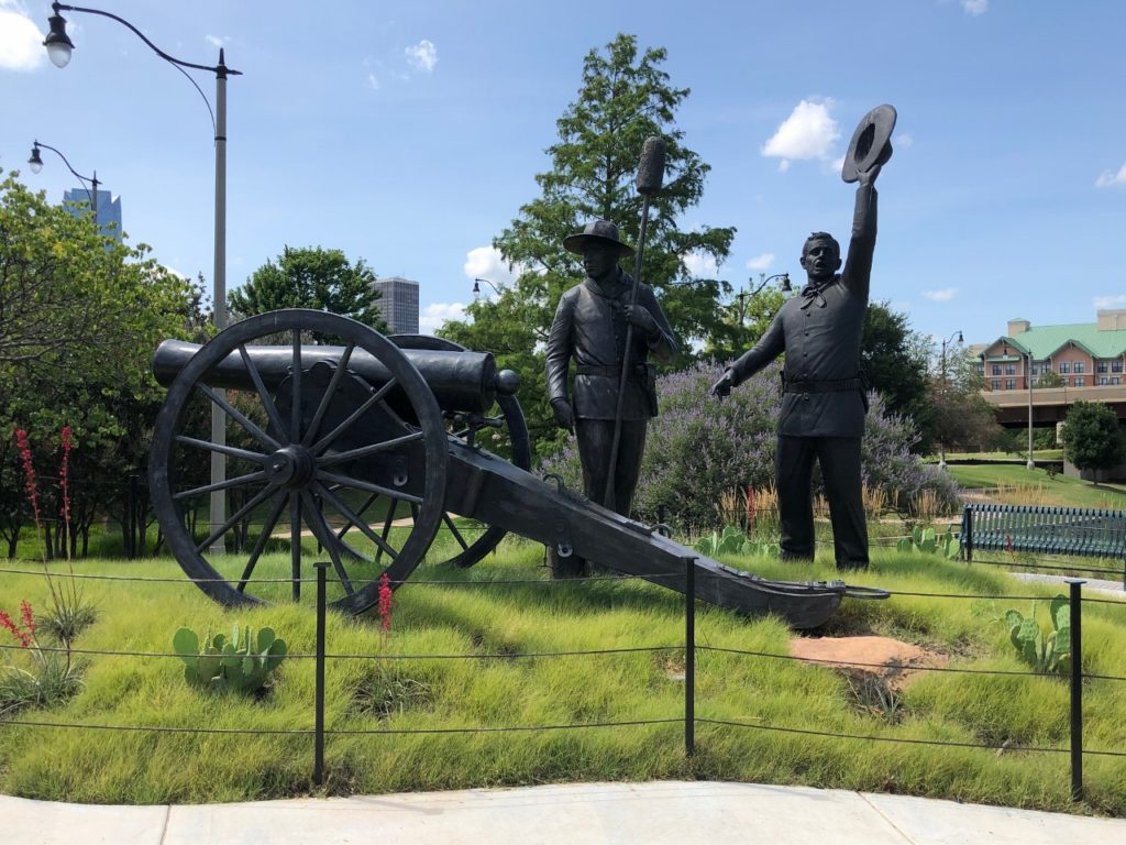
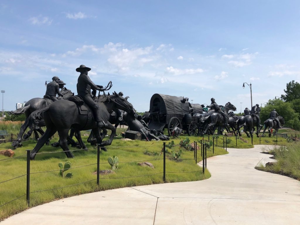
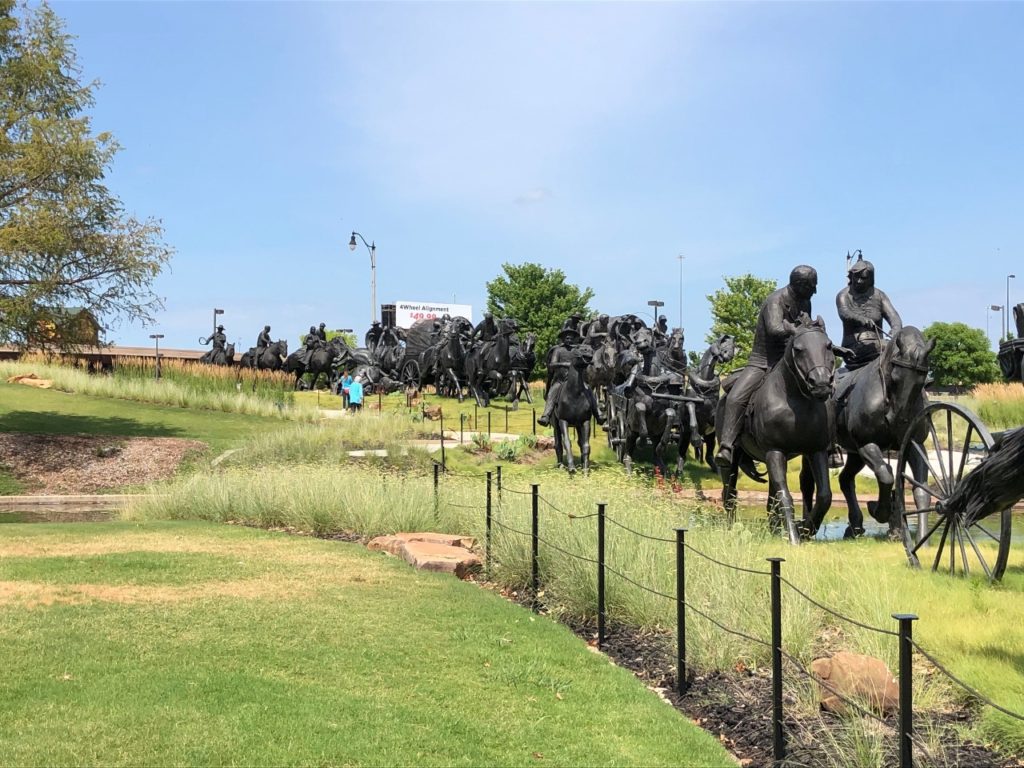
Back on the road, we drove to Oklahoma City. We have also been here several times, but I wanted to stop at the Centennial Land Run Monument and the Chickasaw Monument. Nik apparently doesn’t know the difference between a road and a bridge so rather than drive off the bridge, we had to go and make a u-turn (and then still stop for directions and make another u-turn) to find it. Nik lost some points.
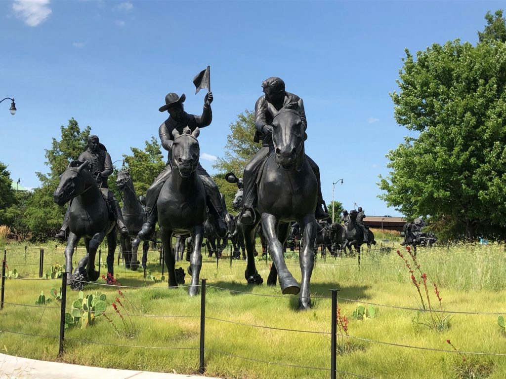
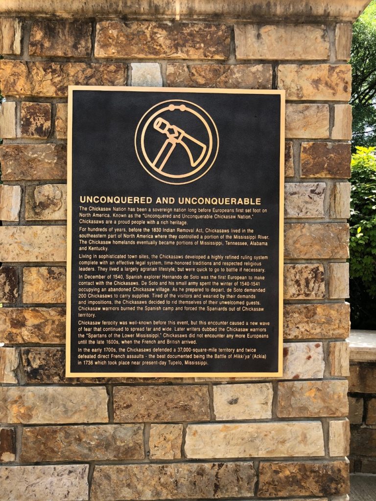
The first photo stop is the Centennial Land Run Monument. This monument commemorates the 1889 land run in Oklahoma. President Harrison opened 2 million acres of Unassigned Land to settlers to stake a claim. Around 50,000 people participated in this first of several land runs. Not all were successful, some were trampled to death, and some returned empty-handed. There was also some cheating involved as some sneaked out before the canon was fired.
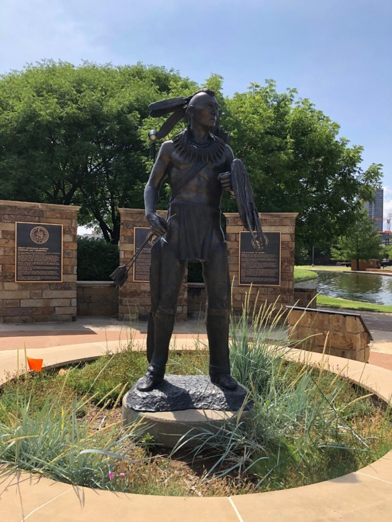
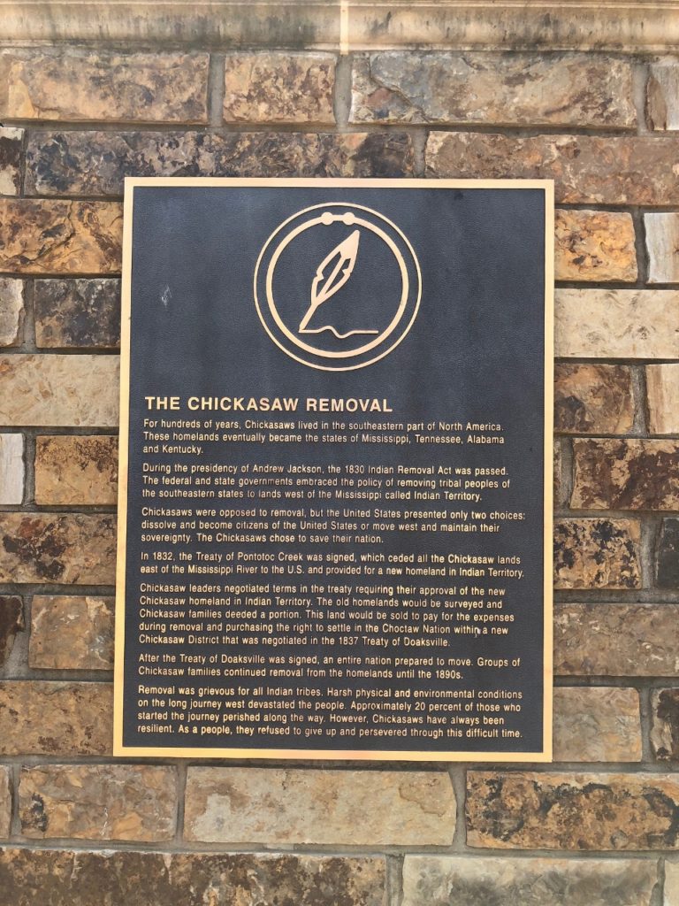
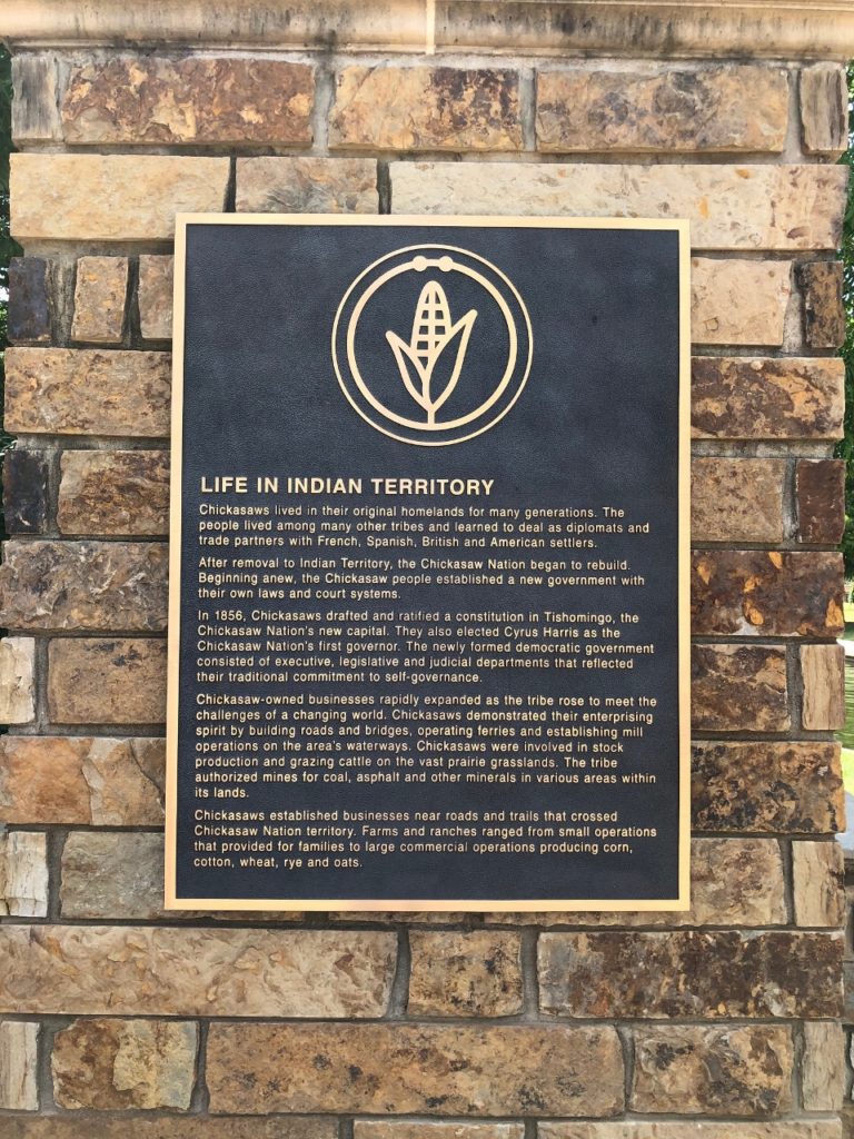
Let’s talk about the “Unassigned Land.” This is referring to land not designated as reservation lands after Jackson’s 1830 Indian Removal Act, which uprooted tens of thousands of Native Americans from their homelands and moved them to Oklahoma – then known as “Indian Territory.” One of these groups was the Chickasaw, and there is a very nice monument set up to commemorate the Chickasaw people. The plaques talk about their way of life, leaders, life in Indian Territory, and their resiliency and determination. The Chickasaw were one of the groups forced out on the Trail of Tears.
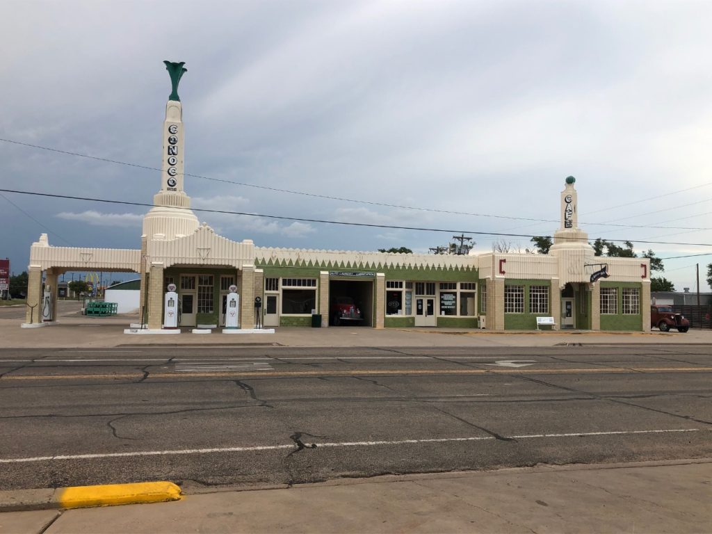
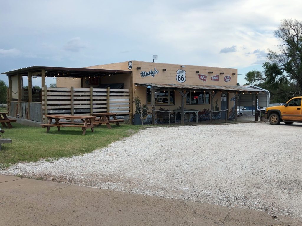
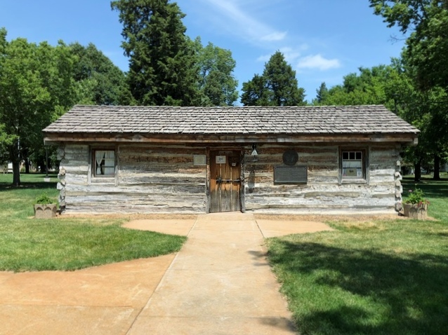
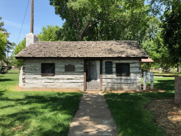
From Oklahoma City, we drove to Weatherford, Oklahoma to charge which involved another u-turn as we passed the exit. Our dinner and charge stop was in Shamrock, Texas. This town is on Historic Route 66, and has some great old buildings from the era. We ate dinner at a little diner/burger stop called Rusty’s – they have both amazing burgers and customer service. If you are in the area stop here to eat!
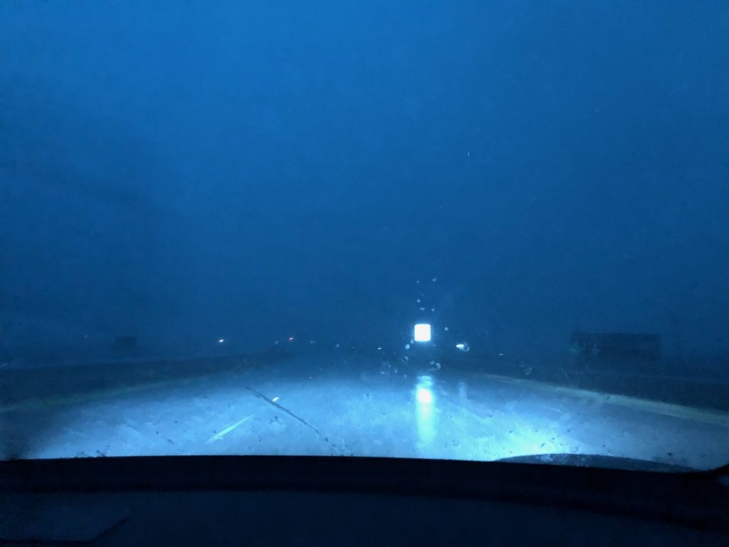
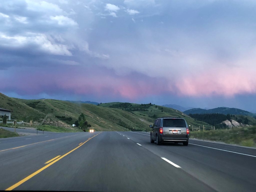
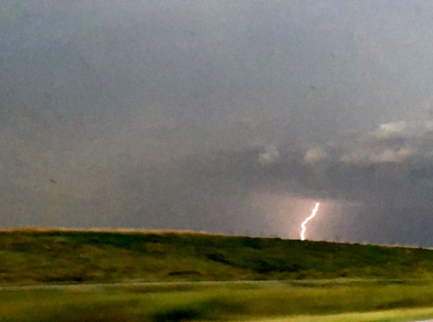
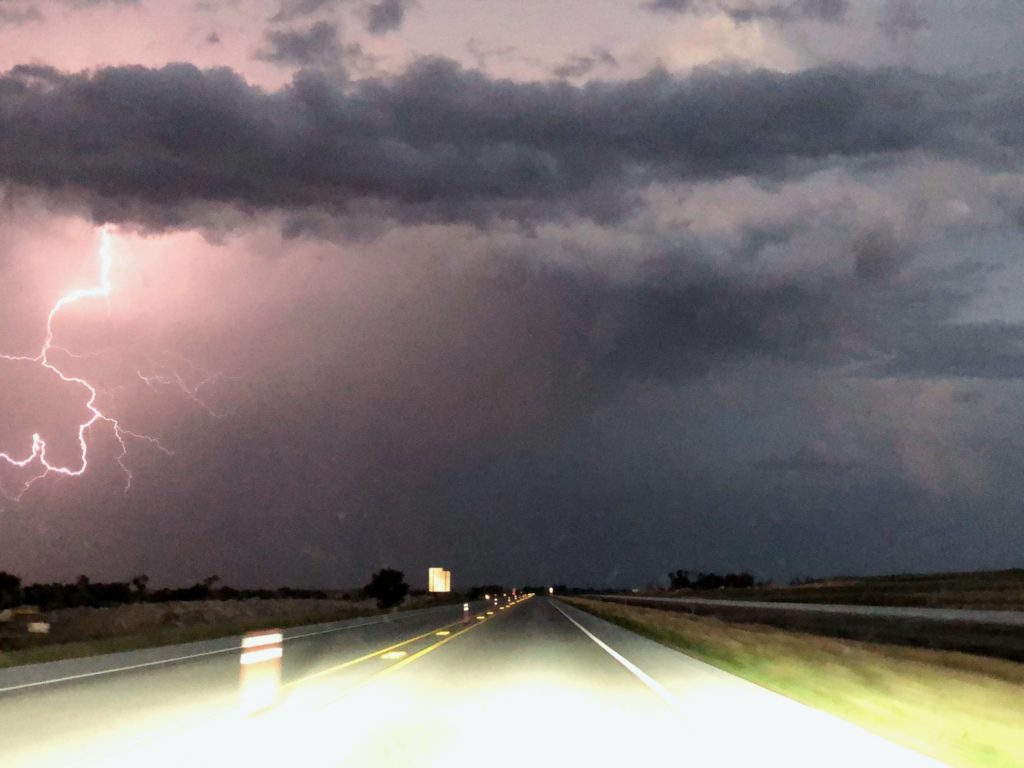
The drive from Shamrock to Amarillo (to charge) got a little crazy as we drove through the mother of all storms! I take back all of my snarky comments from earlier. Haha! No really, good job Val! Nik even refused to drive in so it was all on her. (Well and lots of praying from the passenger seat – so shout out to God for getting us through it alive!)
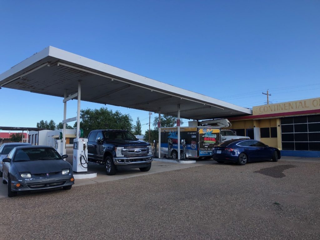
Our last series of u-turns for the day involved finding a bathroom before camping for the night – we literally drove past the charging station 3 times. Finally, around midnight, we plugged in and slept at an old Route 66 gas station that has been converted into a charging station in Tucumcari, New Mexico.
*Day 2*
So car camping in my sister’s car was interesting. Her seats fold down and she has sort of a mattress set up that goes in the trunk and on the back seats. I was pretty sure there wasn’t room for both of us back there so I decided to sleep in the front seat. There were two problems with this: 1 – the seat wouldn’t lean back very far because the back seats were folded down and 2 – her front windows aren’t tinted very dark so I felt weird that anyone could just walk by and look in at me sleeping. So, I ended up in the back with her. Good thing we are close! Haha. There was enough room for us both but barely! I woke up a little tired but by the time it was my turn to drive I was awake.
We left to go to the truckstop for hygiene and to get more ice. We had a slight delay when my sister lost ALL of her masks, but we eventually found them and went about our business. We were on the road by 8:30 and headed to the Bandera Volcano & Ice Cave with our end destination set for Vegas.
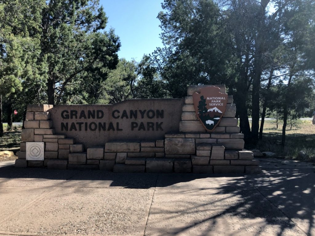
Then, we had a change of plans. It turns out my sister has never been to the Grand Canyon before, and it makes no sense to be this close and not go. So…we cancelled one night at the hotel in Vegas (our original plan was two nights), and decided to car camp again at the Grand Canyon!
Val drove to our first charging stop in Albuquerque, and then I took over and drove to the volcano. I should mention that there was NO construction for my part of the drive today – usually I get all of the construction! So far, this trip, Val has had it all.
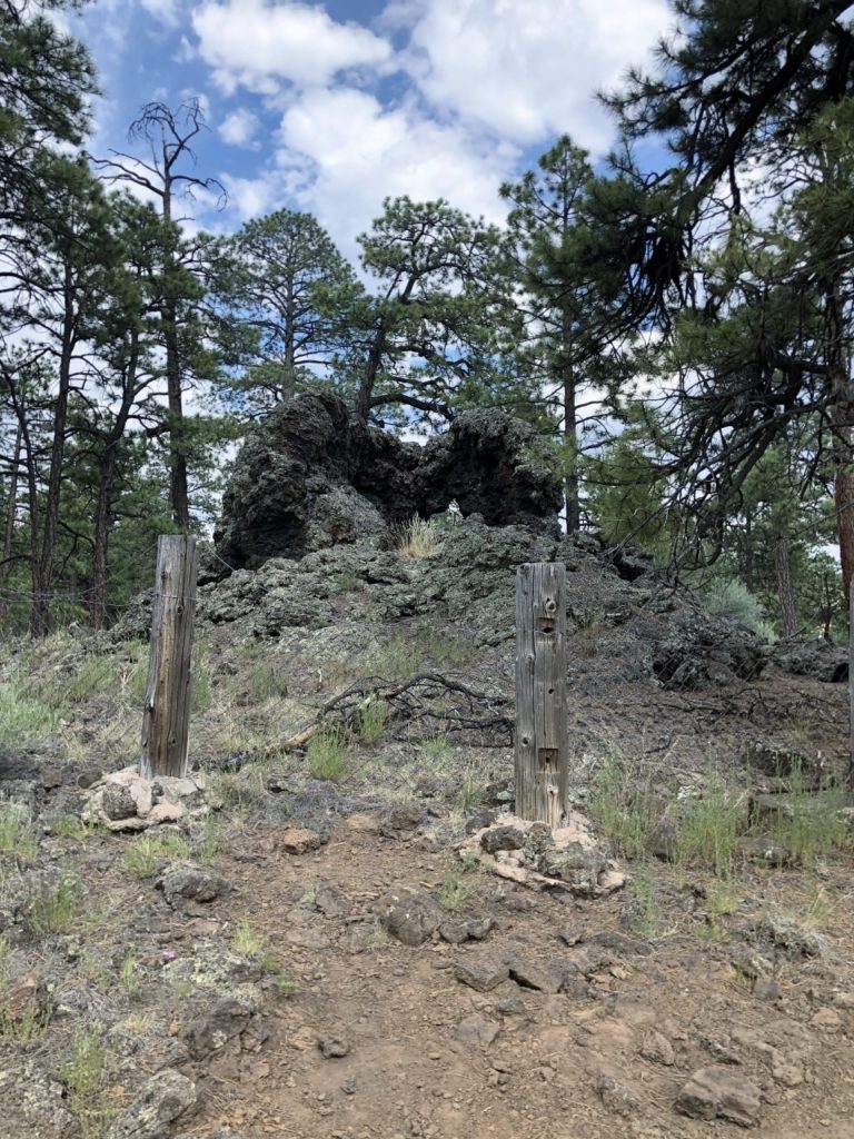
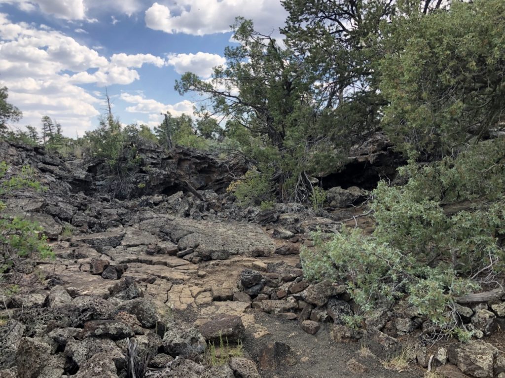
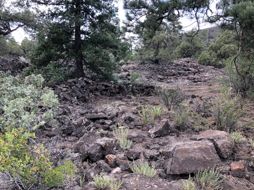
The Bandera Volcano is a dormant volcano. It last erupted around 1170 BC. It is part of the Zuni-Bandera Volcanic Field. This is a great stop because you can actually hike up and into the cinder cone! It was only a mile round trip, and although uphill most of the way there, it was downhill most of the way back! Really the hike wasn’t bad at all. It should take around an hour. It took us about 90 minutes because we made a lot of stops. My sister had ankle surgery that effects her on any terrain that isn’t flat. But she powered through and did the whole thing! We have seen a lot of volcanoes, but never have I been inside the cinder cone. It was cool!
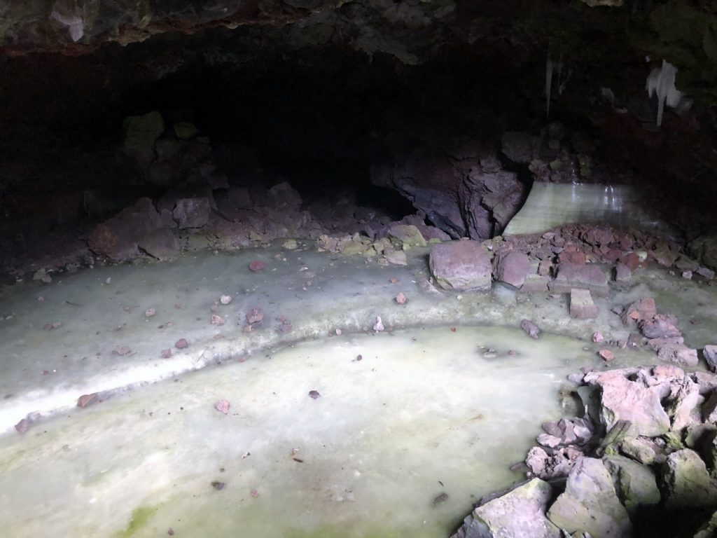
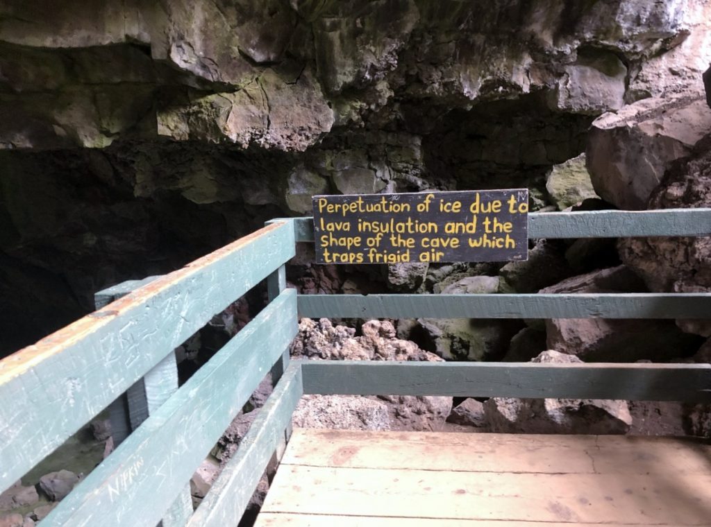
The Ice Cave was somewhat interesting only because the water in the cave is frozen (an interesting green color) due to the wind. It stays frozen year round and is always right at 31° which is bazaar in the middle of the southwest! This hike was shorter at a half a mile, but there were some wild stairs! It took us about an hour. Again it took us longer than it would take you (the stairs got her). It should take around 30 minutes. There are also some Anasazi ruins on this hike, but not the typical ones you think of! These were made up of lava rocks! We paid $12 for admission, and spent several hours here. We also had lunch. The owners were super friendly and very informative.
From the volcano & ice cave we drove to our next charging stop in Gallup where we had a bit of a fiasco with the restroom – the hotel would not let us use it (which apparently they are contracted to do if they have the Tesla Superchargers) so we had to find another option. This has probably been the trickiest thing about road tripping right now – finding restrooms that are open to the public.
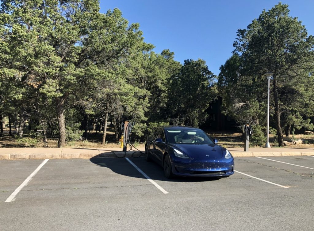
We stopped at the Petrified Forest, but it was already closed. We missed it by a few hours, so our next stop was Holbrook to charge. This charger was in a Burger King parking lot so we grabbed some dinner while we waited. By this time it was almost dark. While heading to our last charging stop in Flagstaff to top off and head to the Grand Canyon, we drove through what I think was the plague of locusts. Some sort of huge bugs kept splattering all over the windshield. They sounded like rocks hitting! I had a hard time seeing! It was crazy! So after charging and cleaning the windshield in Flagstaff, we finally got to the charger in Grand Canyon around 11:30! We plugged in and called it a night! But only after taking a few minutes to appreciate the amazing view of the stars and the milky way that light pollution prevents us from seeing at home!
*Day 3*
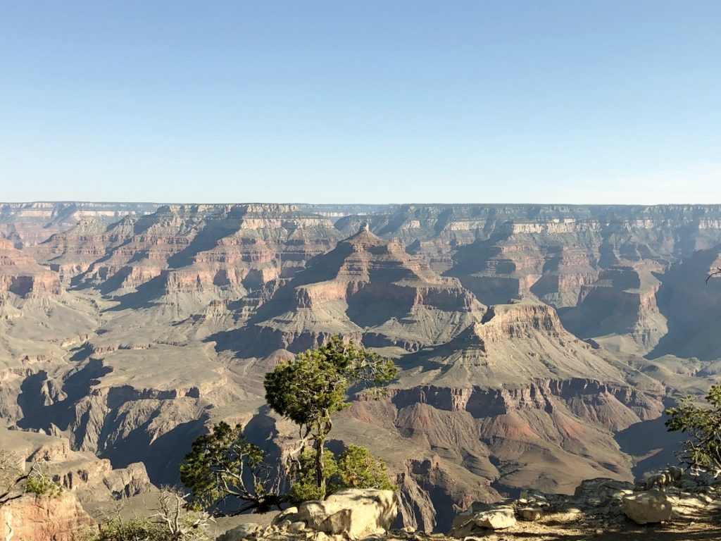
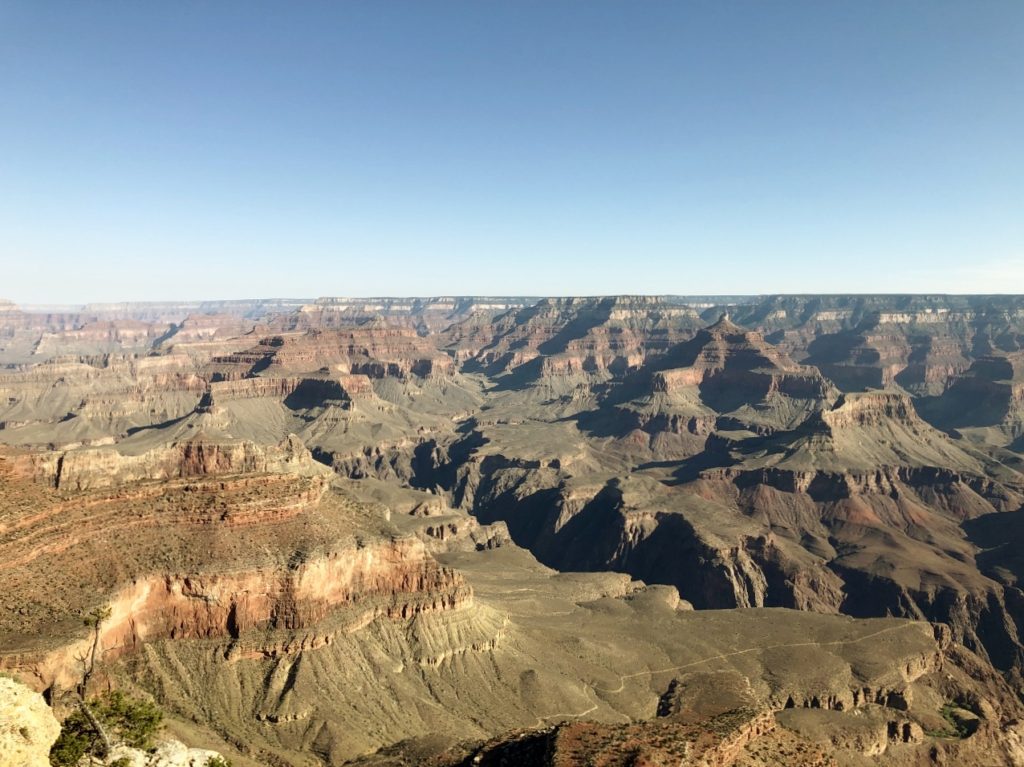
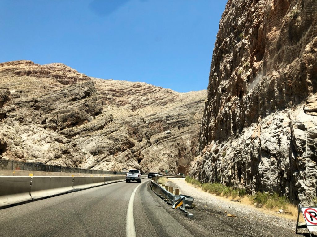
Today we spent the morning driving around the Grand Canyon and taking photos from various scenic overlooks. Then, we headed toward Vegas for our hotel stay after charging in Tusayan. We stopped again to charge in Kingman and had lunch while we waited as well.
On the way to Vegas, we decided to go to the Hoover Dam, but after driving a winding road that made me a nervous wreck, we were turned away by security. Bummer. I am not sure what was up with that, but we missed the dam. We drove the crazy road back to the interstate, and drove the rest of the way to Vegas without incident.
We spent some time enjoying the pool and hot tub at the hotel (while social distancing of course), and we had a super yummy steak dinner at DJT. It was seriously a great steak! This is my first stay in a five star – that is my sister’s thing – she is a hotel snob. Haha. So far it is nice, but for the price I will stick with my Holiday Inns. I will appreciate it more from a historical-ish perspective – I got to stay in a hotel owned by a US President. I will let you know how I slept tomorrow (or whenever we have internet again and I can). Thanks Val for the 5-star experience! Goodnight all!
*Day 4*
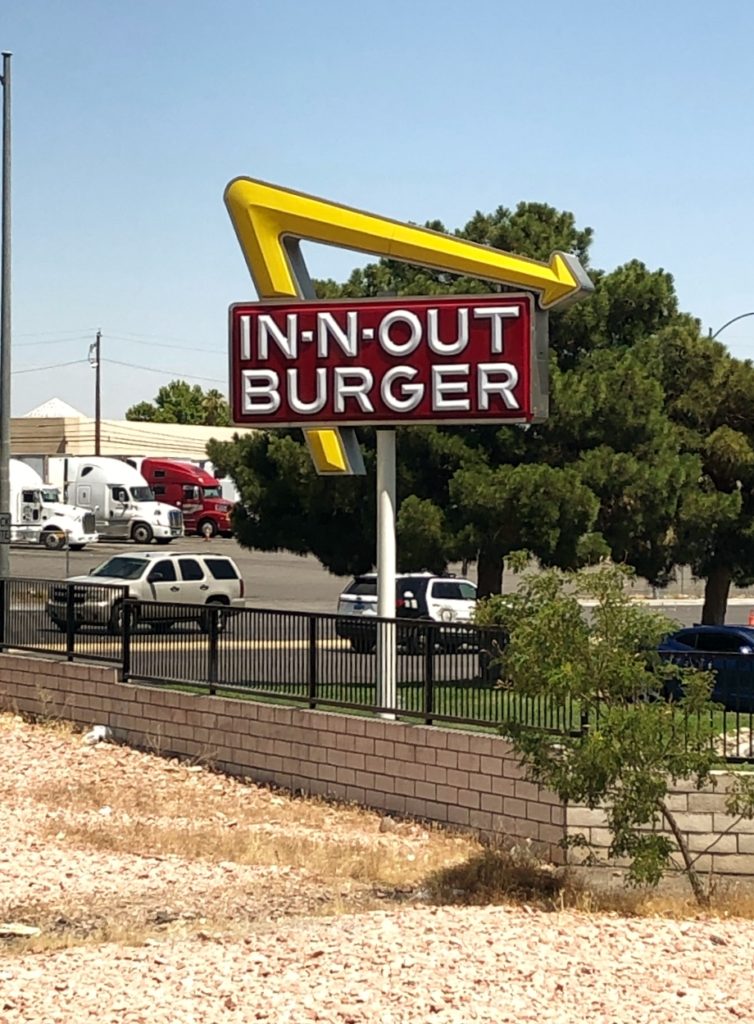
Well, I slept great last night, but that was because I slept in a real bed and not a car. Haha! The sleep quality at the hotel was the same as any other I have stayed at. But, it was nice to have the opportunity. We got to sleep in a little today, and ate lunch at In & Out Burger on our way out of town! And for those who thought yesterday’s posts were a little boring, today was no such thing.

So before we leave Las Vegas behind, I wanted to post this yesterday, but I was just too tired. Vegas has a pretty crazy history! It was founded in 1905, when the railroad auctioned off land around Fremont Street. Fun fact, Fremont Street was the first paved road in Vegas, and it got its gambling startup in the 1930’s during the construction of the Hoover Dam. By the 1940’s, organized crime had taken over and started building casinos on The Strip. This lasted until the 60’s-70’s when most sold out to corporations.
And now for today’s adventures. Today was mostly a drive day. The goal was to make it to the Bonneville Salt Flats in time to watch the sunset. This was an epic fail. Haha. Literally the entire day was like Mr. Toad’s Wild Ride! We had one crazy driver after another! Before we were even out of Vegas, someone tried to change lanes into us and a semi truck had a blow out one lane over in front of us that sent his tire shreds flying our way. “Nik” avoided the lane changer, and Val did a great job with some evasive maneuvers to avoid us being hit by the tire!
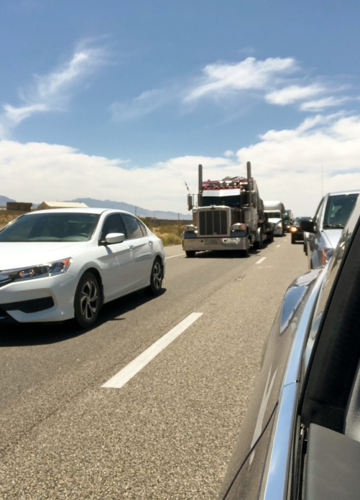
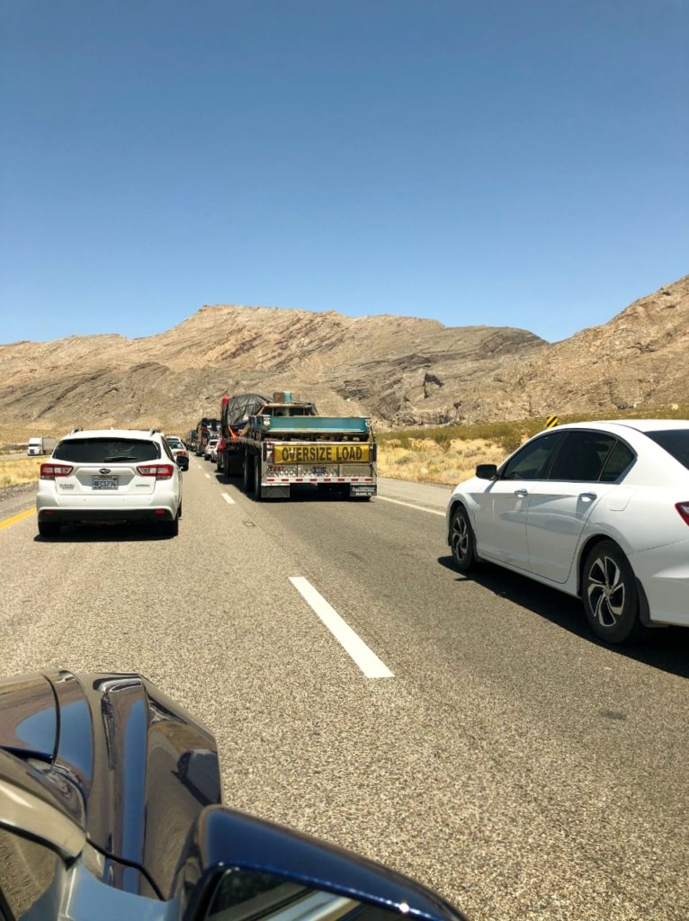
The main time suck for today, was all of the construction we went through – seriously! “Road Work” was the theme of the day – thankfully it was Val’s day to drive – so I dodged that one again. Haha. Our first charging stop was in Saint George, UT. I want to give a shout out to Porkbelly’s Eatery & Catering in Saint George for letting us use their restroom. They were super nice, so stop in here and eat if you are in the area!
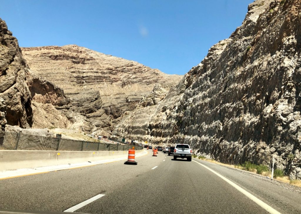
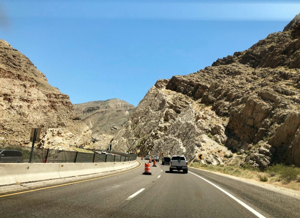
Between Saint George, and Beaver, Utah (our second charging stop), we drove through a really cool mountain pass on I-15! The road had been cut through the mountains and you could see the striations really well. It was a good thing it was interesting, because the entire pass was under construction. It took forever to get through it!
Once we made it through the pass and charged, we went through an area that had wind warnings. I think the wind was trying to start a second Dust Bowl! You could see the dirt blowing across the road. And of course, we had more construction! Then the rain kicked in as well. My poor sister was trying to keep the car on the road while dodging all of the tumble weeds that were being blown across the highway in a construction zone. She even yelled at Nik! The horror! She had crossed the line over onto the shoulder a little because the construction barrels were way over in our lane and when she did, “he” started beeping at her. Hahahaha!
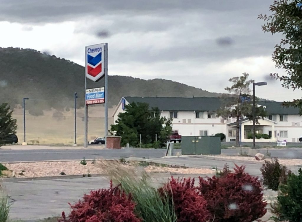
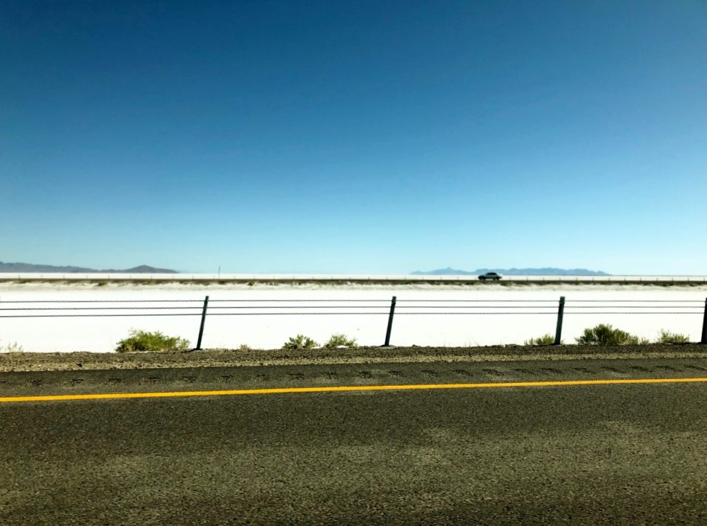
We did finally make it to Nephi to charge, and we also waited out the weather and ate dinner. This is where we figured out for sure we were going to miss the sunset at the salt flats. (We also forgot to figure in the time change from Pacific to Mountain time). We decided to go ahead and drive to the Salt Flats anyway and just get in super late (again) but then get up in time to watch the sunrise.
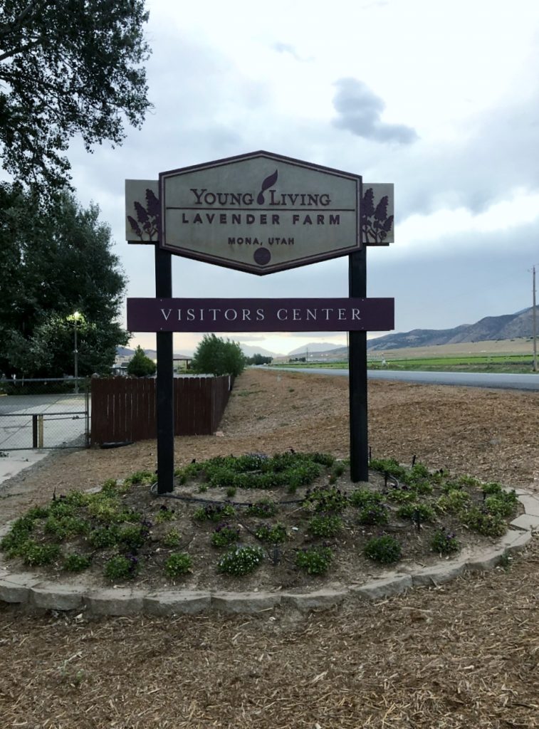
This was our plan for all of five minutes until we saw a sign for the Young Living Lavender Farm. We LOVE Young Living Essential Oils (you can get yours here). So, we detoured to the Lavender Farm. It was closed due to Covid so we snapped some pictures at the sign and of the lavender from outside the fence. We debated about calling it a night and camping there, but decided to go with the Salt Flats plan. So off we went.
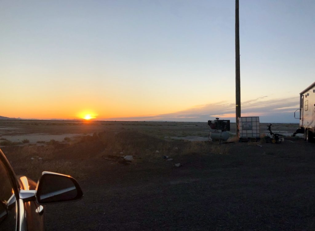
We made it to just outside of Provo, before we hit more construction, and there was literally construction the entire way until we got to Tooele to charge. My sister kept calling it Parvo (she really thought that was what it was called for a minute) which made me laugh every time. Once we left Tooele, I took over the rest of the drive to the Salt Flats. We rolled into the truckstop in Bonneville after midnight, and car camped there. So with Val’s “Camp Mode” we can control the temperature in the vehicle and listen to music. The music went off – don’t know why – and then came on full blast at about 2:30am! It scared us to death. Haha! Hopefully we didn’t wake up everyone else who was sleeping there!
*Day 5*
We woke up bright and early (well Val did) to watch the sun come up over the salt flats. I sat up and looked a few times, but got an extra hour or so of sleep instead (today was my day to start off driving). She got some great photos – check them out on her blog.
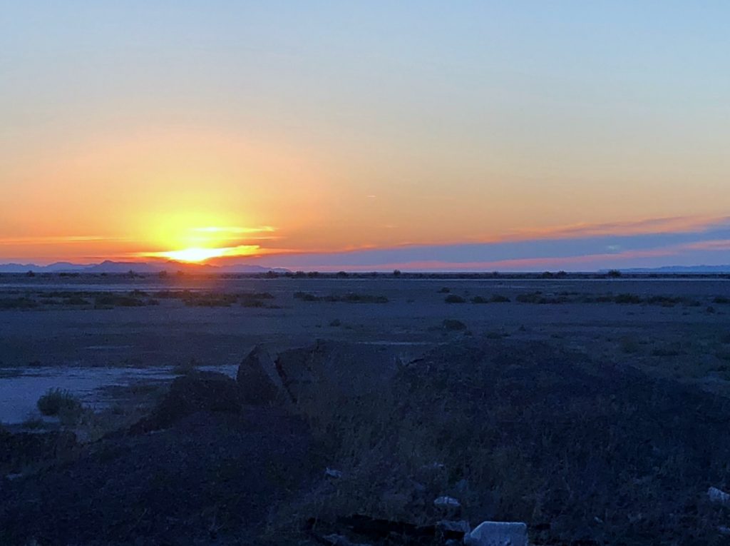
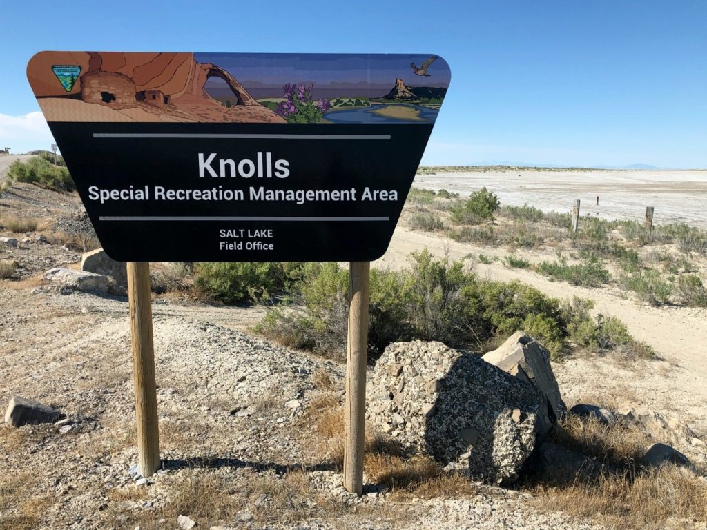
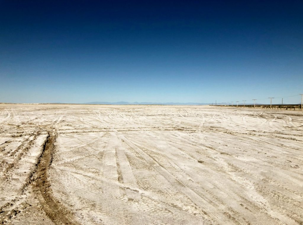
We left the truck stop and drove about 10 minutes out of the way to West Wendover to charge. Then, we headed back east again to the Salt Flats. We stopped at The Knolls Recreation Area and got out to walk around on the salt. This whole area is what is left from the ancient Lake Bonneville, which 15,000 years ago covered most of the Great Basin area. Fun fact, The Great Salt Lake was once part of Lake Bonneville as well.
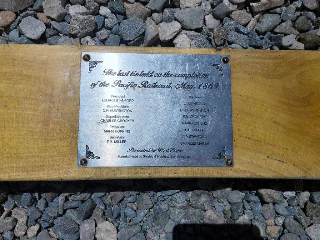
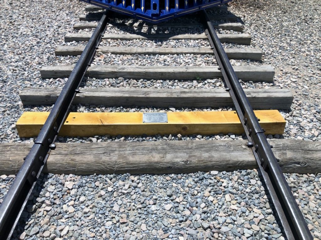
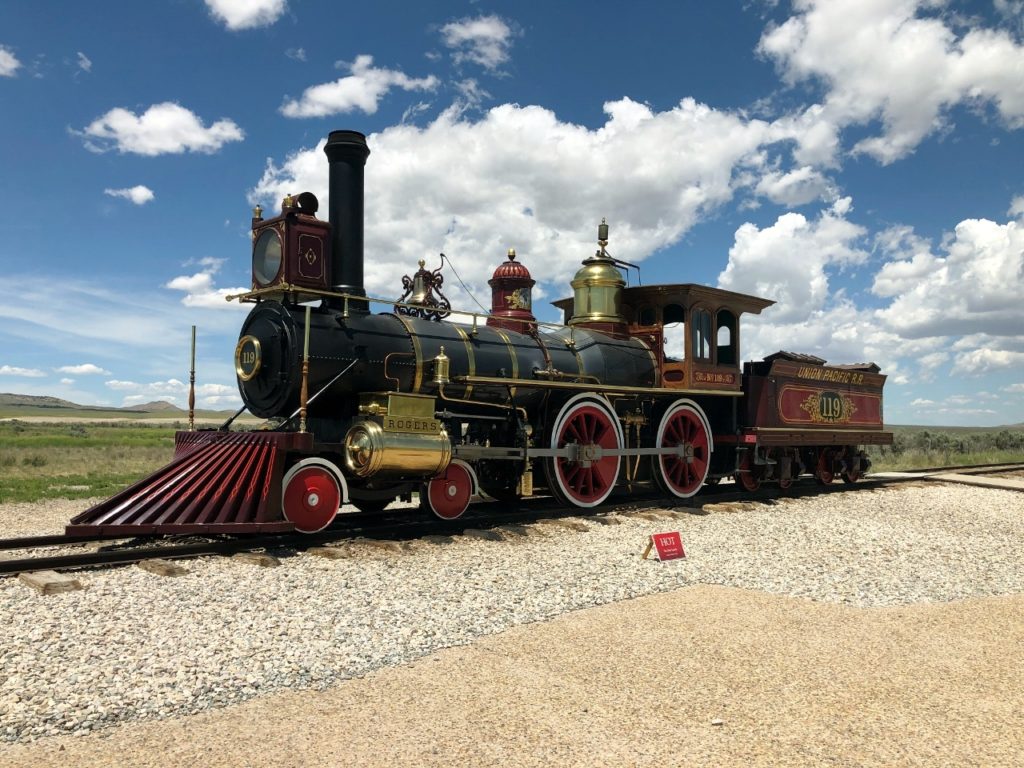
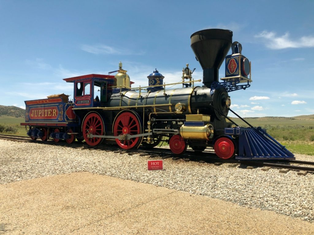
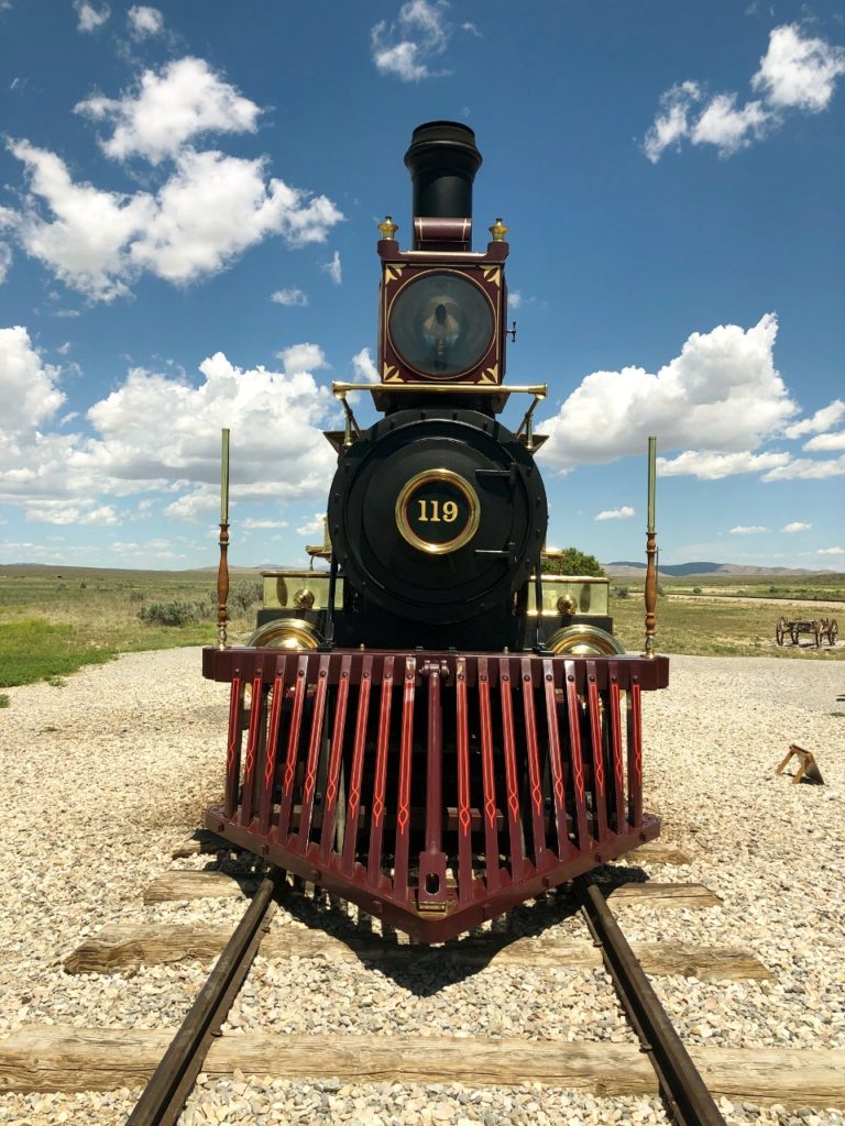
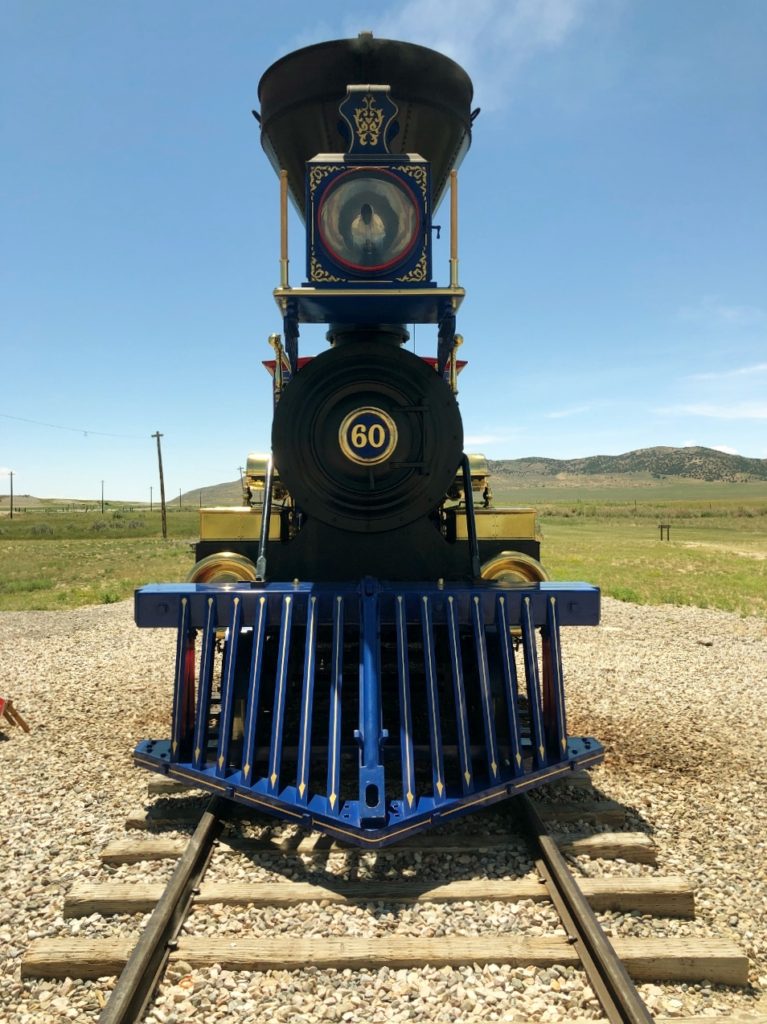
We stopped again at Tooele to top off our charge, and then headed to Tremonton to charge again. From Tremonton, Val drove to the Golden Spike National Historic Park at Promontory Summit – we thought it was going to be mountain back roads which I don’t do – it wasn’t. The park was pretty cool. This park is where the first transcontinental railroad was completed May 10, 1869. It connected the Union Pacific and the Central Pacific Railroads providing 1,776 miles of uninterrupted track! The last spike – made of gold – was driven into a laurelwood tie.
At the Visitor’s Center, you can see replicas of the two engines that were present for The Last Spike: The Central Pacific’s Jupiter, and the Union Pacific’s No. 119. Both locomotives make demonstration runs several times a day. “The Last Spike” site is here as well.
The park has an auto tour that you can take, but the signage is not very good for these. We did part of the West Auto Tour to look for the sign commemorating the 10 miles and 56 feet of track laid in one day – which was a record. I ended up hiking a little ways to get a picture of this. It was hot. Drive it. You have to drive the whole 7 miles west on the gravel road and come back on the auto tour route, which is a much smaller one way gravel road.
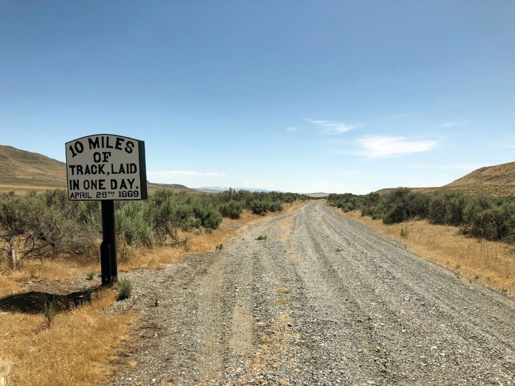
The story here is that the Union Pacific built 8 miles of track in one day and the bet the Central Pacific $10,000 (in 1869 dollars keep in mind) that they couldn’t beat the record. On April 28, 1869, the Central Pacific completed their 10 miles and 56 feet in one day, winning the bet. This stop at the Golden Spike was suggested by our friend, Giorgio in Italy, who has a great website about trains in the American West. You can check it out here.
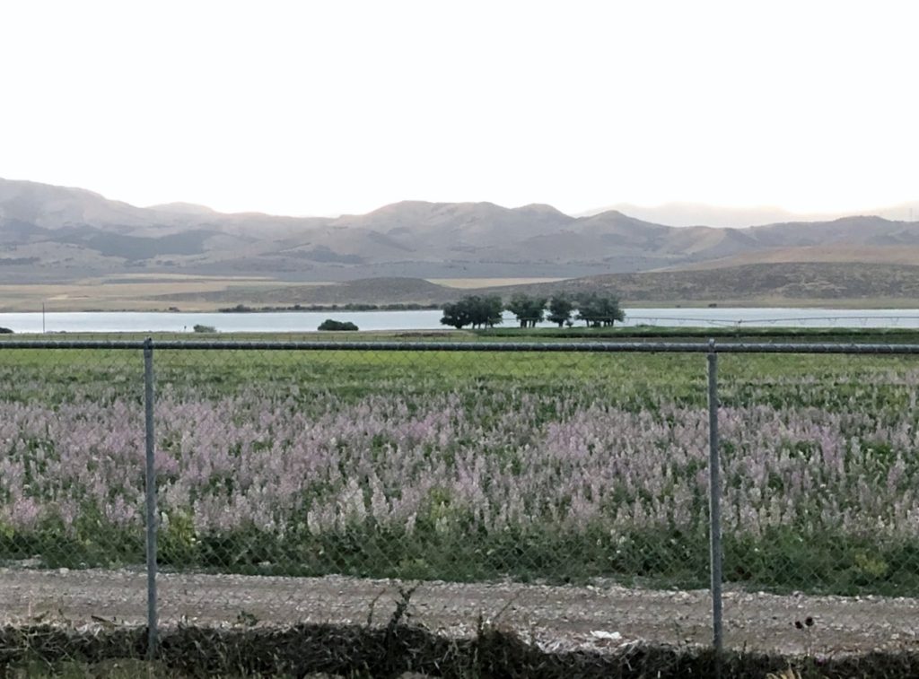
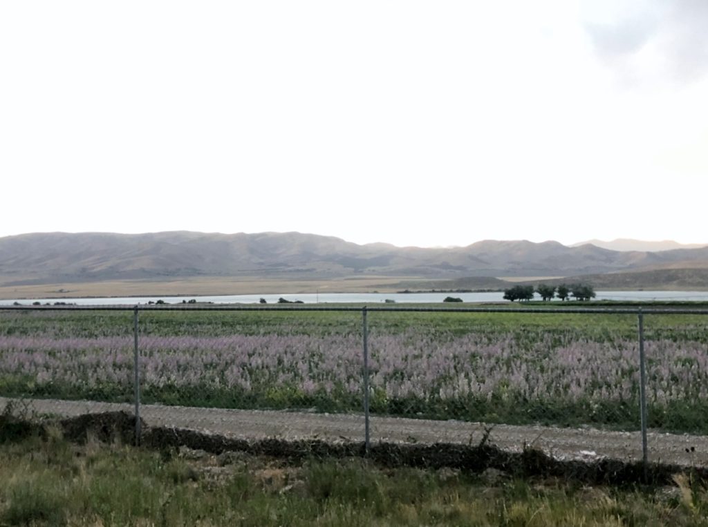
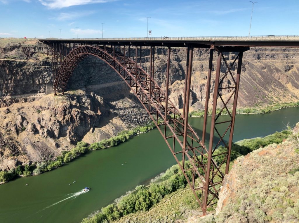
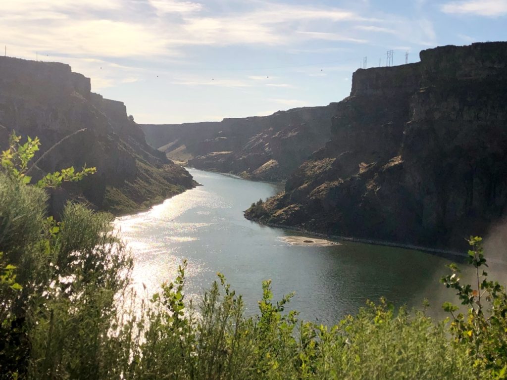
From the Golden Spike, we drove up to Twin Falls, Idaho. Yes! I can check off another state! Only three more to go! Twin Falls is gorgeous around the Snake River Canyon!
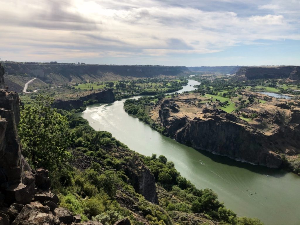
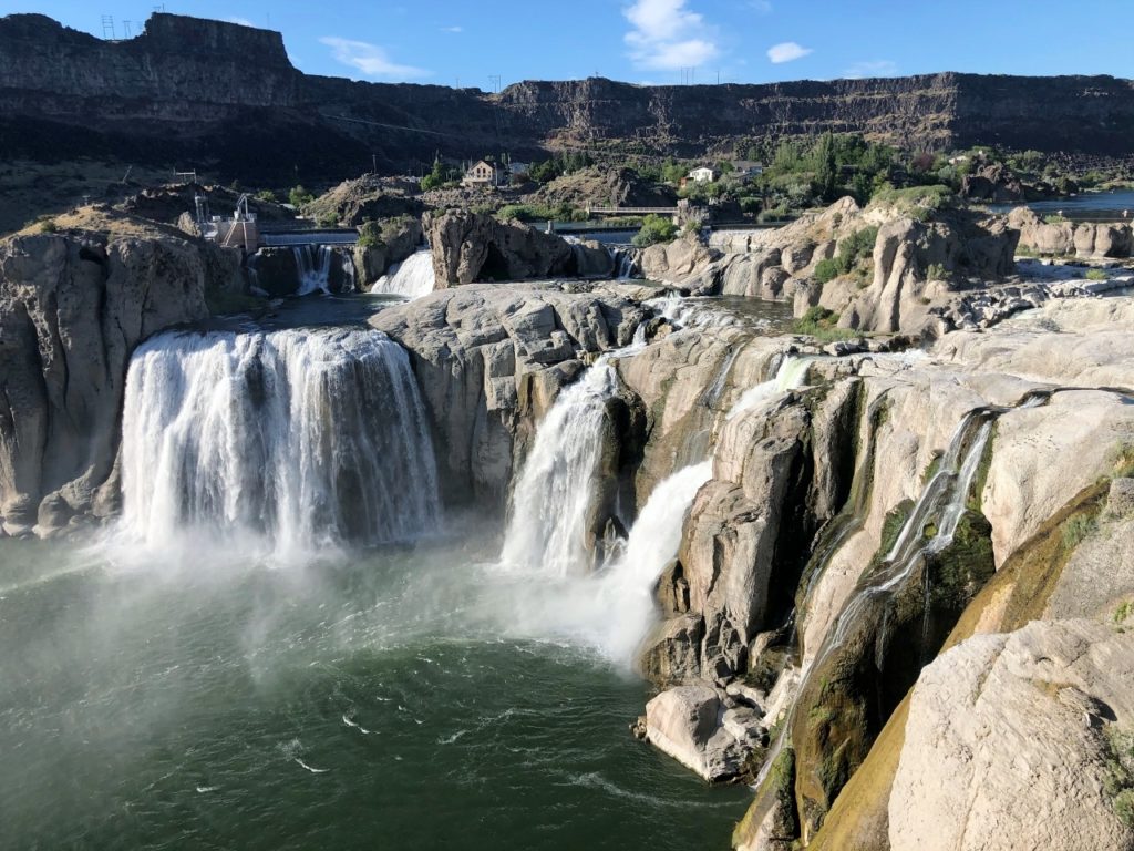
The city gets its name from a set of twin waterfalls nearby. Unfortunately, this waterfall is no longer a “twin” as one side has been dammed up for a power plant. The other side is still beautiful.
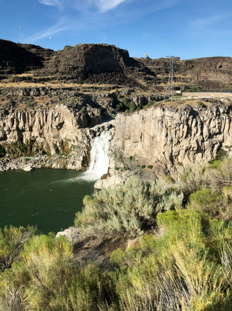
We also drove to nearby Shoshone Falls – another beauty! There is also an overlook of the Snake River Canyon right outside the Visitor’s Center that has amazing views! Tonight we are at the Holiday Inn!
*Day 6*
We got up this morning in time to get breakfast at the hotel which was way better than our instant oatmeal we had been doing on camp days! From the hotel, we went back to the Twin Falls visitor center to charge up for our day at Craters of the Moon National Park. I drove and the roads were great. We got to the park without incident.
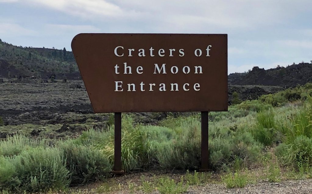
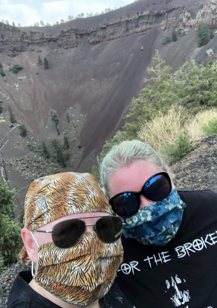
Craters of the Moon received its National Monument status in 1924 under President Coolidge after being featured in National Geographic Magazine, although the landscape has been what it is for thousands of years. It formed from a series of fissures called the Great Rift. Its most recent eruption is believed to have been 2000 years ago. Fun fact, geologists believe that future volcanic events here are likely.
The Shoshone people are known to have migrated through the area, and likely witnessed some volcanic events. In the early 1800s, pioneers and gold seekers traveled the northern border of Crater of the Moon using Goodale’s Cutoff from the Oregon Trail to avoid conflicts with the Shoshone. You will pass by Goodale’s Cutoff right after leaving the Monument if you head toward Idaho Falls.
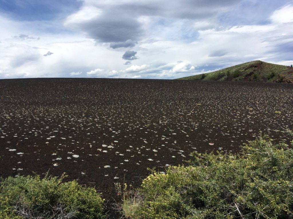
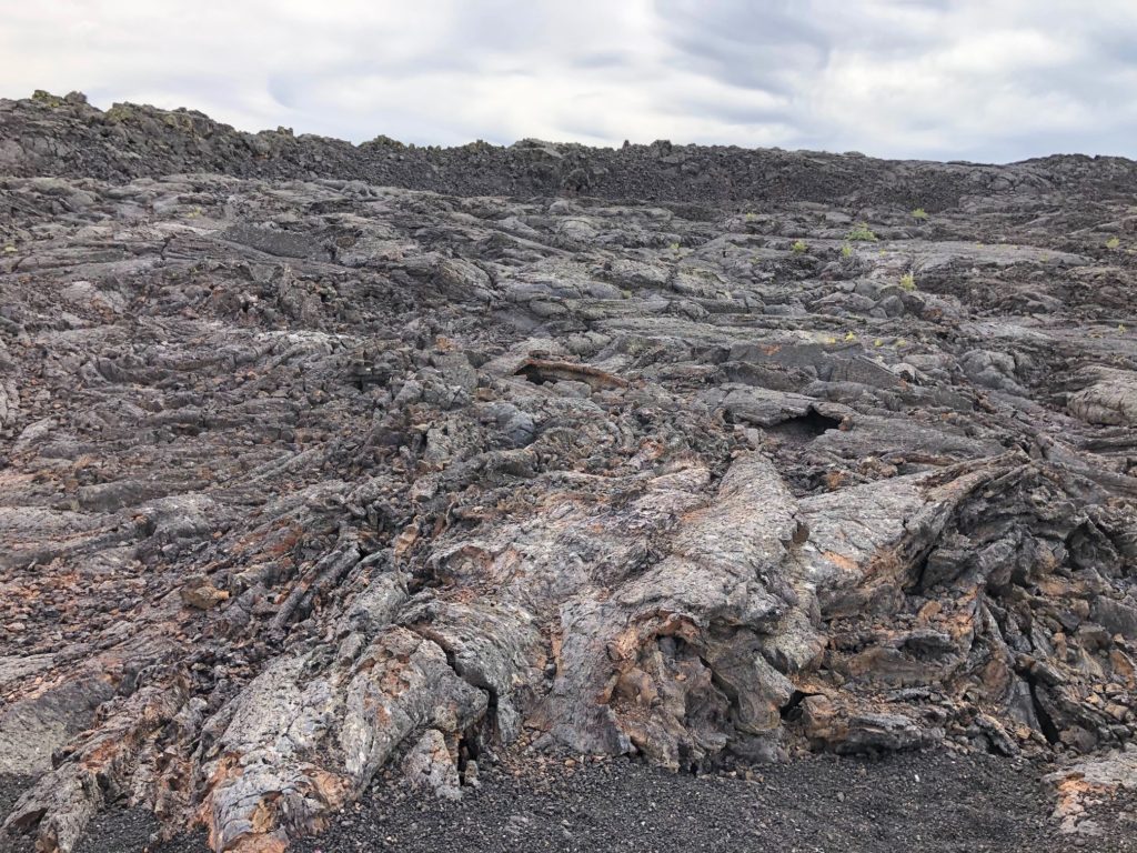
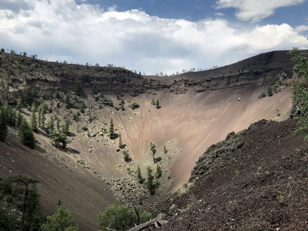
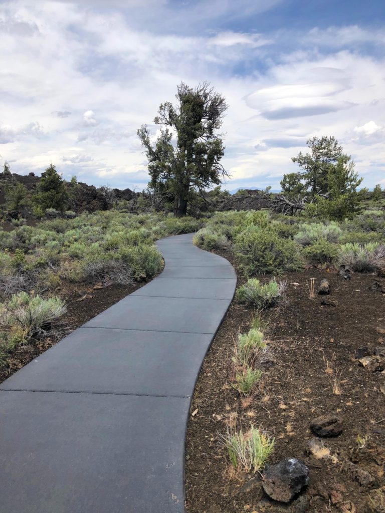
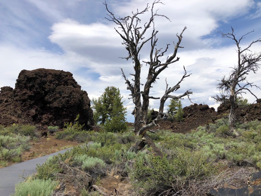
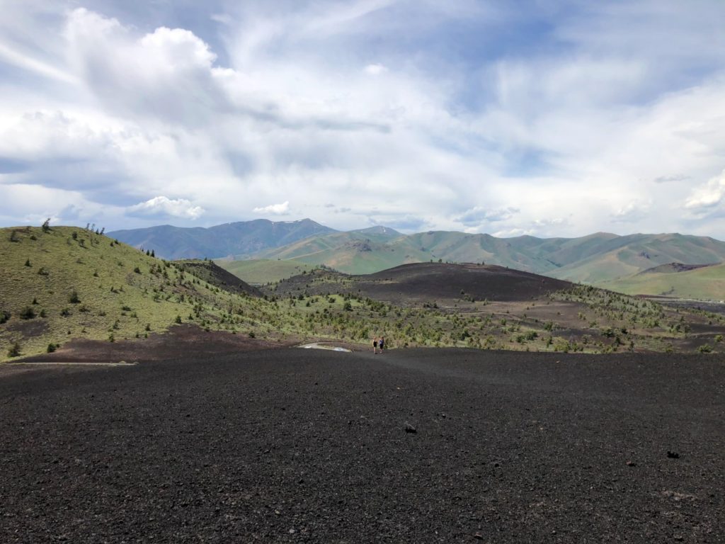
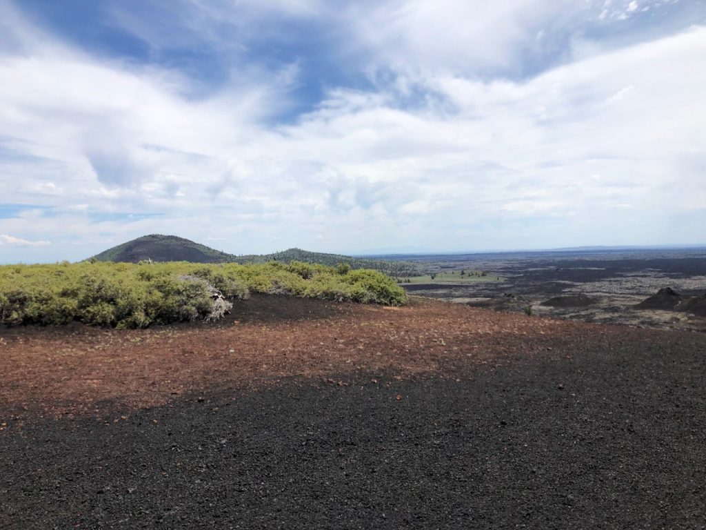
The public part of the Monument consists of a seven mile loop road where you can see lava cascades, spatter cones, and “cinder gardens”. There is a great short hike called Devil’s Orchard that is also very educational. There are signs along the way that explain the geological history of the area. This trail is relatively flat, paved, and only a half a mile and long.
Another even shorter hike, although a little more challenging due to the incline (it is super steep) and the crazy wind, is the quarter mile trek UP the Inferno Cone. You get some really great views at the top. You can see several other cinder cones along the Great Rift in the distance. You are actually walking up the side of the cone on the crushed pumice.
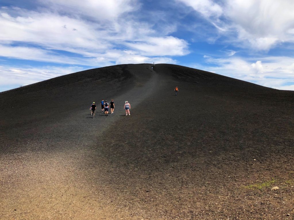
The Monument got its name from comments made by a geologist about how the land resembled the surface of the Moon. It is pretty wild. We drove the loop and took lots of photos. We didn’t do any of the longer hikes for several reasons, we really didn’t have time, my sister’s ankle was swallowed, and after my desert adventure yesterday, I wasn’t feeling it either.
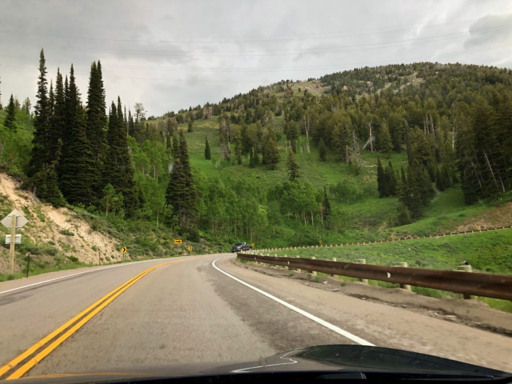
From Craters, we drove to Idaho Falls where we charged the car while we ate dinner at Mackenzie River Pizza Grill & Pub. Their food was fantastic! It was Val’s turn to drive after dinner. I don’t do mountains, and it looked like we were taking back roads across them! Sure enough, we were on a little two lane highway, and by two lanes, I mean one in each direction. She likes driving these, and I do not, so it works out great.
She was having so much fun driving these mountain roads, that she missed our turn so we had to backtrack, but not really very far, maybe just a mile. I was so glad she was driving. There were places along this winding road with no guard rails, and I tried really hard to be a good passenger, but I think I probably nagged her a little too much! She did a great job all the way to Jackson, Wyoming, where we stopped again to charge.
From Jackson, our original plan was to camp at Curtis Canyon Campground, but it was actually about 30 minutes out of our way, so we decided to try one of the US Department of Agriculture Campgrounds that were on the way to Rock Creek. The sunset in the mountains was really pretty. There was also construction, of course, because Val was driving!
The first one we came to was Hoback Campground, and there were sites available. So, we found a spot and set up for the night. We were right next to the Hoback River. We got there just in time as it started raining right after we got back from registering. We settled in and watched a movie (because we could in an electric car) and then called it a night.
*Day 7*
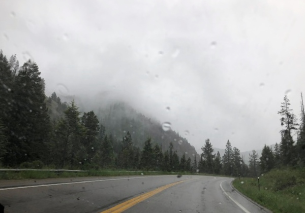
Today we will make it to our 11th state this trip, Nebraska! We did add one extra day to get home so that we wouldn’t be quite so rushed at Craters of the Moon. Luckily we were able to be flexible like this! We woke up and had our instant oatmeal breakfast, and it was still raining. We managed to put the car back together without having to get out into the pouring rain so that was good, but then Val had to drive on the little two lane mountain highway in the rain! So glad it was her day to start driving!
Our first charging stop was Rock Springs, Wyoming, and it was quite a drive so not many extra stops this morning – other than a bathroom break in Pinedale. I am not sure who usually stops to use the restroom in Pinedale, but there were visual directions in case anyone was confused?
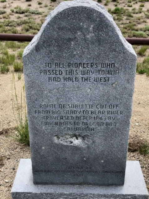
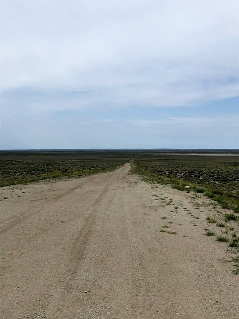
Once we were out of the mountains, we passed by several Oregon Trail sites on our route. The Oregon Trail split at a point called Parting of the Ways and settlers could either take the westbound Sublette Cutoff or the more southbound route toward Fort Bridger. We stopped at a monument that marked the route of Sublette Cutoff between Big Sandy and Bear Rivers. The trail is actually still very worn here and can be clearly seen. We also drove through the town of Farson, where pioneers would have crossed the Big Sandy River on the Fort Bridger Route of the Oregon Trail. What is the benefit of choosing one over the other? Great question! The Fort Bridger route, obviously included a stop at Fort Bridger for some much needed rest and the opportunity to resupply. The Sublette Cutoff had no opportunity to resupply, BUT it cut up to 15 days off of the journey!
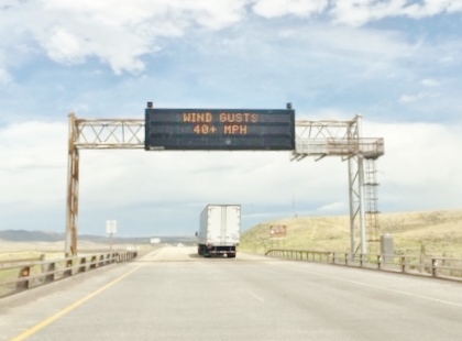
We made it through to Rock Springs in time for lunch, and ate PB&Js and chips while we charged the car. Once we left Rock Springs, things got a little wild! Either I was completely unaware or I forgot (I have been through Wyoming before) that Wyoming is WINDY! In fact, there were signs on the interstate warning of 40+ mile per hour wind gusts. They were not kidding! We passed one wreck where a semi-truck had been blown into the side of a pick up truck!
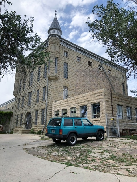
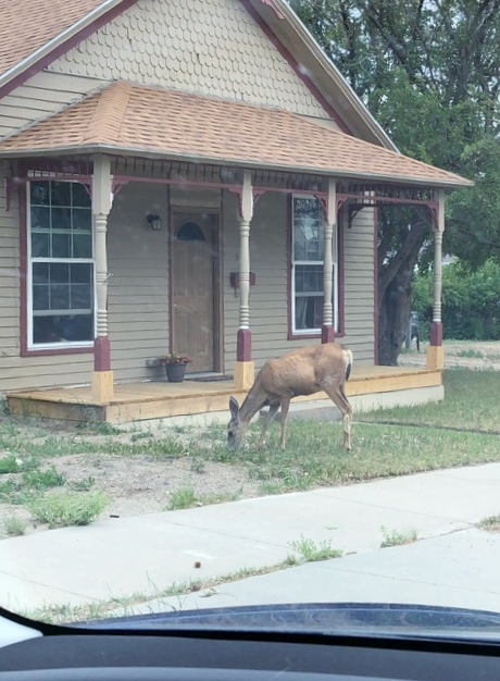
We got off the highway to take a short break and use the restroom in Wamsutter and you could feel the wind lifting the car while we were parked! Again Val was driving in the rough conditions. Haha – although it wasn’t really funny at the time! We made it to Rawlins despite the wind, and we stopped to charge the car. We also stopped at the “Old Pen” for some photos. This was Wyoming’s first state prison constructed in 1893 just three years after becoming a state. It closed in 1981. Under normal circumstances, you can actually tour this facility, but we weren’t able to do the tour right now. We also saw a deer just hanging out in someone’s front yard which is always fun to see.
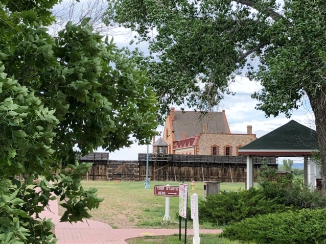
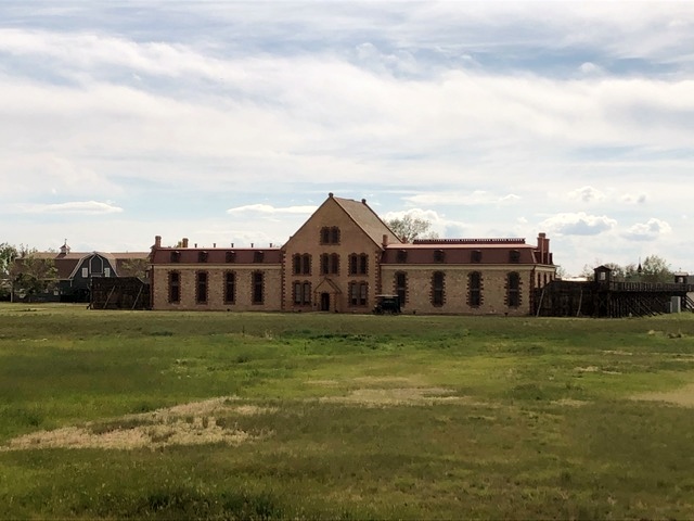
I drove from Rawlins to Laramie where we also charged again. And again the wind was no joke! I was fighting to keep the car on the road the whole way! After we charged, we stopped at the Wyoming Territorial Prison. This Federal prison was built in 1872 and held both men and women. The infamous Butch Cassidy did time here prior to establishing his notorious gang. In 1892, the Broom Factory was built to house the prison industry. Brooms, whisks, and brushes were made in an assembly line format and sold all over the United States. Prisoners here were transferred to Rawlins in 1901, and the prison closed in 1903. It is one of only three remaining Federal Territorial Prisons in the US. It is the most intact with original structure.
From Laramie, I drove us to Cheyenne. The wind had died down just a little. We stopped in Cheyenne to charge, and ate dinner while charging. Once we left Cheyenne, it was Val’s turn to drive again, and of course, we were chasing a storm, but more on that later. We made a quick stop in Sidney, Nebraska to see the National Pony Express Memorial. This memorial was pretty cool. The huge statue of the horse and rider was surrounded by the flags of all of the states on the route.
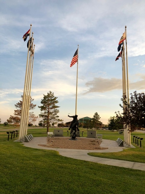
The Central Overland California and Pike’s Peak Express Company, also known as the Pony Express, began April 3, 1860. It was basically a courier service. It promised to deliver mail from the edge of “civilization” in Missouri 1800+ miles to Sacramento, California in just 10 days. This was unheard of at the time. Keep in mind, it took months to get from Independence, Missouri to Oregon by wagon train, the transcontinental railroad was not complete, and sailing around South America took about a month. So 10 days was a big deal. There were 190 stations on the route. Riders would each ride 75-100 miles and switch out their horses every 10-15 miles. Fun fact, Sidney, Nebraska was known as “Sinful Sidney” and”The wickedest town in the west” back in the day!
Now back to the storm we were chasing…it took a little while, but we eventually caught up to it. The rain wasn’t so bad, but there was a lot of lightning. I wondered what would happen to “Nik” if he were struck by lightning. Val did not know, nor was she amused by the question. We actually ended up getting off at an exit in the middle of nowhere and waiting out the storm. I kept checking the radar while Val played some sort of apocalypse game on the car’s computer screen. Haha. After about 20 minutes the radar showed it had moved out of our path and we were on our way again. Then, of course, we hit construction. And some rain. Val has been the lucky one every single time. We survived, of course, and made it to our hotel in Ogallala, Nebraska. I was looking forward to a great night’s sleep in a real bed.
*Day 8*
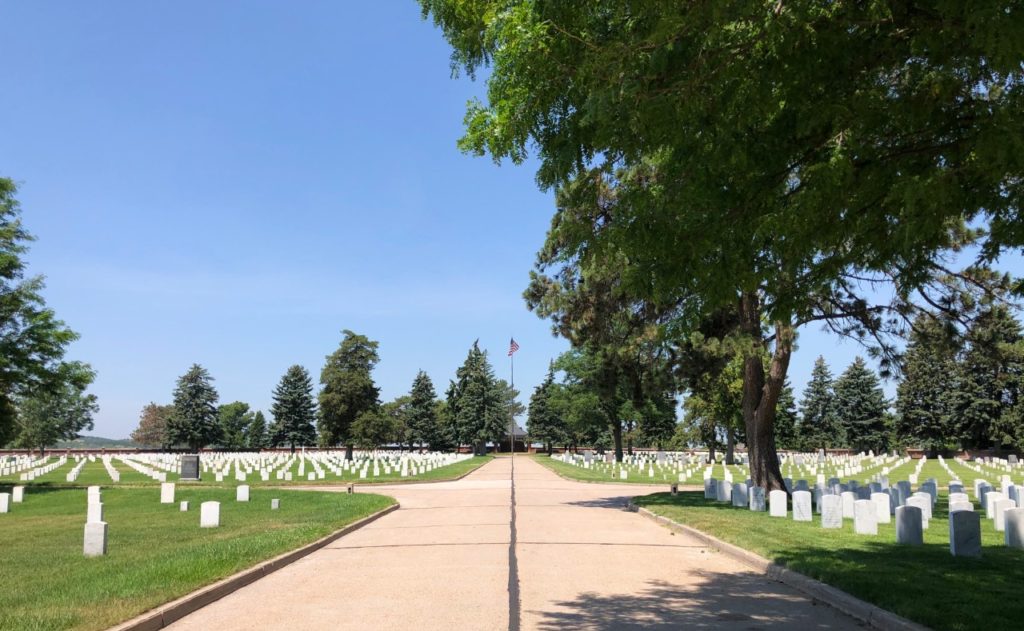
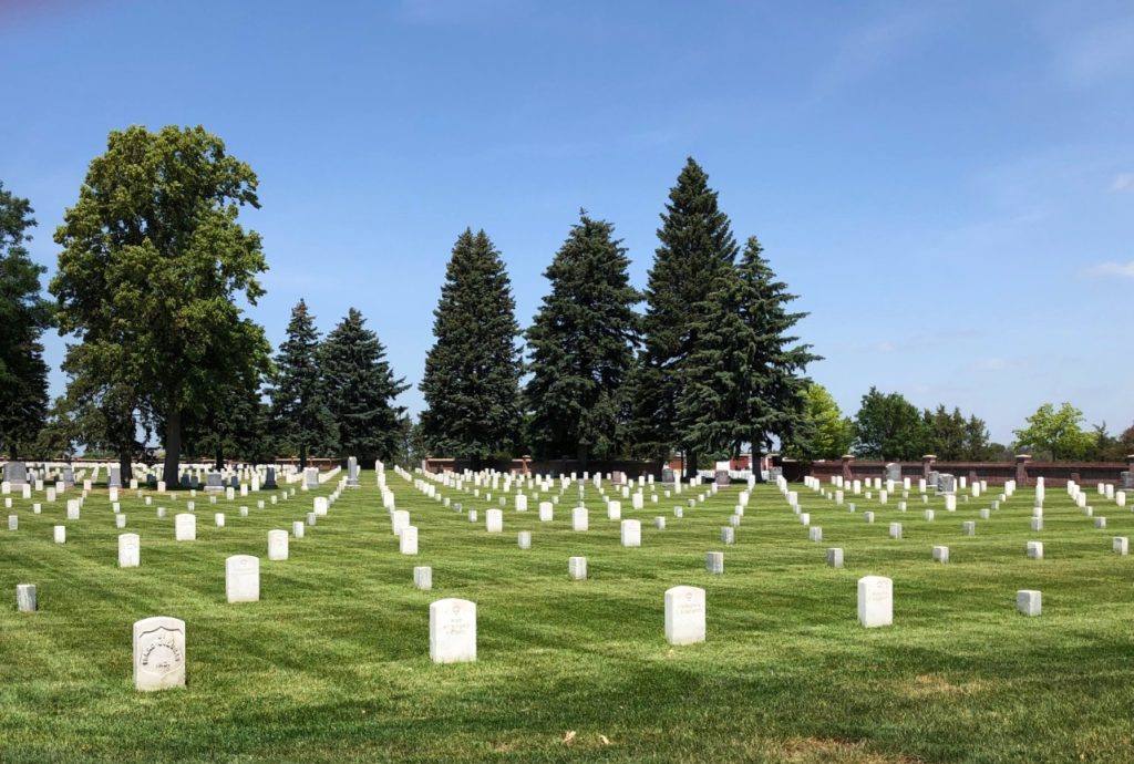
We got up this morning and headed out with no agenda but home. I started off driving. We did end up making a few stops (and detours) along the way. Our first stop was Fort McPherson National Cemetery. This cemetery is near where the historic Fort McPherson once stood, and used to be the Fort’s cemetery. There is actually a monument there now marking the Fort’s location. The land is now someone’s farm. Fort McPherson was a US Army fort constructed in 1863 to protect settlers going west and provide security for railroad construction. The national cemetery was established in 1873 and was used to bury soldiers who died in “the frontier.” Fort McPherson National Cemetery is the only national cemetery in Nebraska.
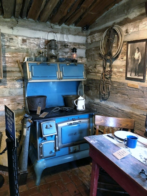
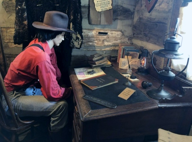
Our next stop was in Gothenburg at the Pony Express Station. Gothenburg was an important town to westward expansion in that the Oregon Trail, the California Trail, the Pony Express all ran through here. The Mormon Trail ran just north of the town. The railroad also ran through Gothenburg. The Pony Express Station & Museum is very small, but it is all original. They have a good exhibit inside and it is free. Our next stop, the Pony Express Station in Willow Creek was a photo stop only. It is not open to the public.
After our Pony Express stops, we stopped to charge and eat lunch in Grand Island. We ate at the Thunder Road Cafe at the truck stop where the superchargers were, and they had great food. After lunch we headed out and ran into our first bit of construction – the first time Val wasn’t driving. We were literally going 2 miles per hour in this one. We had to get off the interstate in the middle of the construction for an emergency bathroom break. Then, we weren’t able to get back on. There was a guy in a yellow vest standing in the middle of the on ramp waving his arms to stop and redirect all of the traffic – never mind that there are gates and crossing arms they could have used to close the exit. This resulted in a 7 mile detour on a gravel road to the next exit where we could get back on the interstate. I made Val drive her fancy car on the gravel! No way was I going to be responsible for that!
With all of the extra construction, we added a stop in Lincoln to charge. We also missed the exit here and had to double back a little (detour number 2). From Lincoln we headed toward our next charging stop in Saint Joseph, Missouri. Fun fact, the Pony Express actually started in Saint Joseph. As in St. Joe was the beginning of the route. The Pony Express National Museum is in Saint Joseph, and is a great place to stop and visit if you are ever in the area. We did not stop this time, but I have been before. The Patee House was the local hotel at the time, and the Pony Express used one of it’s floors as its headquarters.
Between Lincoln and Saint Joseph, we actually clipped the corner of Iowa with our drive on I-29. So, I guess technically instead of 11 states in 7 days, we did 12 states in 8 days. There was a lot of flooding near the Missouri River on the Nebraska/Iowa border.
As it turned out, we didn’t need to stop in Saint Joseph. We did have to stop for just about 10 minutes in North Kansas City to charge enough to make it home, but we made it! We had a great time, and did our best to be safe and responsible travelers in the middle of this pandemic! I hope that you have enjoyed the journey with us, and that you are staying safe and well! Thanks for coming along!


2 Comments
Richard Hough
This was a very informative and quite entertaining blog. I remember quit sometime ago when I took my family on a 7 day vacation out west. Your trip was very interesting and it kept me reading until I finished it. Great job and I can honestly cay “I can hardly wait” for your next history adventure. Have fun and enjoy sharing your adventures with others. It may inspire them to get more involved in history.
Vanessa
Aww thank you! Glad you enjoyed it!