Mysterious Maya Marvels of Mexico
I’ve been teaching about the ancient Maya civilization for the past 14 years, however, for all the times I have been to Mexico in the past, I have never toured the ruins! I know, crazy! I have always gone to the beach, on a catamaran, or snorkeling. So on my trip to Mexico this summer, I was going to do just that, tour several ruins. I was SO stoked!
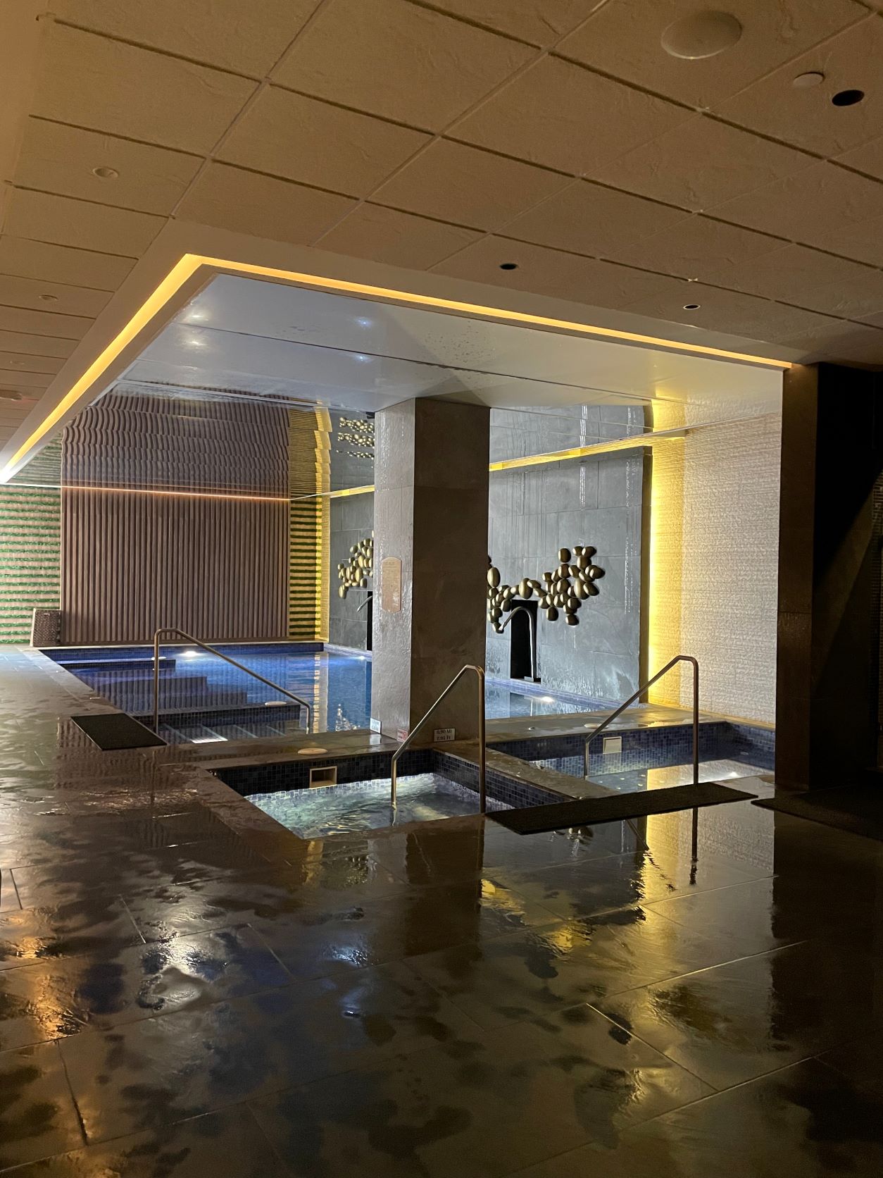
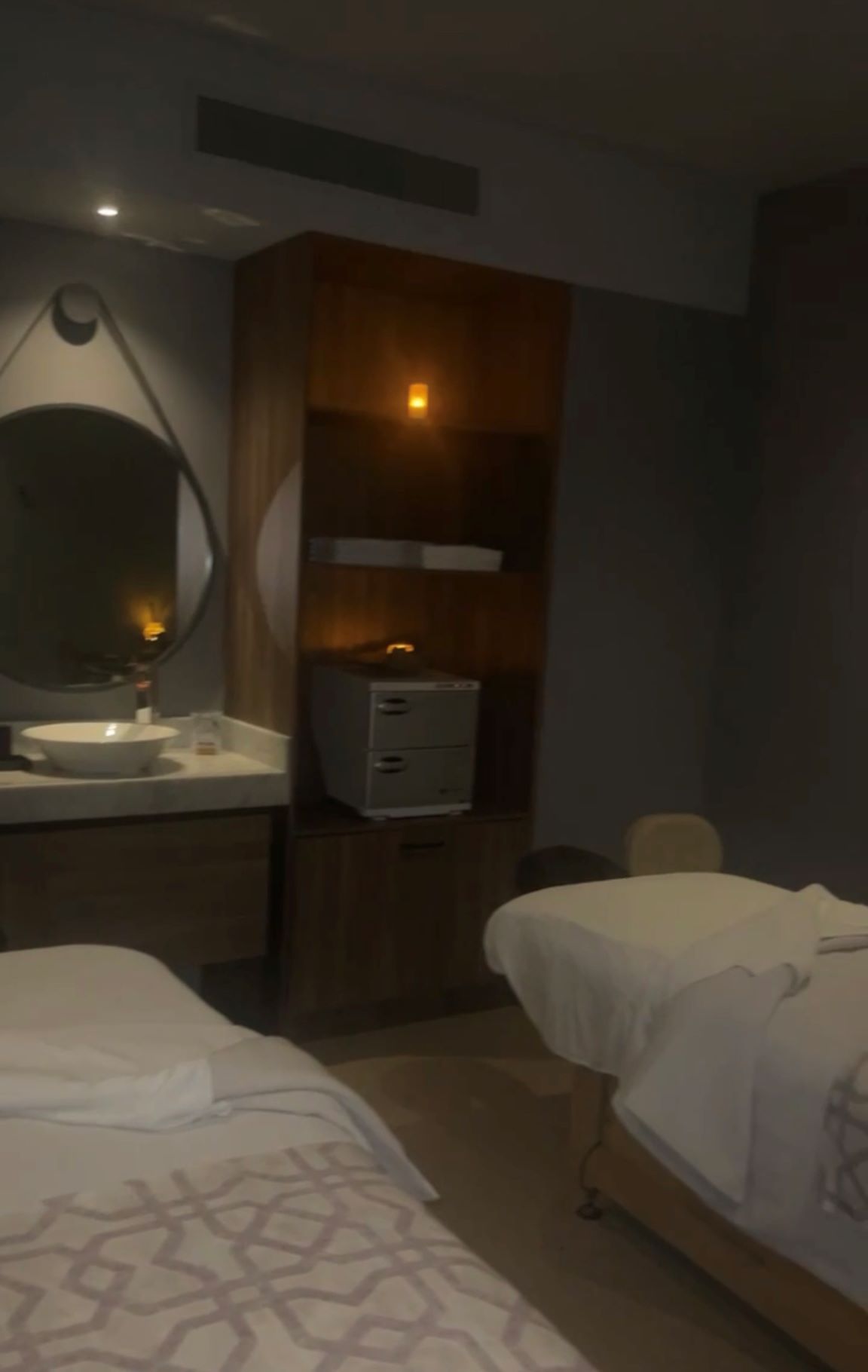
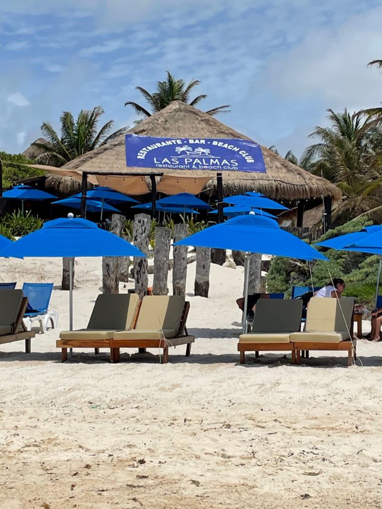
My husband traveled with me this time, as we were going to Cancun for our anniversary. We stayed at Planet Hollywood Adult Scene All Inclusive Resort. It was nice, but quite the party place. So, if you’re looking for peace and quiet, stay somewhere else. We booked a junior swim out suite, which was amazing! We also sampled the spa with one hour massages and hydrotherapy. It was well worth the expense!

Chichen Itza
Our first trip was a full day excursion with Amigo Tours to Chichen Itza with lunch, tequila tasting, a swim in a cenote, and a stop in Valladolid, an old colonial town. I will say that the order of the tour itself was not as advertised, and was a slight letdown. We were supposed to be at Chichen Itza first thing in the morning to avoid crowds and heat, and instead, we ate lunch at 9:30AM! We were at Chichen Itza during the hottest part of the day, and we did not see all of the sites that were listed either – sadly we missed the observatory. I would recommend booking this tour through Excursions Riviera Maya instead. We booked them for our second tour, and they were amazing in every way! More on that later.
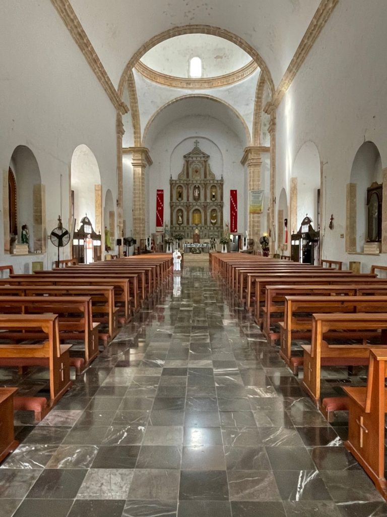
Now onto the positive aspects of the day! I learned SO MUCH! Our guides, Marco and Rodrigo, were a wealth of information! Our first stop of the day was the Colonial town of Valladolid. In this town is the 3rd oldest church in Mexico built in 1546, Iglesia San Servacio. It was later ordered by someone of Catholic authority to be destroyed and rebuilt.
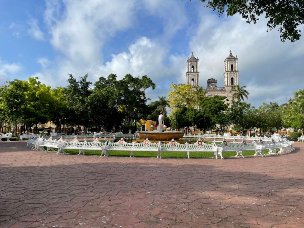
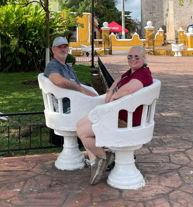
The fountain and park in the middle of the square in Valladolid carries a Sunday afternoon tradition that is still in place today. On Sunday afternoons, parents sit in the chairs that encircle the fountain, and singles walk around the fountain in a circle, females one direction, and males the other. Our guide didn’t say and I forgot to ask, but I am assuming the “conversation chairs” are for those singles who want to get to know one another.
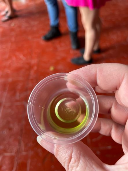
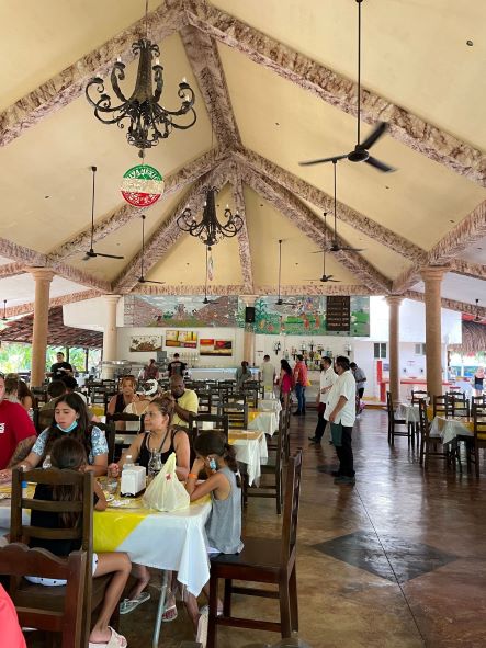
After Valladolid, the next stop was our 9:30AM “lunch” that also came with a sip sized sample of Xtabentún (pronounced shtahben hoon). This is a Maya alcohol that tastes like black licorice. It was interesting, but I was not a fan. We shopped in the market next door to the restaurant to support the locals while we waited for “lunch” to be ready. The food on the buffet was really good, especially the cochinita, a traditional Maya style pork!
On the drive to Chichen Itza, we learned a little about Maya culture, and how to say a few words. For example, Chichen Itza is pronounced chee cha’hen eetz hah and means “in the mouth of the well of water doctors”. Plenty of Maya descendants continue to live traditionally in small villages all over the Yucatan Peninsula. These people still use a shaman, grow their own food, and hunt for their meat twice a month (iguana, armadillo, deer, and wild hog). The primary language spoken in these small villages is Mayan not Spanish. To say good day in Mayan is “Ma’lob K’iin” (pronounced maul ohb kha’een). Historically, the three main industries of the Maya people were yucca, rubber, and chicle (gum). Today, tourism has been added to the list. Fun fact, according to our guide, the ancient Mayans counted by 20s because one has 20 fingers and toes. I don’t know if that is the accurate reason, but the Maya did indeed have a base 20 system rather than a base 10 like we have today. Another fun fact about Maya culture is that the Maya day starts at noon when sun casts no shadow.
Speaking of counting and days, we can’t really talk about the Maya without talking about their famous, or should I say infamous calendar that caused all of the “end of the world paranoia and chaos” in 2012! The Maya were great at astronomy, and based their calendar on a 5,125 year collar cycle. We adjust our calendar by 24 hours every four years with leap year, but the Maya adjusted their calendar just 23 seconds every 5,125 years!! So, was the Maya calendar predicting the end of the world in 2012? No. It was the end of one solar cycle and the beginning of another. The Mayan Era began in 3113 BC. If you add the number of years in a Maya solar cycle, 5,125, to that date, you end up at 2012 AD.
In Maya culture, the Maya calendar was sacred and determined everyone’s destiny. For example, our tour guide was born on the day of Pop. Pop is a Maya god who is the one who shares the knowledge. He believes that his tour guide career fits with this. I purchased a copy of the Maya calendar for the day I was born just for fun to share with my students. I was born on the day of Muan. Muan is he who can see through everything, he who observes beyond all, the keeper of the heavens. His virtue is imagination. Think what you will, haha.
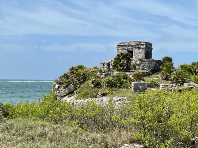
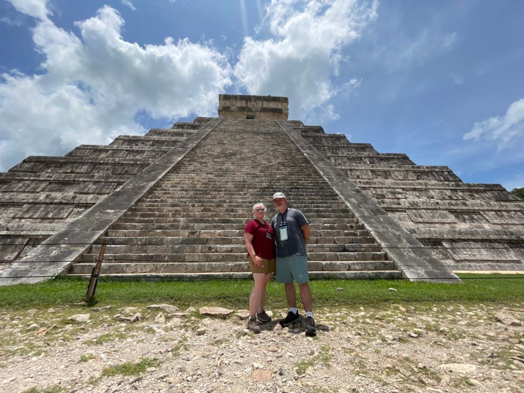
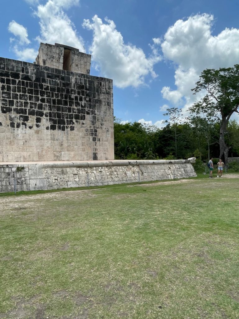
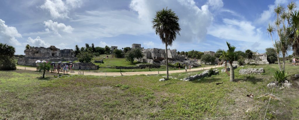
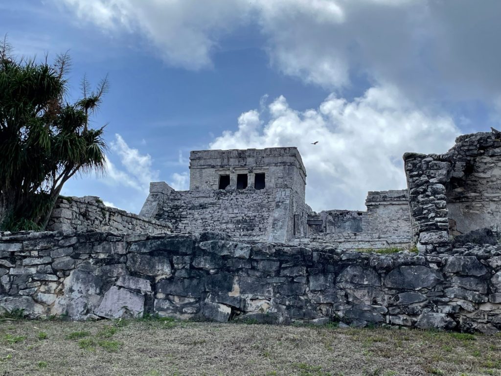
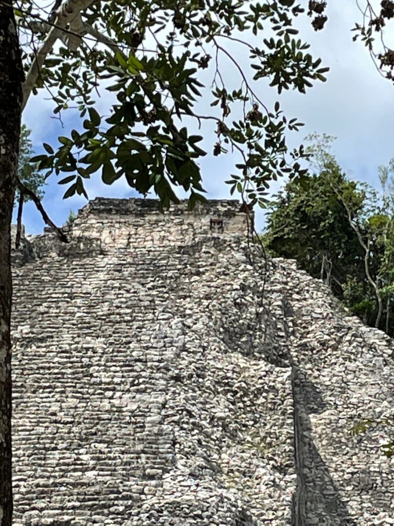
We finally arrived at Chichen Itza, which in 2007 was voted one of the Seven Wonders of the Modern World. You will understand why as you read on! Our guide made sure to let us know that it was NOT pronounced chicken pizza. Our guide at Chichen Itza, Rodrigo, grew up in the immediate vicinity, and was full of knowledge. Chichen Itza was the most important Maya city, but it was also one of the smallest. The main temple at Chichen Itza is the highest, and according to the Maya, it was built in the center of the universe.
The story goes something like this…in 600 BC, the Maya split into two groups looking for the edge of the earth. This was when they still believed it was flat. One group walked all the way to what is today Anchorage, Alaska, and the other group walked all the way to the tip of South America in Argentina. Both groups then walked back and found the middle of the two points where they built Chichen Itza.
Chichen Itza also lines up with two other Maya cities along the Tropic of Cancer that, according to NASA, match Orion’s belt. For this reason, they believe many more ruins remain undiscovered in the Yucatan jungles. Both NASA and MIT have worked with Chichen Itza to understand its significance. More on MIT later.
As I said before, the temple at Chichen Itza was the highest, however, it was not the first temple built on this site. There is actually another pyramid/temple beneath the one we see today. The first temple was built in 300 BC. It is 70 feet in height. This temple was built for their god Kukulkan (aka Quetzal Quantal) when the Maya still believed the earth to be flat. However, in 52 years, the snake, which was the representation of their god, Kukulkan, did not appear. They figured out they would have to rebuild the temple because the earth is round. The original builders and their descendants were made lower class and slaves until the city was finished about 1000 years later. Beneath the original temple are 4 upside down pyramids that support the foundation, and beneath those pyramids is a sacred cenote.
The second temple took 52 years to build by people working with stone age tools and no wheel. The city was built by 190,000 people working of their own free will and another 250,000 who were “won” in the ballgame. The Maya King and Queen convinced people to choose to join them by promising equality and no taxes. People followed because the pyramid belonged to a god not a king – kings issue taxes, not gods. Another way that people were recruited to build the city was through the ballgame. The loser of the ballgame was executed, and his people had to follow the winner.
When the second pyramid was finished, it was 85 feet high. Fun fact, the pyramid is actually a calendar as well. Each façade has 91 steps for the number of days it takes the sun to move 45 degrees. 91 times 4 is 364, then adding the 1 top step equals 365, a calendar year.
This pyramid is also not a square, it is an X. Every 91 days the sun’s position changes 45 degrees, so when the sun’s position changes from one corner to the next, it means the season or weather is changing. This was especially important for farming. During summer and winter Solstice, half of the pyramid is in the light and half is in the shadows. This is half on the diagonal if that makes sense. It is a representation of equality and duality similar to the yin and yang.
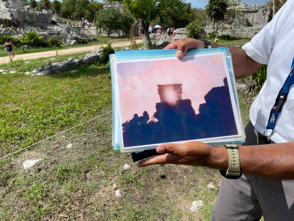
During the spring and fall Equinox in March and September, the “snake descends from heaven to bless the land.” This takes approximately 1 hour and involves the sun casting a shadow on the corner of the pyramid so that it appears a snake is descending down the edge. We were able to recreate this phenomenon somewhat by walking sideways (see the video clip below).
It is said that the seven triangles in the snake’s body represent the seven energy points in the body known as chakras in eastern medicine. While the snake takes one hour to appear, it takes only seven minutes to disappear. It disappears into the mouth of the snake. Our guide had a photo of this phenomenon.
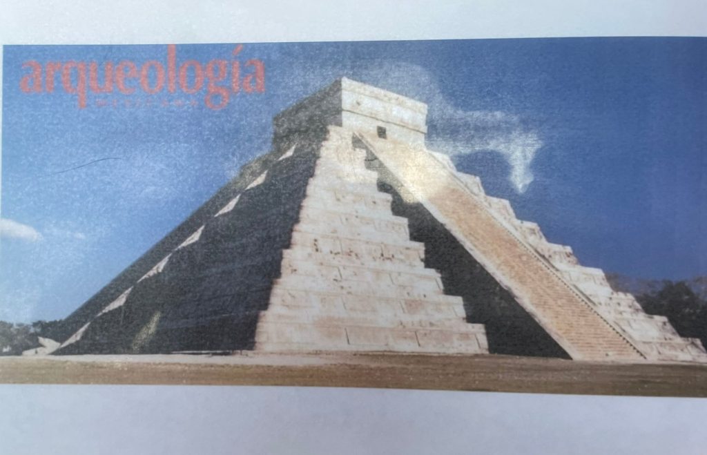
At the top of the Castillo, or the pyramid, is the one last step, which is a chamber rather than a step. Symbols of a square (representing male) and a circle (representing female) can be seen on the top of the pyramid. This represents equality between the genders. The “doors” in the top are also intentionally very short to force one to bow when entering.
Another purpose this box at the top of the pyramid serves is that of a speaker system! When you visit, clap at the bottom of Castillo, and listen to what happens. Your clap starts at a low frequency, about 33hz, but by the time the sound bounces up the staircase, it echoes out of the speaker at 185Mhz! Be sure to watch the video clip! Scientists from MIT came out to Chichen Itza to measure and study this phenomenon. The staircase is the driver of the sound.
Why was the pyramid built in this way? Great question! It was built in this way to call upon their god. Imagine 200,000 people surrounding the 4 staircases clapping three times and then pausing in unison. The noise the 3 claps make when echoed back from the speaker sounds a lot like ku kul kan! Another fun fact is that this sound could be heard 21 miles away!
The next stop at Chichen Itza was at the Temple of Warriors. The pillars at this temple represent 1000 warriors. There are 999 pillars around the temple itself, plus 1 further out on the grounds which was also a sundial. Its location is marked today with a round concrete shape. Another sound phenomenon takes place at the location of the sundial. One can clap and hear it echo back from the jungle.
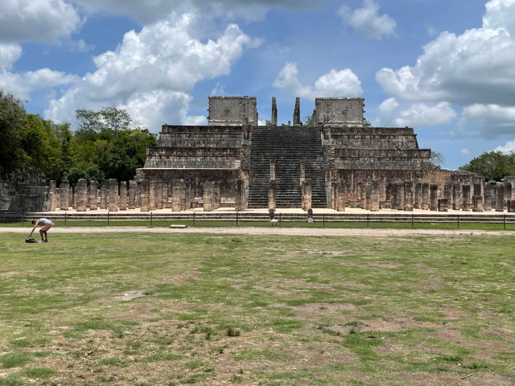
This temple was also significant because it was the finish line for a race to determine who would be sacrificed to the Maya gods. The sacrifice was always voluntary, and the race was competitive! Approximately 600 teenage slaves would compete. They ran from the wall of the Ballcourt to the Temple of Warriors. The winner received the title of “Black Jaguar” and would be sacrificed. This was such an honor, that the family would be promoted from slaves to wealthy for seven generations!
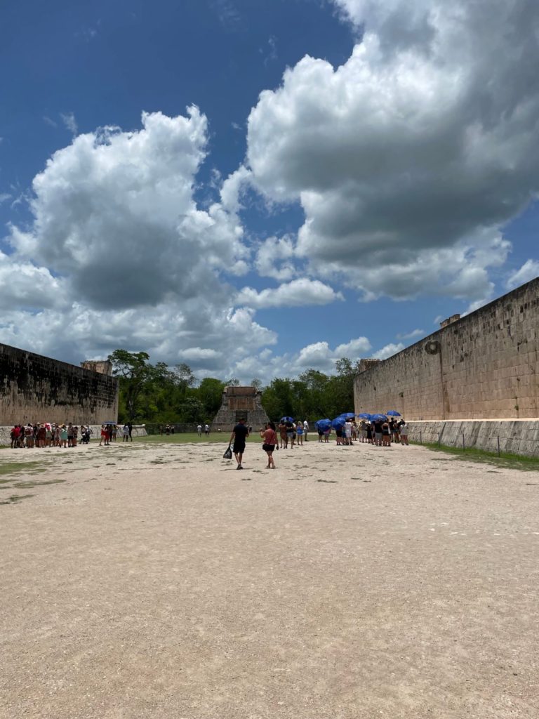
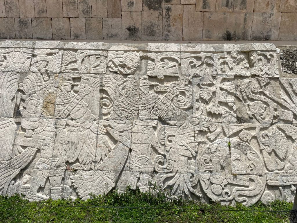
The Ballcourt was our final stop at Chichen Itza, and it was just as fascinating as the Castillo! According to our guide, the Maya executed low and high class alike, there was no discrimination. The Ballgame was a way to sort out differences among tribes instead of going to war. Seating at the Ballcourt was as follows: the king and queen sat on the tribune, and the working class and high class people sat on the wall. Slaves sat at ground level.
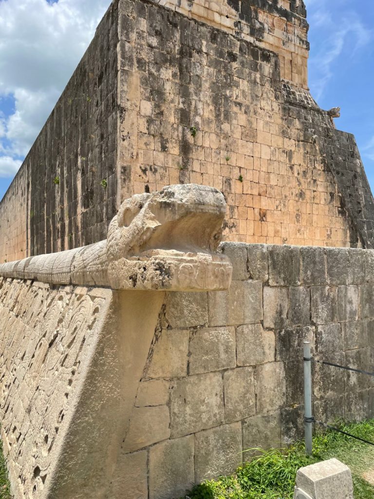
The rules of the game were as follows: Each team consisted of 7 players. Only the leader could run along the higher level. The other 6 players stayed on the ground. Usually the game was played by higher class people. They used a rubber ball that weighed 7.5 pounds. The players on the ground must move the ball using only their hips with the exception of one player called the receptor, who could use his knees to pass the ball to the leader. The leader could then use his hips, knees, elbows, or shoulders to get the ball through the ring to score. The ring is 29 feet high. Only 1 point needed to be scored to win, and a typical game took about 6.5 hours. If no one scored, no one died, and conflict must have ended that night. However, once a point was scored, the loser was executed on the decapitation chair by the winner.
On the wall of the Ballcourt at Chichen Itza, there are glyphs showing a warrior who has a piercing in his nose. There is a man next to him with a longer piercing who was the winner of the game. He is holding a dagger and a head with blood coming out of the neck. This is the head of the loser. You can also see a headless man who has 7 snakes coming out of his head. The ball in this glyph is pointing toward the loser.
Another sound phenomenon takes place inside the Ballcourt at Chichen Itza. If you clap your hands in the Ballcourt, you will hear 7 echoes due to the three “speaker” boxes on the walls of the court. However, the sound is amplified to 98 Mhz, which MIT engineers have not been able to explain. Additionally, if you record the sound and play it back, you can hear what sounds like dripping water! Check out the video! It is fascinating!
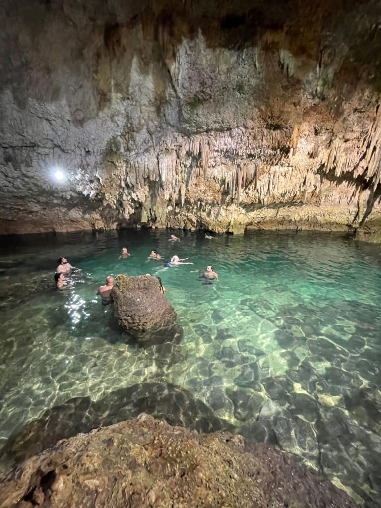
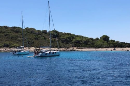
From Chichen Itza, we headed to the next stop for our cenote swim at Saamal, sometimes also spelled Samaal. You are required to rent a life jacket if you are going to swim in the cenote, but it was cheap, 50 pesos which is just under $3.00. A cenote is a sinkhole that is full of freshwater. This cenote was very pretty even though the water was somewhat cloudy. I did have a bit of a mishap here.
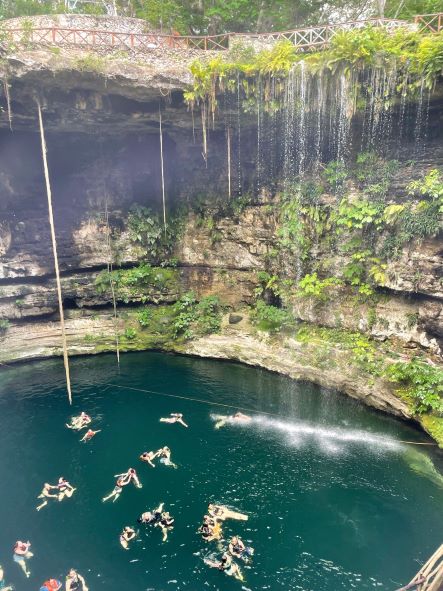
For those who know me, you know I am short. Well, I had short people problems here. I was going down the steps to get into the cenote (fun fact this was actually the exit, but it was only signed that way at the bottom), and a guy told me there was one more step. Well, I never found that one last step. Instead, I ended up losing my balance reaching for it and fell in. Water, of course, went up my nose and then down my throat. I came up sputtering and gagging and wondering if I was going to pay for it with “Montezuma’s Revenge”.
The unfortunate answer to that question was yes, for almost 2 weeks! But, thankfully with my essential oils, it was very mild. I only swam for a few minutes after falling in because my germ phobia got the best of me, and I couldn’t stop thinking about what I may have ingested. The water was refreshing, though, after being so hot at Chichen Itza! After our cenote swim, we started the 3 hour ride back to our resort. It had been a long but (mostly) enjoyable day!
Tulum & Coba
The second set of ruins we toured was Tulum. We booked this tour through Excursiones Riviera Maya, and they were fantastic. First, it was a much smaller group so we were in a van rather than a bus. And Carlos, our guide was fantastic! Once he found out I was a history teacher, he threw in all kinds of fun facts along the way.
For example, the story of Mexico City is that it was built in the middle of Lake Texcoco by the Aztec people. This part of the story is an undisputed fact. However, according to legend, the Aztec were looking for a place to build their city and the sign was to be a snake. They observed a snake on a post in the middle of the lake, and that is why they built their city, Tenochtitlan, there. So here is your fun fact according to Carlos…this story may not actually be true. Another fun fact is that Mexico in the Aztec language means “in the center of the moon”.
Why were we talking about the Aztec, when we were going to visit Maya ruins? Great question. I will elaborate. In Pre-Columbian Mexico, there were 66 groups of indigenous people. One of the most well known was the Aztec Empire. One group of indigenous people known as the Toltec, however, split from the Aztec Empire and built their own capital city in Tula in Hidalgo. Eventually, they abandoned their city and walked 1,000 miles to the Yucatan. Here they fought with the Maya people. They eventually took over and merged to form the Maya-Tolteca.
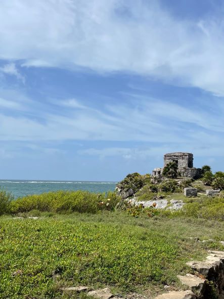
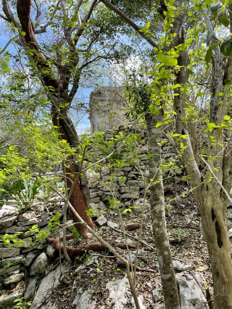
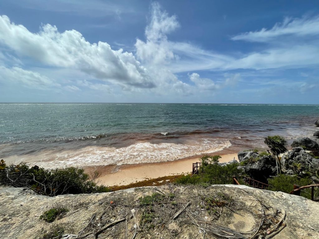
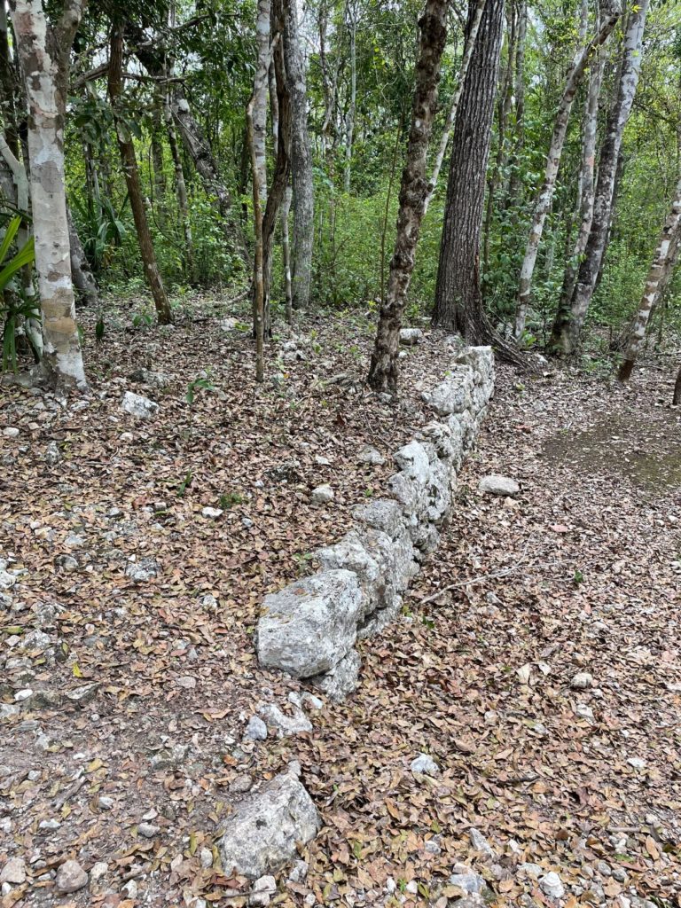
Now back to Tulum, called Zama by the Maya, which means dawn, as the city faces the sea. Tulum was the last Maya city to be built. It is the only Maya city built along the coast. It was built to be a trading port once the Maya began trading. It has sheer cliffs that drop off into the Caribbean Sea on one side, and the other three sides have walls built to protect the city with a watch tower in each of the two corners.
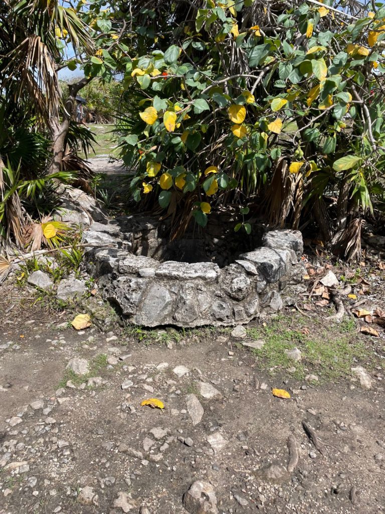
Our first stop inside Tulum was the House of the Cenote. According to Carlos, 90% of Maya ruins were built near cenotes. Fun fact: there are approximately 3500 cenotes in the Yucatán Peninsula. How did they form you ask? I will let you decide which theory you believe. One theory according to Carlos, is that the 6 mile wide asteroid that struck the earth 66 million years ago near Mexico and caused the mass extinction of the dinosaurs created the cenotes. They were basically holes poked in the earth by the fallout from the asteroid’s impact. Another theory is that rainwater absorbs carbon dioxide which over time eats away at the limestone. Believe what you will.
We next walked to a vantage point where we could take in most of the city. We were able to see some residential foundations, the Temple of the Descending God, and El Castillo. The temple of the descending god has the image of this god carved above the door of the temple. It looks like an upside down person. During the summer and winter solstice, the sun lines up with the hole in this temple and creates a starburst effect. Carlos has a photo of this for us to see.
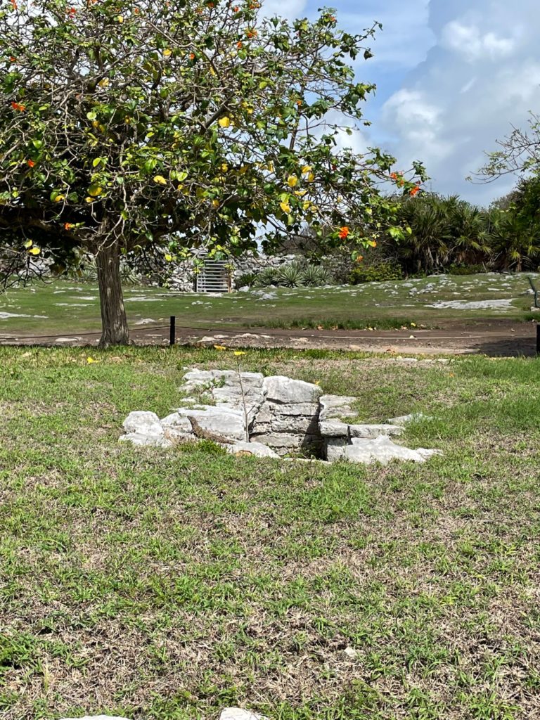
From here we passed by a cistern, and a burial site. Most Maya were cremated, however, those of importance were buried with their possessions. They were also buried with cornmeal in their mouths. These were all things they would need in Xibalba, what the Maya called the underworld.
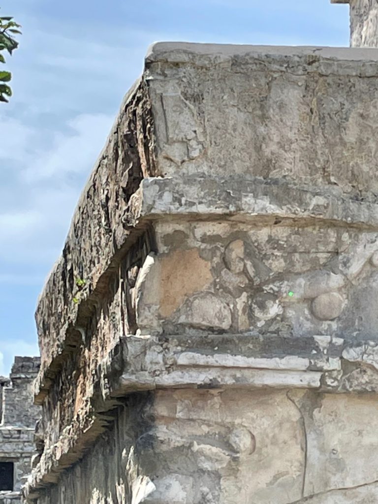
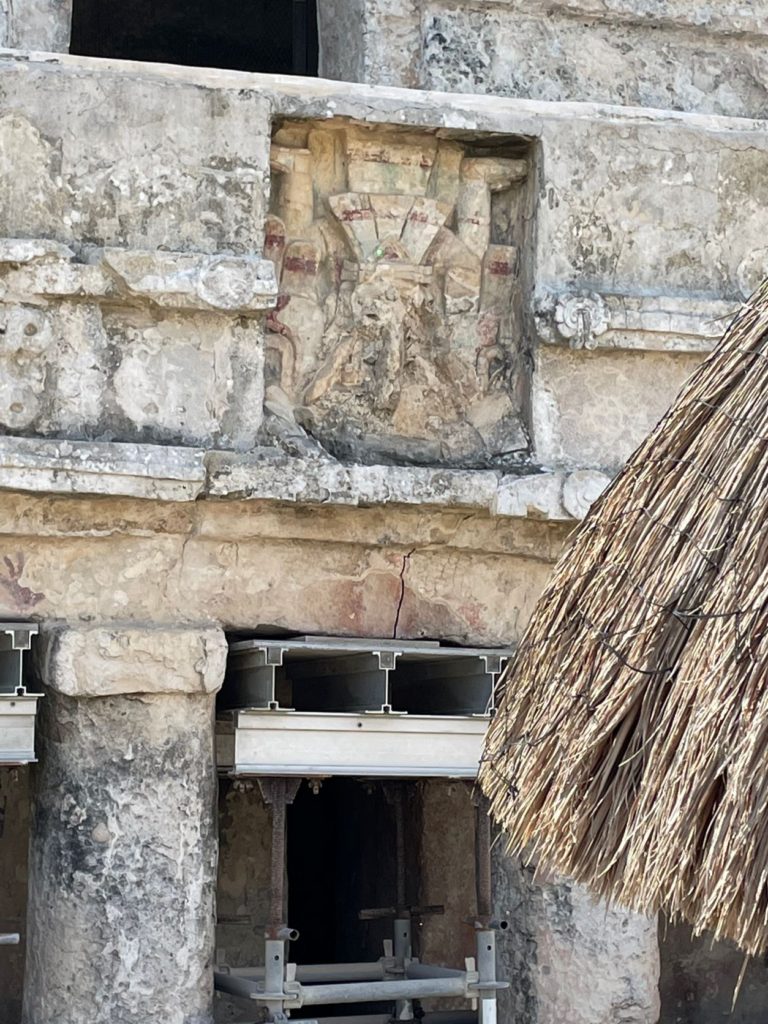
Next we came to the Temple of the Frescoes. This building had religious significance, and there were several different Maya gods carved into the stone. The descending god can be seen again here along with Ixchel, the fertility goddess. On each corner of this building is a mask – one has eyes open, and the other has eyes shut. Near the top are hand prints in red. The left hand has seven fingers. It is believed that many infants were born with anomalies and birth defects due to inbreeding. According to Carlos, it was the children with the birth defects who were sacrificed to the gods here in Tulum. He also mentioned that inbreeding is one of the theories for why the Maya civilization disappeared.
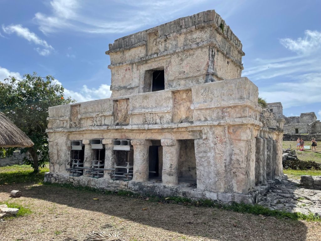
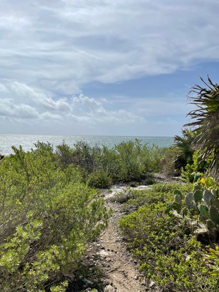
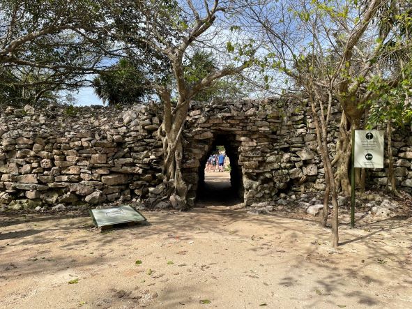
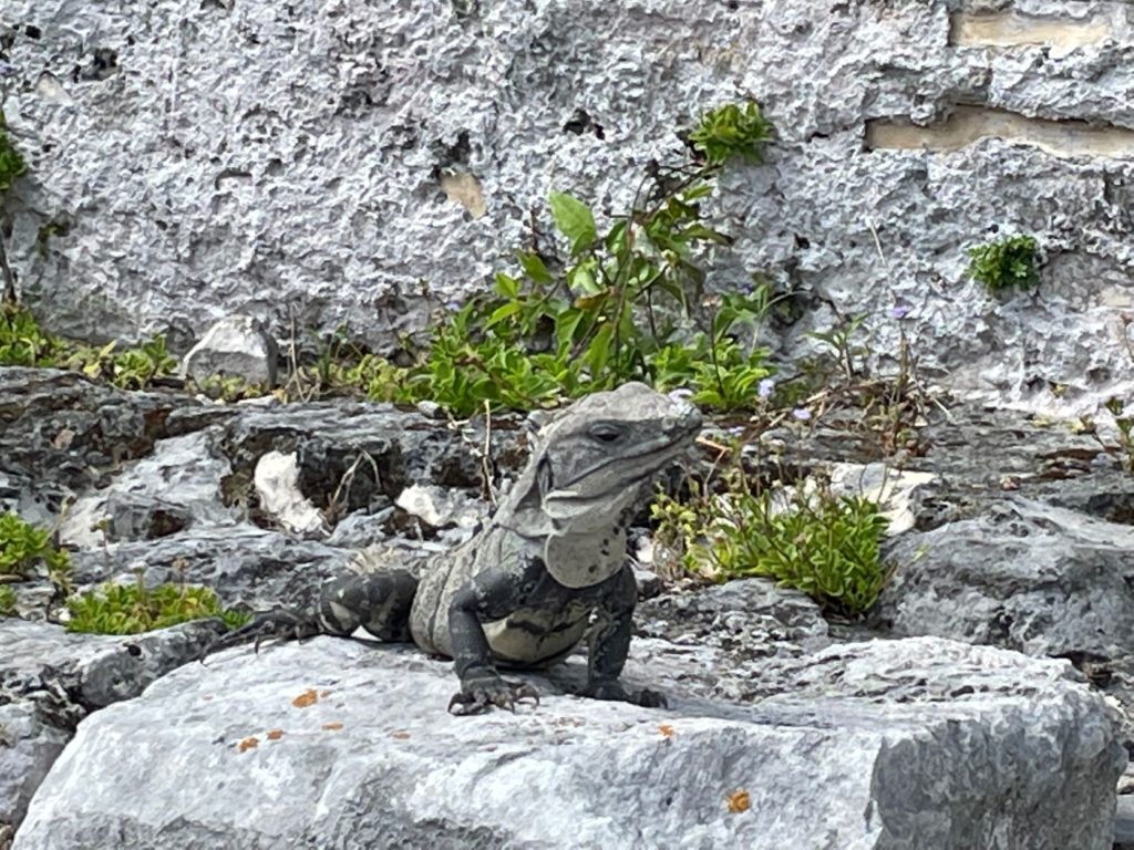
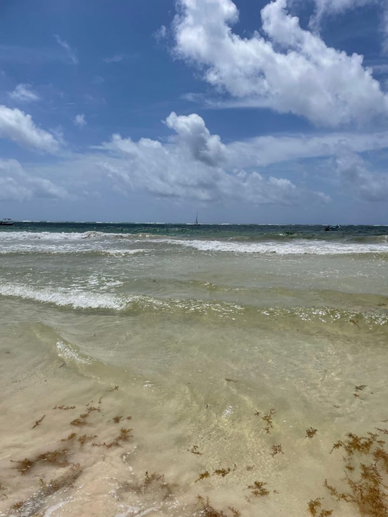
We had some free time to walk up to El Castillo and look over the cliffs at the Caribbean Sea. We saw several iguanas of various sizes. They are all over at Tulum. From there, we exited the city of Tulum through an access tunnel in one of the walls, and headed for a short beach break at Paradise Beach.
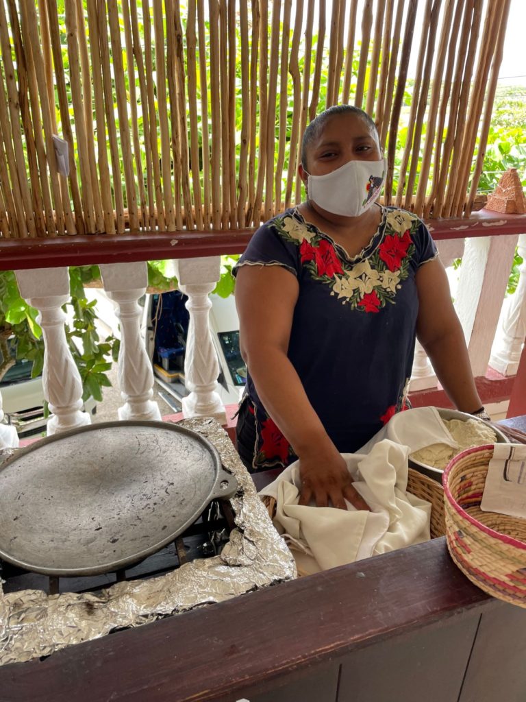
After our beach break, we began the drive to our next set of Maya ruins, Coba (pronounced koh bah with the emphasis on the last syllable). On the way we stopped for another buffet lunch. This one was even better than the first as there was a lady making handmade tortillas for the tacos.
As we rode to lunch, we discussed theories of how the Maya came to the Yucatan. It was interesting to hear these different theories. The first is the one we have all been taught, and that is that they crossed the land bridge in the Bering Strait before it was submerged, meaning that all indigenous people in the America’s are of Asian descent. Another theory that Carlos shared was that the Maya were one of the lost tribes of Israel. The third theory he shared was that the Maya were descendants of the ancient Egyptians. This theory is based not only on their building pyramids aligned with the stars, planets, and sun, but also based upon their writing system of glyphs very similar to hieroglyphics. Another theory is based upon the work of Thor Hyerdahl who theorized that people sailed east from Africa on Kon-Tiki boats.
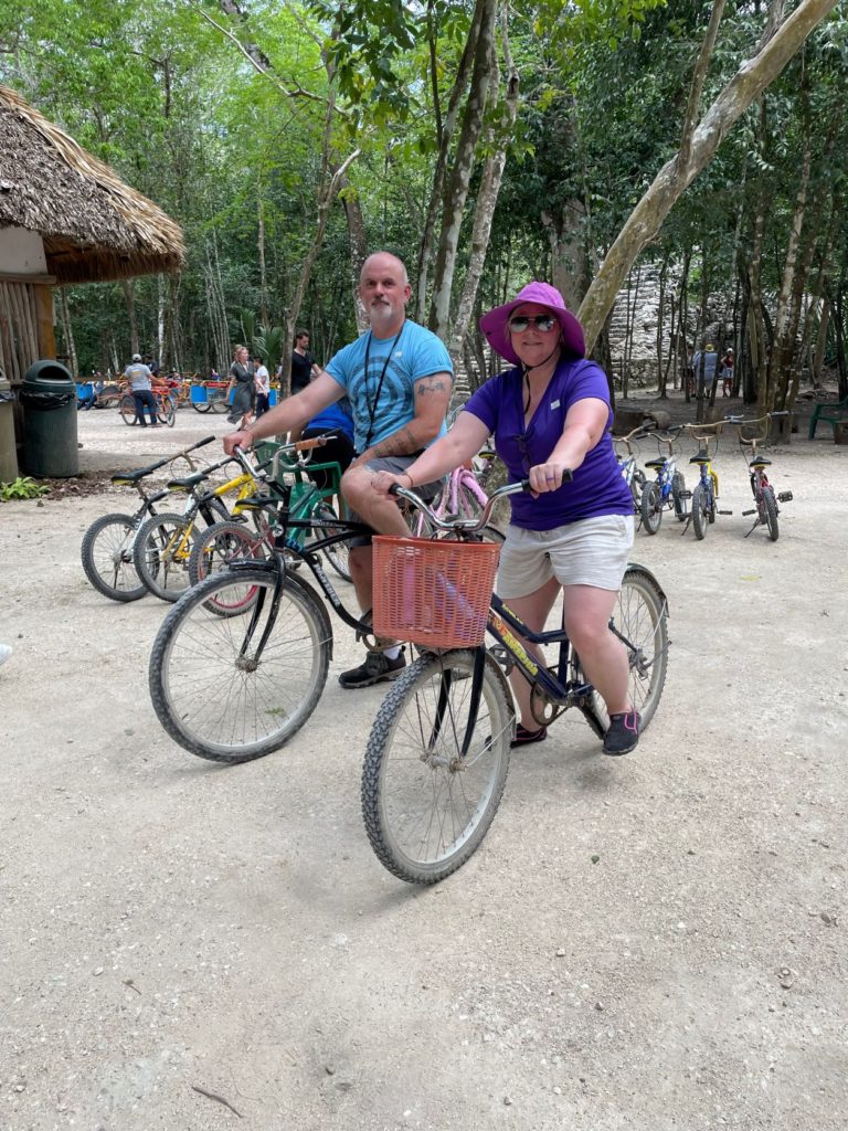
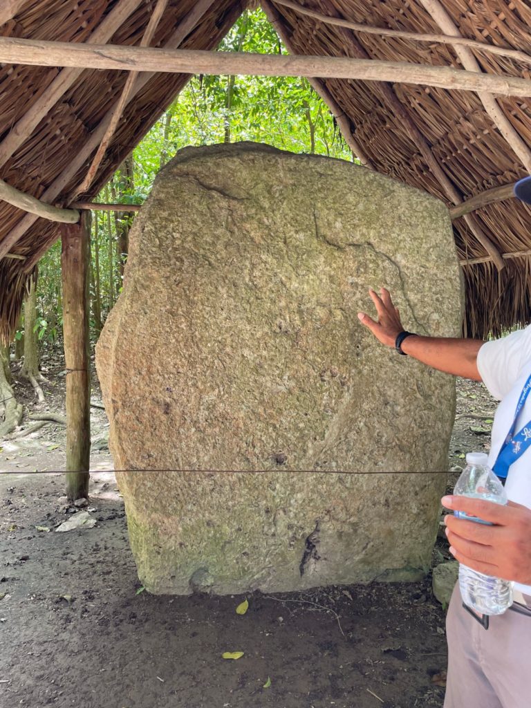
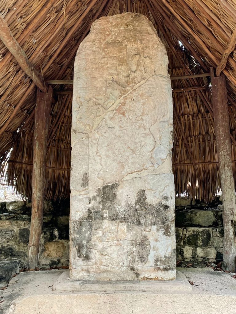
Once we arrived in Coba, we chose to rent bicycles to explore the ruins. It was very inexpensive at $50 pesos per person, just under $3 US dollars. Coba means turbulent water in the Mayan language. We rode first to an example of a stila, a large stone that is a sort of calendar and recorded history. Wealthy or powerful people displayed them near their residences as a show of their position. This particular one shows a man in a headdress with some sort of staff standing on the backs of two slaves.
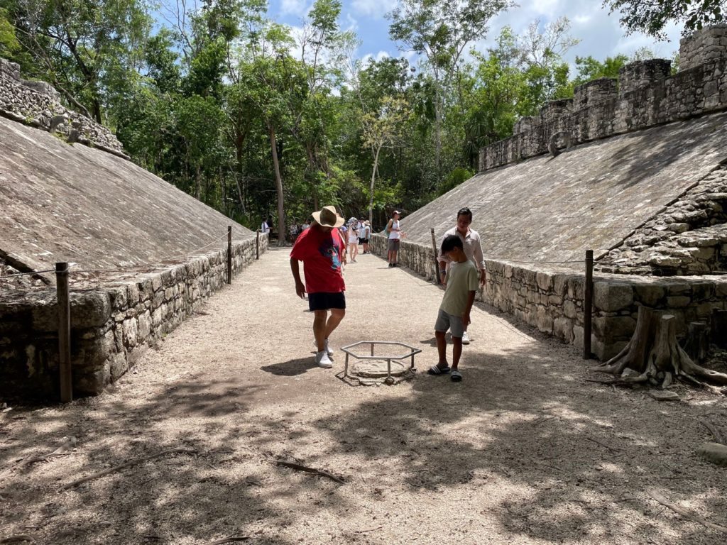
Coba has two ball courts, one of which was our next stop. These were on a much smaller scale than the one at Chichen Itza. In Coba, ball was only played when they needed something from the gods: rain, harvest, etc., and then a sacrifice was made.
The next structure we stopped to see was a road. This road was actually discovered by NASA. It ran 63 miles from Coba to Chichen Itza, and then to another city beyond Chichen Itza. It is raised, and much like ancient Roman roads, has light colored stones to reflect the way at night.
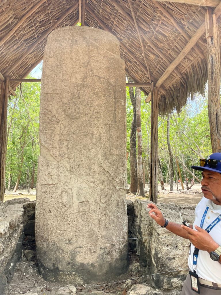
We stopped at the planetarium or observatory in Coba. This is a small pyramid shaped building, only its corners are rounded. Very similar to the architecture in Angkor Wat. This, Carlos said, was another indication of Asian descent. From the observatory, we rode to another stila. This one also had a man standing on top of slaves.
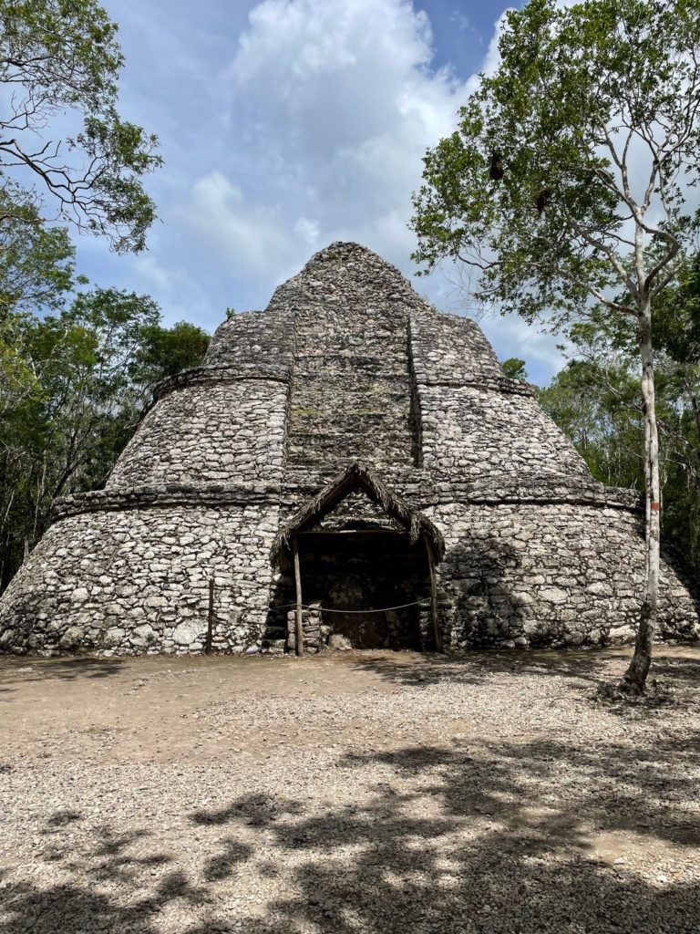
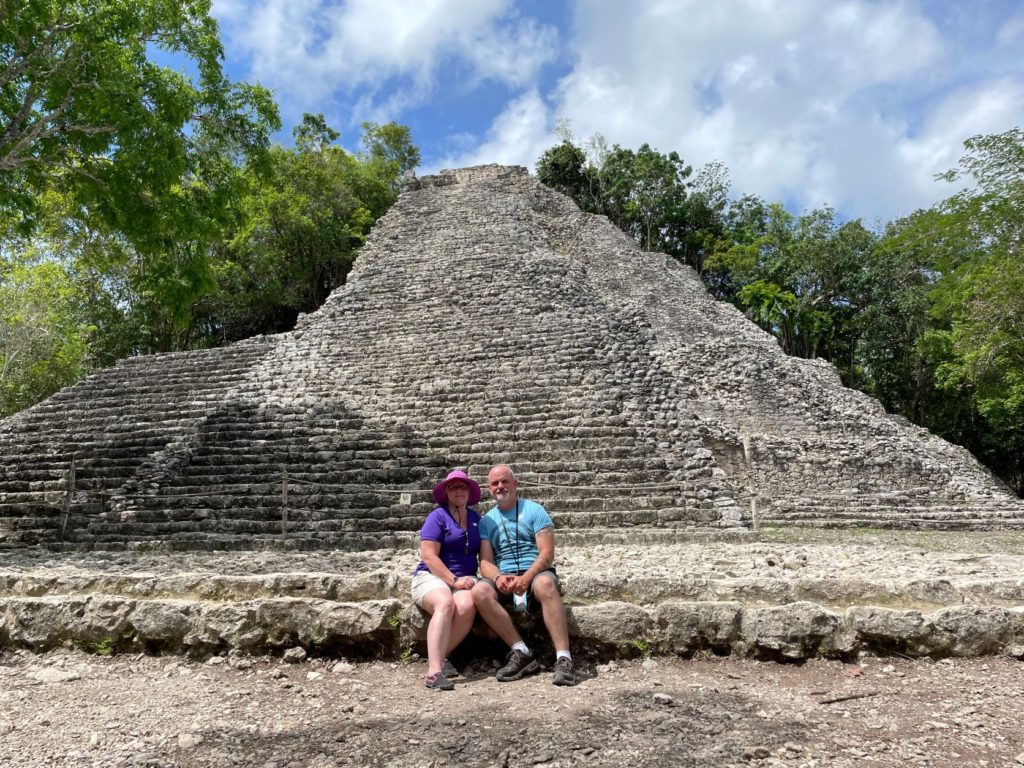
We finally arrived at the Nohoch Mul Pyramid, which unfortunately you can no longer climb. It was closed for Covid, and never reopened, which is best for preservation anyway. The descending god can be seen at the top of this pyramid as well. We learned that each Maya city had one high priest. There were approximately 100,000 Maya who lived in Coba, and the average life expectancy was 45!
When we left Coba, we traveled a short distance to the Choo Ha Cenote. Choo Ha means dripping water. This was a much better experience than the day before. Getting into the water was much easier, and I had no falls or mishaps haha! This cenote is almost completely underground. It appears almost more like a cave. The water is crystal clear, and you can see fish swimming around in the water. It was very refreshing before the long ride back to the resort.
As always, if you enjoyed what you read, please subscribe to be updated when new posts are published. You are also invited to join our new community on Facebook: Tours, Trips & Travel Tips for History Lovers | by Travel the World History. If you enjoy planning your own travel, or you want to receive emails about great deals, feel free to register here. You will then receive email updates on amazing travel deals, and have access to use my booking engine. If you are interested in a vacation quote, you can submit your request using this form. And lastly, if you are curious about how I have turned my passion for travel into an income, please reach out here! You can find links to additional tours in my resource page here. Thanks for reading!


3 Comments
whoiscall
Thanks.
Ann Meigs
I’m Amy Napier’s sorority sister. I’m watching everything while y’all are on your amazing summer trip! I’m a teacher, too, and take students on EF trips.
Vanessa
Awww! I love that! Maybe you can join us some time!